THE ADVENTURE COLLECTIVE® · Independent discovery and booking for outdoor travel

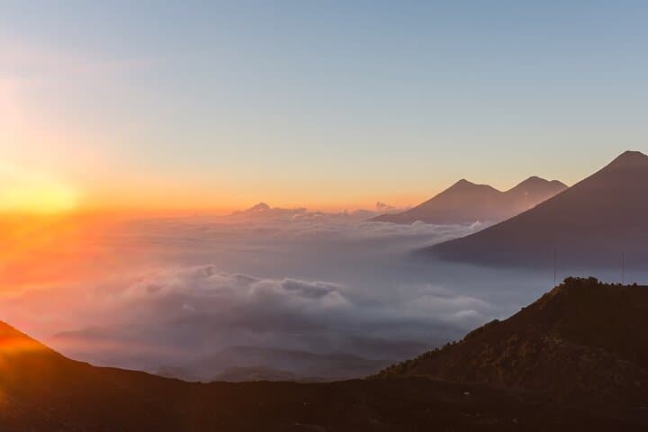
Climb Pacaya for an hour-and-a-half guided ascent to watch the sun crown one of Guatemala’s most active volcanoes. Expect basalt lava fields, sweeping views of Lake Amatitlán and neighboring cones, and a village breakfast in San Vicente Pacaya before you return.
Climb Pacaya for an hour-and-a-half guided ascent to watch the sun crown one of Guatemala’s most active volcanoes. Expect basalt lava fields, sweeping views of Lake Amatitlán and neighboring cones, and a village breakfast in San Vicente Pacaya before you return.
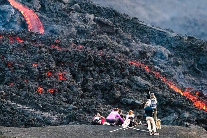
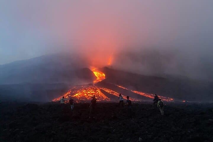
Before dawn the road out of Guatemala City narrows and the air cools; headlamps pick out the dark silhouette of Pacaya against a bruise-colored sky. By sunrise (or as the sun slides toward evening), the volcano throws light across jagged lava fields, and the summit breezes push a sulfur-scented whisper through the grasses. The walk up is immediate—rock, ash, and the occasional scrub of coffee plants at lower elevations.
Verified experiences and guided adventures in the surrounding area.
Operated by Novaxplorer · San Vicente Pacaya, Escuintla Department
Before dawn the road out of Guatemala City narrows and the air cools; headlamps pick out the dark silhouette of Pacaya against a bruise-colored sky. By sunrise (or as the sun slides toward evening), the volcano throws light across jagged lava fields, and the summit breezes push a sulfur-scented whisper through the grasses. The walk up is immediate—rock, ash, and the occasional scrub of coffee plants at lower elevations.
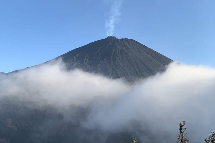
Geology here is raw: Pacaya is one of Guatemala’s most active volcanoes at about 2,552 m, its modern cone reshaped by frequent eruptions and fresh basalt flows that harden into black, pitted terrain. Look west for Lake Amatitlán and a chain of neighboring volcanoes—Agua, Fuego and Acatenango—each a chapter in the region’s volcanic story. Culturally, the route drops you into San Vicente Pacaya, a working village where coffee and forest edge meet volcanic soil.
Practical guide: expect a guided ascent of roughly 1.5 hours over uneven, rocky ground; the full excursion is about 8–10 hours with transfers from Guatemala City. Trails can be steep and loose—sturdy boots, 2+ liters of water, and a headlamp for pre-dawn departures are non-negotiable. Guides handle entrance fees and local access; they also pick routes around recent lava or fumarolic activity. Weather shifts fast—mornings are clearer in the dry season, while afternoon storms are common in the rainy months. Respect trail closures, keep clear of hot flows, and pack layers for both chilly starts and sun-exposed ridgelines.
moderate.
8–10 hours (round trip with transfers); 1.5-hour ascent.
Moderate fitness required—able to hike for 90 minutes uphill on uneven terrain and tolerate brief steep sections.
The guided ascent takes about 1.5 hours from the trailhead; overall trip time from Guatemala City is typically 8–10 hours including transport and village time.
Pacaya is active, but certified local guides monitor conditions; trails may be rerouted or closed if activity increases—always follow guide instructions and keep a safe distance from hot flows.
Children and less-fit travelers can join if able to walk for up to 90 minutes on uneven ground; the operator notes this is not recommended for those with serious health issues, pregnancy, or spinal/heart conditions.
Sunrise gives clearer morning skies and cooler temperatures; sunset can produce dramatic colors but may involve a darker return—choose based on weather forecasts and whether you prefer a pre-dawn climb or an afternoon approach.
Pacaya’s modern cone has been frequently active in the 20th and 21st centuries; local communities have long adapted agricultural practices to nutrient-rich volcanic soils.
Stay on marked trails, avoid removing volcanic rock or ash, and use local guides to ensure visits support community incomes and minimize environmental impact.
Novaxplorer operates guided outdoor trips and adventures with an emphasis on safety, stewardship, and memorable experiences.
Before dawn the road out of Guatemala City narrows and the air cools; headlamps pick out the dark silhouette of Pacaya against a bruise-colored sky. By sunrise (or as the sun slides toward evening), the volcano throws light across jagged lava fields, and the summit breezes push a sulfur-scented whisper through the grasses. The walk up is immediate—rock, ash, and the occasional scrub of coffee plants at lower elevations.
Before dawn the road out of Guatemala City narrows and the air cools; headlamps pick out the dark silhouette of Pacaya against a bruise-colored sky. By sunrise (or as the sun slides toward evening), the volcano throws light across jagged lava fields, and the summit breezes push a sulfur-scented whisper through the grasses. The walk up is immediate—rock, ash, and the occasional scrub of coffee plants at lower elevations.
Geology here is raw: Pacaya is one of Guatemala’s most active volcanoes at about 2,552 m, its modern cone reshaped by frequent eruptions and fresh basalt flows that harden into black, pitted terrain. Look west for Lake Amatitlán and a chain of neighboring volcanoes—Agua, Fuego and Acatenango—each a chapter in the region’s volcanic story. Culturally, the route drops you into San Vicente Pacaya, a working village where coffee and forest edge meet volcanic soil.
Practical guide: expect a guided ascent of roughly 1.5 hours over uneven, rocky ground; the full excursion is about 8–10 hours with transfers from Guatemala City. Trails can be steep and loose—sturdy boots, 2+ liters of water, and a headlamp for pre-dawn departures are non-negotiable. Guides handle entrance fees and local access; they also pick routes around recent lava or fumarolic activity. Weather shifts fast—mornings are clearer in the dry season, while afternoon storms are common in the rainy months. Respect trail closures, keep clear of hot flows, and pack layers for both chilly starts and sun-exposed ridgelines.