THE ADVENTURE COLLECTIVE® · Independent discovery and booking for outdoor travel

Catch sunrise on Mt. Batolusong and cool off at Kay Ibon Falls in a single day trip from Manila. This 4–6 hour outing combines steep grassy ridgelines, short scrambles, and a refreshing waterfall approach—best taken with a local guide.
Catch sunrise on Mt. Batolusong and cool off at Kay Ibon Falls in a single day trip from Manila. This 4–6 hour outing combines steep grassy ridgelines, short scrambles, and a refreshing waterfall approach—best taken with a local guide.
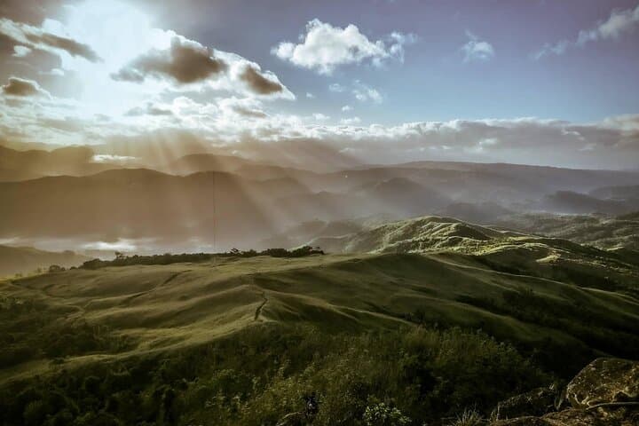
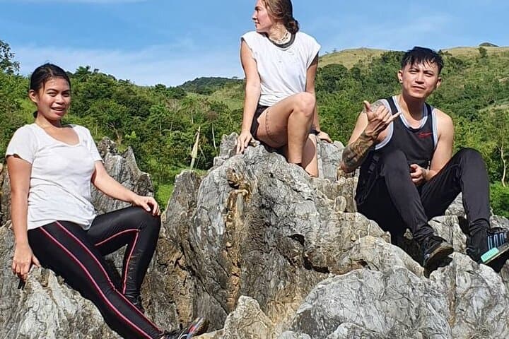
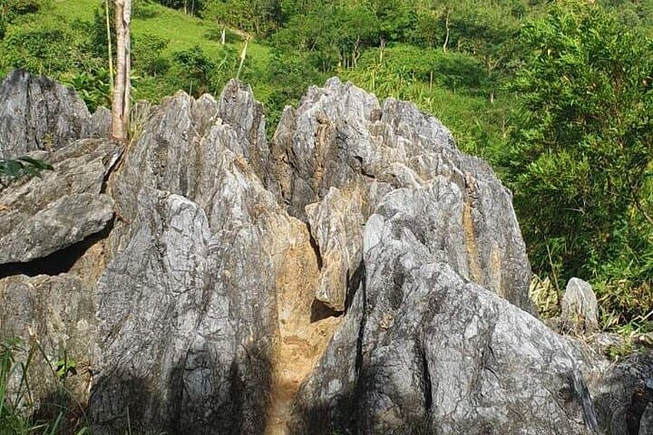
A pre-dawn scramble up a wet, grassy ridge pushes you into the light: low clouds lift from the valley and the silhouette of the Sierra Madre spills eastward. Mt. Batolusong’s crest is a mix of steep grassland, rocky outcrops and narrow trails that give way to forest pockets; below, Kay Ibon Falls cuts a cool line through boulders and plunge pools that invite a well-earned break.
Verified experiences and guided adventures in the surrounding area.
Operated by Hike Manila · Tanay, Rizal
A pre-dawn scramble up a wet, grassy ridge pushes you into the light: low clouds lift from the valley and the silhouette of the Sierra Madre spills eastward. Mt. Batolusong’s crest is a mix of steep grassland, rocky outcrops and narrow trails that give way to forest pockets; below, Kay Ibon Falls cuts a cool line through boulders and plunge pools that invite a well-earned break.
The massif sits on the eastern edge of Rizal province and is one of the accessible high points of the Sierra Madre foothills. Geologically the route traces older orogenic rocks—weathered, folded slopes that create steep gullies and exposed ridgelines. Locally, small barangays and farm terraces speak to a practical mountain culture: hikers often pass through rice paddies and community trails where guides are drawn from the villages.
Practically, expect a 4–6 hour outing from Manila, with a roundtrip distance of roughly 6–10 km and elevation gain in the 600–800 m range depending on your start point. Terrain alternates between packed dirt, loose scree and wet rock near the falls; short, steep sections require sure footing and occasional hands-on scrambling. Start before sunrise to avoid afternoon heat and unpredictable showers; bring layered rain protection, 2–3 liters of water, a headlamp, and steady trekking shoes. Permits and a local guide are common and advisable for route-finding and safety. Weather can change fast—when the clouds stack up, visibility and footing both drop.
This daytrip pairs a ridge-top sunrise with a cooling waterfall descent: a compact, demanding taste of the Sierra Madre that rewards planning and respect for steep, changeable terrain.
challenging.
4–6 hours.
Good cardiovascular fitness and strong legs recommended; previous day-hike experience helps with sustained climbs and uneven terrain.
Plan for 4–6 hours total; time varies with group pace, exact trailhead, and time spent at the summit and falls.
Local guides are strongly recommended and sometimes required by barangay authorities; they can also secure permits and improve safety.
Physically fit beginners with prior day-hike experience can complete it, but the route includes steep, exposed sections that demand sure footing.
Swim spots and plunge pools exist, but check local conditions—currents, water depth and cleanliness vary after rains.
The area’s trails have long linked farming barangays; many today follow old footpaths used for trade and forest foraging.
Stick to established trails, pack out waste, and follow local permit rules—rising visitor numbers stress trails and freshwater at the falls.
Hike Manila operates guided outdoor trips and adventures with an emphasis on safety, stewardship, and memorable experiences.
A pre-dawn scramble up a wet, grassy ridge pushes you into the light: low clouds lift from the valley and the silhouette of the Sierra Madre spills eastward. Mt. Batolusong’s crest is a mix of steep grassland, rocky outcrops and narrow trails that give way to forest pockets; below, Kay Ibon Falls cuts a cool line through boulders and plunge pools that invite a well-earned break.
A pre-dawn scramble up a wet, grassy ridge pushes you into the light: low clouds lift from the valley and the silhouette of the Sierra Madre spills eastward. Mt. Batolusong’s crest is a mix of steep grassland, rocky outcrops and narrow trails that give way to forest pockets; below, Kay Ibon Falls cuts a cool line through boulders and plunge pools that invite a well-earned break.
The massif sits on the eastern edge of Rizal province and is one of the accessible high points of the Sierra Madre foothills. Geologically the route traces older orogenic rocks—weathered, folded slopes that create steep gullies and exposed ridgelines. Locally, small barangays and farm terraces speak to a practical mountain culture: hikers often pass through rice paddies and community trails where guides are drawn from the villages.
Practically, expect a 4–6 hour outing from Manila, with a roundtrip distance of roughly 6–10 km and elevation gain in the 600–800 m range depending on your start point. Terrain alternates between packed dirt, loose scree and wet rock near the falls; short, steep sections require sure footing and occasional hands-on scrambling. Start before sunrise to avoid afternoon heat and unpredictable showers; bring layered rain protection, 2–3 liters of water, a headlamp, and steady trekking shoes. Permits and a local guide are common and advisable for route-finding and safety. Weather can change fast—when the clouds stack up, visibility and footing both drop.
This daytrip pairs a ridge-top sunrise with a cooling waterfall descent: a compact, demanding taste of the Sierra Madre that rewards planning and respect for steep, changeable terrain.