THE ADVENTURE COLLECTIVE® · Independent discovery and booking for outdoor travel

A reachable 6,000-meter objective in Sajama National Park, Acotango offers non-technical climbing, stark high-altitude scenery, hot springs and queñua groves over a 3-day itinerary. Plan for acclimatization and layered gear.
A reachable 6,000-meter objective in Sajama National Park, Acotango offers non-technical climbing, stark high-altitude scenery, hot springs and queñua groves over a 3-day itinerary. Plan for acclimatization and layered gear.
The climb begins before dawn: a convoy of 4x4s cuts across the puna, headlamps picking out the fluted contours of volcanic scree as cold air pushes against your face. Acotango’s snow-capped cone rises like a patient challenger on the Bolivia–Chile border, its shoulders ringing with wind and the quiet of high-altitude plains.
Verified experiences and guided adventures in the surrounding area.
Operated by Tangara Expediciones Travel and Adventure · Oruro, Oruro
The climb begins before dawn: a convoy of 4x4s cuts across the puna, headlamps picking out the fluted contours of volcanic scree as cold air pushes against your face. Acotango’s snow-capped cone rises like a patient challenger on the Bolivia–Chile border, its shoulders ringing with wind and the quiet of high-altitude plains.
Geologically, Acotango is part of the Central Volcanic Zone of the Andes—an andean giant of layered lava and pyroclastic deposits. Culturally the route threads Aymara highlands where shepherds tend vicuñas and ancient pathways link hot springs, queñua groves and steaming geysers. Sajama National Park protects these features and the fragile puna ecosystem that gives the approach its brittle, open beauty.
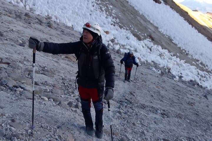
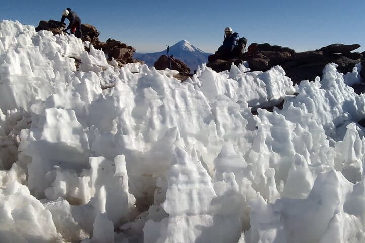
The organized itinerary typically runs three days: travel from Oruro, an acclimatizing visit to queñua forest and hot springs, then an early-morning 4x4 ride to ~5,500 m and a 5–6 hour summit push. The terrain is primarily high-step trail and loose volcanic scree with short snow/ice sections near the top—non-technical but unforgiving at altitude.
Practical guidance: prioritize acclimatization and hydration, use layered clothing and quality boots, and practice using crampons and an ice axe if approaching in icy conditions. Expect thin air—pace conservatively and monitor symptoms of acute mountain sickness.
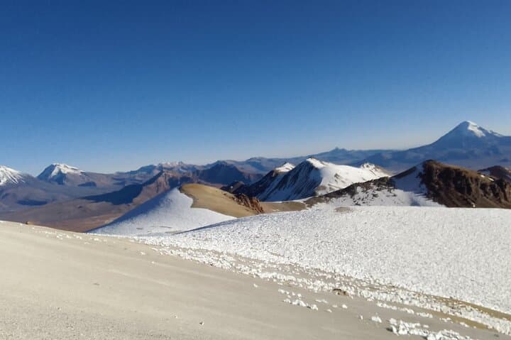
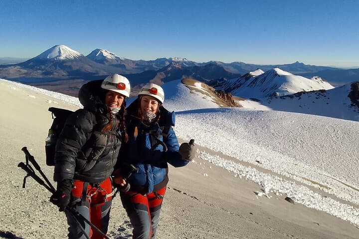
For travelers seeking a reachable 6,000-meter objective, Acotango blends straightforward route-finding with raw high-altitude exposure, rewarding careful preparation with wide, wind-swept views across the Altiplano.
challenging.
3 days.
Good cardiovascular fitness and experience with multi-hour hikes at altitude; ability to carry a daypack and move steadily for 5–6 hours.
No technical rock-climbing skills are required, but basic crampon and ice-axe familiarity and high-altitude hiking experience are strongly recommended.
The 3-day itinerary includes an acclimatization day with lower-elevation activity and hot springs before the early-morning summit push.
Summit is 6,052 m; guides monitor for AMS—descent is the primary emergency measure and operators typically have radios and evacuation plans but limited oxygen on site.
April–May and September–November often offer the most stable weather; avoid afternoon storms in the summer wet season (Dec–Mar).
Acotango sits within Andean volcanic chains long traversed by Aymara communities; the park protects cultural routes and traditional highland grazing areas.
Sajama’s puna is fragile—stick to established paths, pack out all waste, and avoid trampling queñua seedlings and geothermal features.
Tangara Expediciones Travel and Adventure operates guided outdoor trips and adventures with an emphasis on safety, stewardship, and memorable experiences.
The climb begins before dawn: a convoy of 4x4s cuts across the puna, headlamps picking out the fluted contours of volcanic scree as cold air pushes against your face. Acotango’s snow-capped cone rises like a patient challenger on the Bolivia–Chile border, its shoulders ringing with wind and the quiet of high-altitude plains.
The climb begins before dawn: a convoy of 4x4s cuts across the puna, headlamps picking out the fluted contours of volcanic scree as cold air pushes against your face. Acotango’s snow-capped cone rises like a patient challenger on the Bolivia–Chile border, its shoulders ringing with wind and the quiet of high-altitude plains.
Geologically, Acotango is part of the Central Volcanic Zone of the Andes—an andean giant of layered lava and pyroclastic deposits. Culturally the route threads Aymara highlands where shepherds tend vicuñas and ancient pathways link hot springs, queñua groves and steaming geysers. Sajama National Park protects these features and the fragile puna ecosystem that gives the approach its brittle, open beauty.
The organized itinerary typically runs three days: travel from Oruro, an acclimatizing visit to queñua forest and hot springs, then an early-morning 4x4 ride to ~5,500 m and a 5–6 hour summit push. The terrain is primarily high-step trail and loose volcanic scree with short snow/ice sections near the top—non-technical but unforgiving at altitude.
Practical guidance: prioritize acclimatization and hydration, use layered clothing and quality boots, and practice using crampons and an ice axe if approaching in icy conditions. Expect thin air—pace conservatively and monitor symptoms of acute mountain sickness.
For travelers seeking a reachable 6,000-meter objective, Acotango blends straightforward route-finding with raw high-altitude exposure, rewarding careful preparation with wide, wind-swept views across the Altiplano.