THE ADVENTURE COLLECTIVE® · Independent discovery and booking for outdoor travel

A two-day guided ascent from Baños to the 5,020 m summit of Tungurahua. Expect volcanic scree, an overnight refuge at 3,500 m, and expansive Andean views—prepare for altitude and rapidly changing weather.
A two-day guided ascent from Baños to the 5,020 m summit of Tungurahua. Expect volcanic scree, an overnight refuge at 3,500 m, and expansive Andean views—prepare for altitude and rapidly changing weather.
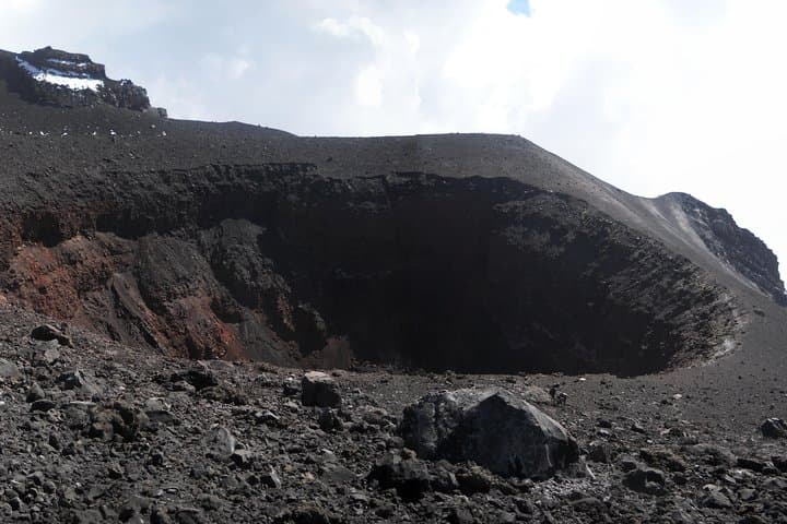
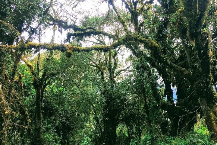
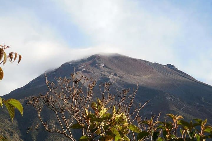
You start from the river-carved valley below Baños, the town's hot springs already steaming in the morning chill, and the cone of Tungurahua looming like a charged machine above the cloud line. The trail climbs from agricultural terraces into high grass and black volcanic scree; fumarolic breath and occasional plumes remind you the mountain is alive and watching.
Verified experiences and guided adventures in the surrounding area.
Operated by HAT TRAVEL · Baños de Agua Santa, Tungurahua Province
You start from the river-carved valley below Baños, the town's hot springs already steaming in the morning chill, and the cone of Tungurahua looming like a charged machine above the cloud line. The trail climbs from agricultural terraces into high grass and black volcanic scree; fumarolic breath and occasional plumes remind you the mountain is alive and watching.
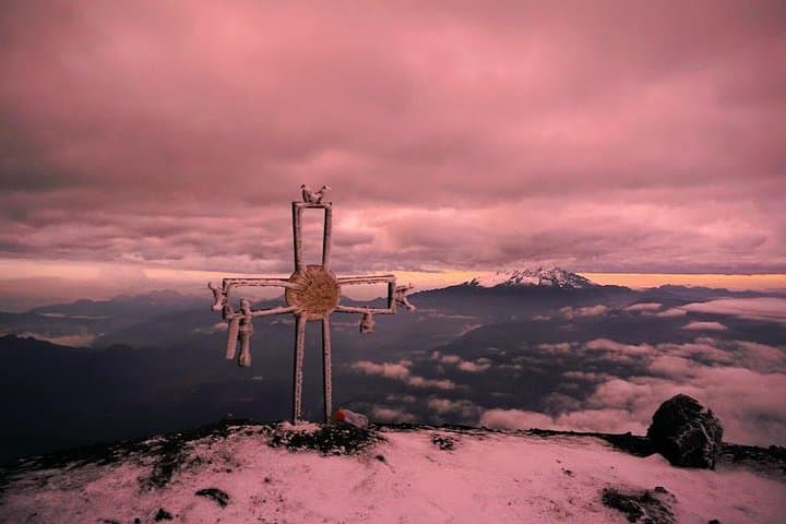
Tungurahua is a steep stratovolcano that reaches about 5,020 meters. Its recent eruptive cycles have shaped local settlement patterns and routes; communities around Baños have long adapted to both the fertility and the risk the volcano provides. Geologically, the ascent moves from Andean foothills into pumice fields and solidified lava flows, with sweeping views toward the Llanganates and the high, often snow-capped peaks visible on clear days.
The standard itinerary is two days: a 3-hour approach to the refuge at ~3,500 m on day one, overnight at the shelter, then a 4–6 hour summit push the following day. Expect loose scree, steep pitches above 4,000 m, and changing weather—sun can turn to sleet quickly. Guides typically provide helmets, harnesses, and lamps; they also manage permits and transport from Baños. Acclimatize in town, carry layered insulation, and plan for early starts for the summit push to avoid afternoon winds and poor visibility.
Practically: boots with good ankle support, trekking poles, a headlamp for pre-dawn movement, and a focus on pacing against altitude are essential. The route rewards persistent climbers with raw high-Andean panoramas and the sound of a mountain that refuses to be ignored.
challenging.
2 days.
Good aerobic fitness and previous high-elevation day-hike experience; able to ascend steep terrain for several hours.
The program is over two days: a 3-hour trek to the refuge (~3,500 m) on day one, then a 4–6 hour summit push and return on day two—times vary with pace and weather.
No formal technical climbing background is required, but participants should be comfortable on steep, loose terrain and have prior high-elevation hiking experience.
Weather changes quickly; guides monitor conditions and can postpone summit attempts. Helmets, harnesses, and lamps are typically provided and used where necessary.
Guides usually handle entrance fees and park permits (the tour includes park entrance and shelter fees), but confirm with the operator when booking.
Local communities have long lived with Tungurahua's eruptions; the volcano has recorded active cycles in recent decades that shaped evacuation practices and land use around Baños.
High-Andean ecosystems are fragile—stick to trails, pack out all waste, and follow guide instructions to minimize erosion and disturbance.
HAT TRAVEL operates guided outdoor trips and adventures with an emphasis on safety, stewardship, and memorable experiences.
You start from the river-carved valley below Baños, the town's hot springs already steaming in the morning chill, and the cone of Tungurahua looming like a charged machine above the cloud line. The trail climbs from agricultural terraces into high grass and black volcanic scree; fumarolic breath and occasional plumes remind you the mountain is alive and watching.
You start from the river-carved valley below Baños, the town's hot springs already steaming in the morning chill, and the cone of Tungurahua looming like a charged machine above the cloud line. The trail climbs from agricultural terraces into high grass and black volcanic scree; fumarolic breath and occasional plumes remind you the mountain is alive and watching.
Tungurahua is a steep stratovolcano that reaches about 5,020 meters. Its recent eruptive cycles have shaped local settlement patterns and routes; communities around Baños have long adapted to both the fertility and the risk the volcano provides. Geologically, the ascent moves from Andean foothills into pumice fields and solidified lava flows, with sweeping views toward the Llanganates and the high, often snow-capped peaks visible on clear days.
The standard itinerary is two days: a 3-hour approach to the refuge at ~3,500 m on day one, overnight at the shelter, then a 4–6 hour summit push the following day. Expect loose scree, steep pitches above 4,000 m, and changing weather—sun can turn to sleet quickly. Guides typically provide helmets, harnesses, and lamps; they also manage permits and transport from Baños. Acclimatize in town, carry layered insulation, and plan for early starts for the summit push to avoid afternoon winds and poor visibility.
Practically: boots with good ankle support, trekking poles, a headlamp for pre-dawn movement, and a focus on pacing against altitude are essential. The route rewards persistent climbers with raw high-Andean panoramas and the sound of a mountain that refuses to be ignored.