THE ADVENTURE COLLECTIVE® · Independent discovery and booking for outdoor travel

Trade Marrakech’s red alleys for high mountain air on a full-day hike from Imlil that climbs to Tiddeli’s ridgeline. Expect 10 km and 600–700 m of gain, a rooftop Berber lunch, and sweeping Atlas panoramas.
Trade Marrakech’s red alleys for high mountain air on a full-day hike from Imlil that climbs to Tiddeli’s ridgeline. Expect 10 km and 600–700 m of gain, a rooftop Berber lunch, and sweeping Atlas panoramas.
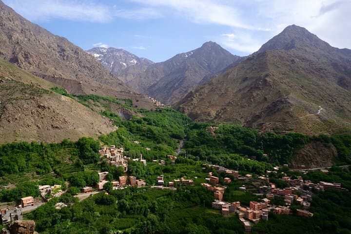
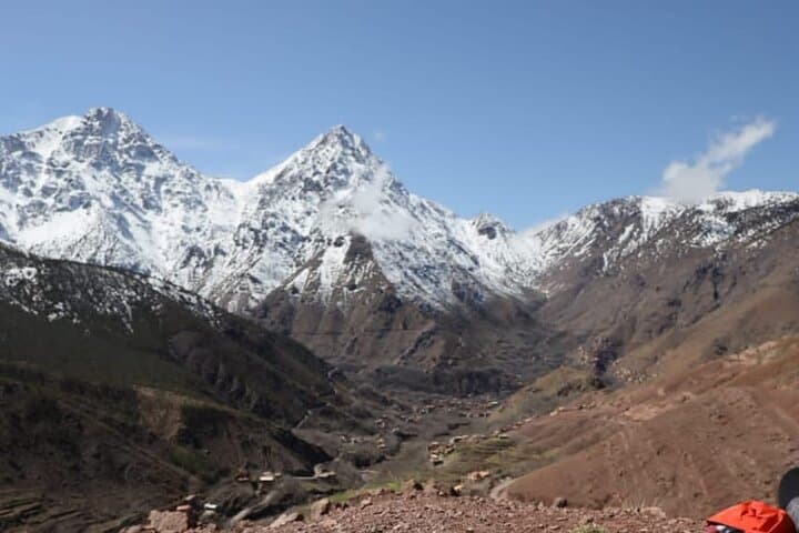
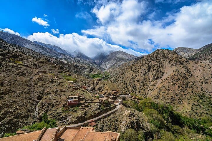
You step out of the minibus into crisp, thin air at Imlil—stone houses stacked against terraces, a stream muttering downhill, and a wind that seems to push you toward the ridge. The trail climbs from 1,740 m on mule tracks and shepherd paths, weaving through orchards and scrub, until the path opens and the High Atlas lays its raw angles before you.
Verified experiences and guided adventures in the surrounding area.
Operated by Toubkal Treks Morocco · Imlil, Marrakech-Safi
You step out of the minibus into crisp, thin air at Imlil—stone houses stacked against terraces, a stream muttering downhill, and a wind that seems to push you toward the ridge. The trail climbs from 1,740 m on mule tracks and shepherd paths, weaving through orchards and scrub, until the path opens and the High Atlas lays its raw angles before you.
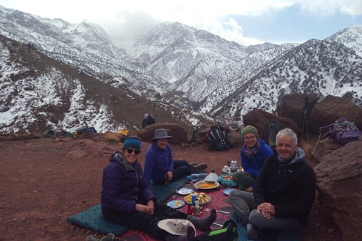
Geology here is blunt: uplifted limestone and schist carved by glacial action and seasonal streams, giving the range its steep valleys and broad panoramic saddles. The valleys are lived-in landscapes: Berber villages farm terraces, trade in small markets on Saturdays, and host hikers for mint tea and tagine. Lunch at a family home is both social and practical—fuel for the climb and a view from a rooftop terrace toward North Africa’s highest peaks.
Expect a purposeful day: roughly 10 km (about 6–8 miles) of hiking with 600–700 m of elevation gain to reach the highest point (commonly between 2,100–2,600 m). Trails vary from packed dirt to loose scree; occasional steep steps require steady footing. The hike itself takes about 5 hours on the trail; door-to-door from Marrakech runs 7–8 hours depending on traffic and stops.
Practical notes: go early to avoid midday heat, layer for rapid weather shifts, carry 2–3 L of water, and use trekking poles for steep descents. A local mountain guide handles route-finding, pacing, and cultural translation—supporting local families while keeping the experience safe and efficient.
challenging.
7–8 hours.
Good aerobic fitness and steady legs; regular hikers or those who walk uphill for several hours will cope best
The trail covers about 10 km round-trip with roughly 600–700 m of ascent; hiking time on the trail is around 5 hours.
This is challenging for true beginners due to sustained ascent and altitude; fit walkers who regularly hike uphill can manage with a guide.
Yes—lunch is served in a Berber family home (typical couscous or tagine); vegetarian options are usually available if requested in advance.
The route reaches up to ~2,600 m; most people tolerate this, but drink water, move at a steady pace, and tell your guide if you feel unwell.
High Atlas valleys are inhabited by Amazigh (Berber) communities for centuries; traditional agriculture and seasonal markets remain central to village life.
Stick to marked trails to limit erosion, pack out waste, and use local guides whose fees support village economies and trail maintenance.
Toubkal Treks Morocco operates guided outdoor trips and adventures with an emphasis on safety, stewardship, and memorable experiences.
You step out of the minibus into crisp, thin air at Imlil—stone houses stacked against terraces, a stream muttering downhill, and a wind that seems to push you toward the ridge. The trail climbs from 1,740 m on mule tracks and shepherd paths, weaving through orchards and scrub, until the path opens and the High Atlas lays its raw angles before you.
You step out of the minibus into crisp, thin air at Imlil—stone houses stacked against terraces, a stream muttering downhill, and a wind that seems to push you toward the ridge. The trail climbs from 1,740 m on mule tracks and shepherd paths, weaving through orchards and scrub, until the path opens and the High Atlas lays its raw angles before you.
Geology here is blunt: uplifted limestone and schist carved by glacial action and seasonal streams, giving the range its steep valleys and broad panoramic saddles. The valleys are lived-in landscapes: Berber villages farm terraces, trade in small markets on Saturdays, and host hikers for mint tea and tagine. Lunch at a family home is both social and practical—fuel for the climb and a view from a rooftop terrace toward North Africa’s highest peaks.
Expect a purposeful day: roughly 10 km (about 6–8 miles) of hiking with 600–700 m of elevation gain to reach the highest point (commonly between 2,100–2,600 m). Trails vary from packed dirt to loose scree; occasional steep steps require steady footing. The hike itself takes about 5 hours on the trail; door-to-door from Marrakech runs 7–8 hours depending on traffic and stops.
Practical notes: go early to avoid midday heat, layer for rapid weather shifts, carry 2–3 L of water, and use trekking poles for steep descents. A local mountain guide handles route-finding, pacing, and cultural translation—supporting local families while keeping the experience safe and efficient.