THE ADVENTURE COLLECTIVE® · Independent discovery and booking for outdoor travel

Ascend through cloud forest to the rim of Volcán Santa Ana (Ilamatepec) for crater views, a green crater lake and vistas that stretch to Lake Coatepeque and the Pacific on clear days. This guided day-hike blends geology, local history and hands-on conservation guidance.
Ascend through cloud forest to the rim of Volcán Santa Ana (Ilamatepec) for crater views, a green crater lake and vistas that stretch to Lake Coatepeque and the Pacific on clear days. This guided day-hike blends geology, local history and hands-on conservation guidance.
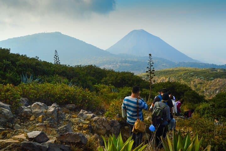
You step onto a narrow trail and the forest answers: moss-laden trunks brush your shoulders, cloud fingers slide through the pines, and the path angles upward with a steady, honest pitch. The air thins and the scent of wet earth and coffee farms follows you—Santa Ana’s slopes wear both wilderness and human history.
Verified experiences and guided adventures in the surrounding area.
Operated by La Ruta Travels · Santa Ana, Santa Ana Department
You step onto a narrow trail and the forest answers: moss-laden trunks brush your shoulders, cloud fingers slide through the pines, and the path angles upward with a steady, honest pitch. The air thins and the scent of wet earth and coffee farms follows you—Santa Ana’s slopes wear both wilderness and human history.
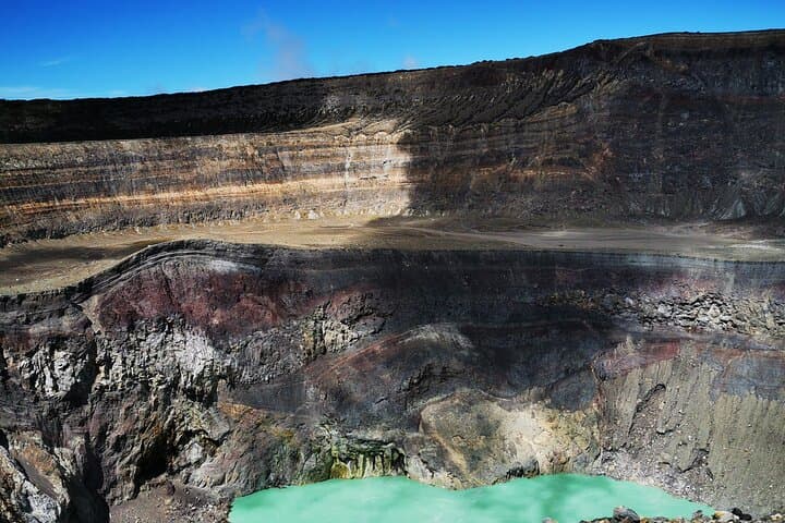
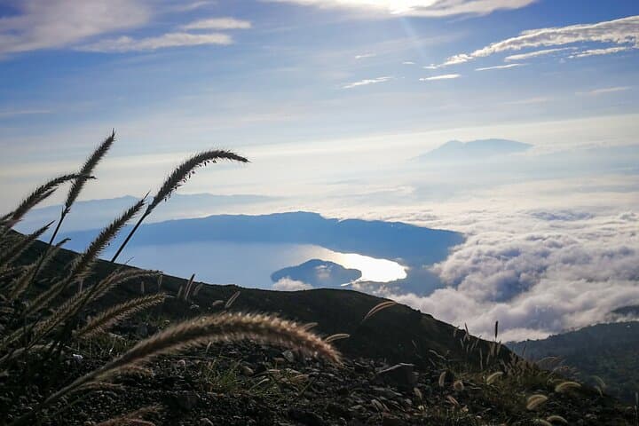
Geology here is immediate. Ilamatepec’s caldera cuts a rim 2,381 meters above sea level; its crater hosts a green lake and, on clear mornings, the palms of Lake Coatepeque and a distant band of Pacific coastline read like a map. The volcano erupted in 2005, a recent reminder of an active past that shaped local soils and the region’s coffee economies. Guides often weave geology with cultural notes—how volcanic ash fed smallholdings and how trails trace old pastoral paths.
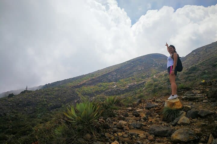
Expect about 4–5 km of trail to the summit from the park entrance, with an ascent that commonly takes 1.5–2 hours and roughly 600–700 m of elevation gain depending on start point. Terrain shifts from damp cloud forest to open ridgeline with loose volcanic scree; boots with traction matter. The full excursion runs about 5–6 hours including summit time and a lakeside stop at Coatepeque.
Practicalities: start early to avoid midday heat and afternoon clouds, carry 2L of water, layer for wind and sun, and heed guide advice—this route is popular but volcanic terrain demands respect. If you have respiratory, cardiac, or pregnancy concerns, sit this one out. Finish with a lakeside refreshment and you’ll understand why locals read the mountain as both challenge and classroom.
moderate.
5–6 hours.
Moderate fitness; able to sustain a steady uphill pace for 1.5–2 hours with short breaks
The trail to the summit is about 4–5 km from the park entrance with an ascent typically taking 1.5–2 hours; expect sustained uphill sections and about 600–700 m of elevation gain depending on start point.
This tour is guided and includes park entry; going with a licensed guide is recommended for safety and local knowledge, and permits or entrance fees are handled as part of organized trips.
Santa Ana is an active volcano with a notable eruption in 2005; guided hikes follow established trails and are generally safe, but people with respiratory or cardiovascular issues should avoid the trip.
Yes — many guided itineraries include a stop at Lake Coatepeque after the summit for a short boat option or lakeside relaxation and refreshments.
Known locally as Ilamatepec, Santa Ana’s eruptions have repeatedly reshaped the landscape; ash deposits helped create fertile soils that fueled regional coffee cultivation.
The cloud forest and crater rim are ecologically fragile; stick to trails, pack out trash and consider hiring local guides to support community conservation efforts.
La Ruta Travels operates guided outdoor trips and adventures with an emphasis on safety, stewardship, and memorable experiences.
You step onto a narrow trail and the forest answers: moss-laden trunks brush your shoulders, cloud fingers slide through the pines, and the path angles upward with a steady, honest pitch. The air thins and the scent of wet earth and coffee farms follows you—Santa Ana’s slopes wear both wilderness and human history.
You step onto a narrow trail and the forest answers: moss-laden trunks brush your shoulders, cloud fingers slide through the pines, and the path angles upward with a steady, honest pitch. The air thins and the scent of wet earth and coffee farms follows you—Santa Ana’s slopes wear both wilderness and human history.
Geology here is immediate. Ilamatepec’s caldera cuts a rim 2,381 meters above sea level; its crater hosts a green lake and, on clear mornings, the palms of Lake Coatepeque and a distant band of Pacific coastline read like a map. The volcano erupted in 2005, a recent reminder of an active past that shaped local soils and the region’s coffee economies. Guides often weave geology with cultural notes—how volcanic ash fed smallholdings and how trails trace old pastoral paths.
Expect about 4–5 km of trail to the summit from the park entrance, with an ascent that commonly takes 1.5–2 hours and roughly 600–700 m of elevation gain depending on start point. Terrain shifts from damp cloud forest to open ridgeline with loose volcanic scree; boots with traction matter. The full excursion runs about 5–6 hours including summit time and a lakeside stop at Coatepeque.
Practicalities: start early to avoid midday heat and afternoon clouds, carry 2L of water, layer for wind and sun, and heed guide advice—this route is popular but volcanic terrain demands respect. If you have respiratory, cardiac, or pregnancy concerns, sit this one out. Finish with a lakeside refreshment and you’ll understand why locals read the mountain as both challenge and classroom.