THE ADVENTURE COLLECTIVE® · Independent discovery and booking for outdoor travel

Ride the TelefériQo to 4,050 m and tackle a high-altitude full-day trek to Rucu Pichincha’s summit. Expect 3–4 hours up through volcanic terrain, fragile páramo and panoramic views of Quito.
Ride the TelefériQo to 4,050 m and tackle a high-altitude full-day trek to Rucu Pichincha’s summit. Expect 3–4 hours up through volcanic terrain, fragile páramo and panoramic views of Quito.
The cable car stutters skyward and Quito slips into a patchwork bowl below as walkers step off at 4,050 m and begin the climb toward Rucu Pichincha’s ridgeline. Wind and thin air set the rhythm; talus and volcanic scree demand focus while páramo grasses bend like audience arms to reveal the city between crags.
Verified experiences and guided adventures in the surrounding area.
Operated by latitudetripec · Quito, Pichincha
The cable car stutters skyward and Quito slips into a patchwork bowl below as walkers step off at 4,050 m and begin the climb toward Rucu Pichincha’s ridgeline. Wind and thin air set the rhythm; talus and volcanic scree demand focus while páramo grasses bend like audience arms to reveal the city between crags.
Rucu Pichincha is part of the Pichincha volcanic complex that rims Quito’s western skyline. Its flanks are young volcanic deposits—ash, lava and hardened scoria—shaped by eruptions that have punctuated local history and influenced settlement patterns on the valley floor. Indigenous and colonial routes crossed these heights for grazing and signal fires; today guides translate that landscape into manageable waypoints and panoramic breathing room.
Expect a 3–4 hour ascent from the cable car station, then a shorter descent, with a total outing around seven hours. Terrain alternates packed trail, loose rock and exposed ridgelines; altitude is the main challenge rather than technical climbing. Weather changes fast—fog, wind and sudden rain are common—so the operator will cancel in unsafe conditions.
Practical edge: acclimatize in Quito for 24–48 hours if arriving from low elevation; carry at least 1.5–2 liters of water, sun protection and a windproof layer. Sturdy trekking boots and poles make the slog on scree and steep sections safer. The summit rewards effort with sweeping city views and a close reading of Andean geology and páramo ecology before you return to the cable car and the valley below.
challenging.
6–8 hours.
Good aerobic fitness and prior high-altitude hiking experience recommended; acclimatization advised
The standard tour begins at the cable car upper station (Cruz Loma) and uses it to reach 4,050 m; confirm ticket inclusion when booking.
The summit sits around 4,600–4,700 m; expect roughly 3–4 hours to ascend from the cable car station and 1–2 hours to descend, total ~6–8 hours.
No technical climbing skills are required, but solid high-altitude hiking fitness and experience on loose terrain help.
This tour is not recommended for pregnant travelers or those with serious heart or spinal conditions; suitability for children depends on fitness and acclimatization—check with the operator.
Rucu Pichincha is part of the Pichincha volcanic complex that has influenced Quito’s development; eruptions and lava flows shaped routes and settlements on the western slopes.
The páramo is a fragile water-capturing ecosystem—stay on trails, avoid trampling plants and carry out all garbage to protect fragile soils and native species.
latitudetripec operates guided outdoor trips and adventures with an emphasis on safety, stewardship, and memorable experiences.
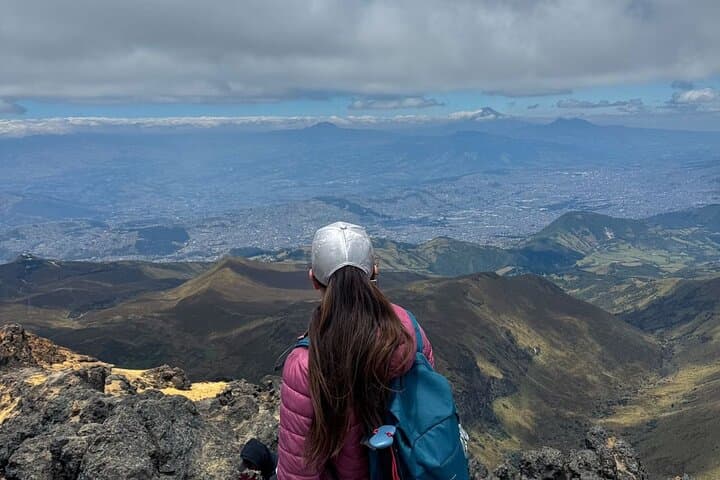
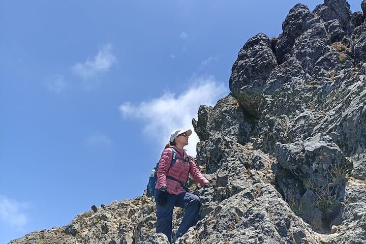
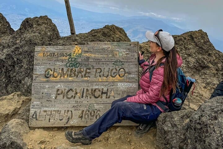
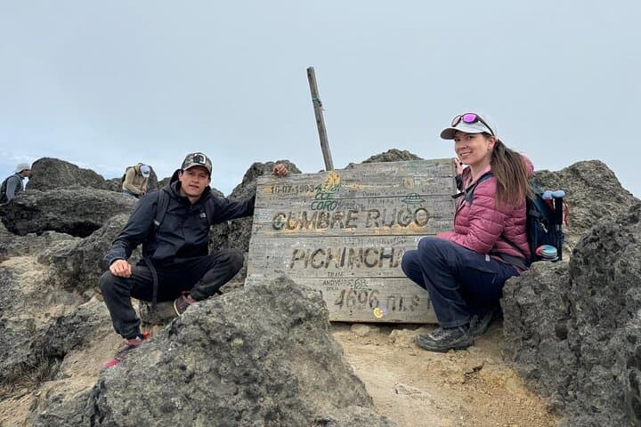
The cable car stutters skyward and Quito slips into a patchwork bowl below as walkers step off at 4,050 m and begin the climb toward Rucu Pichincha’s ridgeline. Wind and thin air set the rhythm; talus and volcanic scree demand focus while páramo grasses bend like audience arms to reveal the city between crags.
The cable car stutters skyward and Quito slips into a patchwork bowl below as walkers step off at 4,050 m and begin the climb toward Rucu Pichincha’s ridgeline. Wind and thin air set the rhythm; talus and volcanic scree demand focus while páramo grasses bend like audience arms to reveal the city between crags.
Rucu Pichincha is part of the Pichincha volcanic complex that rims Quito’s western skyline. Its flanks are young volcanic deposits—ash, lava and hardened scoria—shaped by eruptions that have punctuated local history and influenced settlement patterns on the valley floor. Indigenous and colonial routes crossed these heights for grazing and signal fires; today guides translate that landscape into manageable waypoints and panoramic breathing room.
Expect a 3–4 hour ascent from the cable car station, then a shorter descent, with a total outing around seven hours. Terrain alternates packed trail, loose rock and exposed ridgelines; altitude is the main challenge rather than technical climbing. Weather changes fast—fog, wind and sudden rain are common—so the operator will cancel in unsafe conditions.
Practical edge: acclimatize in Quito for 24–48 hours if arriving from low elevation; carry at least 1.5–2 liters of water, sun protection and a windproof layer. Sturdy trekking boots and poles make the slog on scree and steep sections safer. The summit rewards effort with sweeping city views and a close reading of Andean geology and páramo ecology before you return to the cable car and the valley below.