THE ADVENTURE COLLECTIVE® · Independent discovery and booking for outdoor travel

An energetic two-day trek from Imlil to the refuge and up to Mount Toubkal’s 4,167 m summit. Expect steep scree, early starts, Berber villages and sweeping Atlas vistas.
An energetic two-day trek from Imlil to the refuge and up to Mount Toubkal’s 4,167 m summit. Expect steep scree, early starts, Berber villages and sweeping Atlas vistas.
Pre-dawn air bites at 3,000 meters as headlamps stitch a path through scree and shale. Low terraces give way to raw, wind-sculpted ridgelines; the trail climbs in tight switchbacks, riverbeds daring you to cross and the Atlas itself pressing skyward like a patient opponent.
Verified experiences and guided adventures in the surrounding area.
Operated by Morocco Treks and Tours · Imlil, Marrakesh-Safi
Pre-dawn air bites at 3,000 meters as headlamps stitch a path through scree and shale. Low terraces give way to raw, wind-sculpted ridgelines; the trail climbs in tight switchbacks, riverbeds daring you to cross and the Atlas itself pressing skyward like a patient opponent.
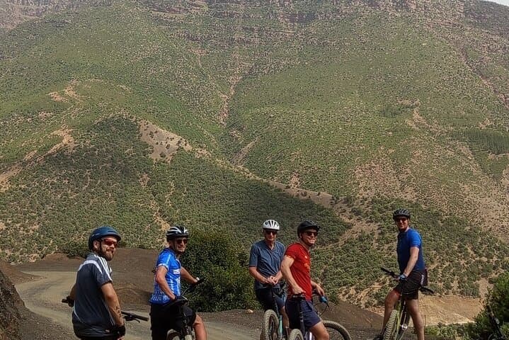
The route from Imlil to Toubkal Refuge follows the Maizane Valley, passing village hamlets, the shrine of Sidi Chamharouch, and alpine floodplains before the steep thrust to the summit. Geologically the High Atlas is young uplifted rock—shales, sandstones and volcanic intrusions—so expect loose scree near the top and solid moraines lower down.
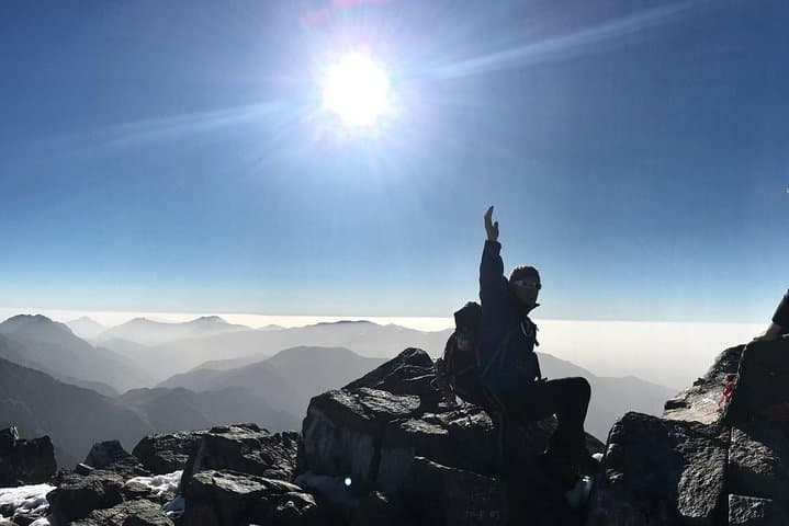
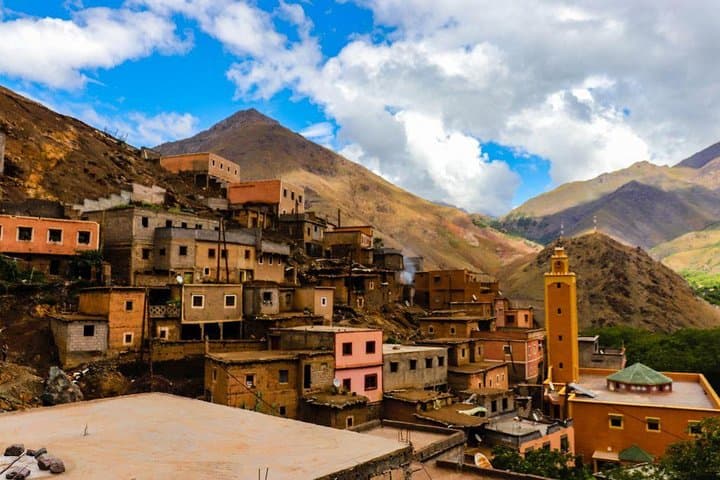
Culturally this is Berber country: shepherding and terraced agriculture persist, and mule tracks remain the true highways. A night at the refuge gives you time to acclimatize before a 3–4 hour push to 4,167 m on day two; under clear skies the summit opens to 360° views across the Atlas to the plains and, occasionally, a distant glimpse of the Sahara.
Practically, plan for rapid weather swings, strong sun and significant elevation change. Start very early on summit day, carry layered clothing, and use trekking poles for the descent on scree. Guides, mules and a cook are commonly provided and useful for logistics and safety.
This two-day itinerary is non-technical but physically demanding—it's a high-altitude hike that rewards effort with a commanding summit and a deep sense of place in North Africa's great range.
challenging.
2 days (approx. 48 hours).
High aerobic fitness and endurance for long ascents and descent; regular hikers should prepare with uphill training
No technical climbing is required in summer conditions; the ascent is a steep, non-technical hike though loose scree can be challenging.
Expect about 3–4 hours from the refuge to the summit depending on pace and acclimatization.
Yes—symptoms can appear above 3,000 m; climb slowly, hydrate, and descend if symptoms worsen.
Many operators include a guide, mules and a cook; mules carry luggage while you hike, which eases the effort.
The High Atlas has long been inhabited by Berber communities whose transhumant patterns and stone villages predate modern borders.
The region is vulnerable to erosion and overgrazing; stick to established trails and support local guides to lower your footprint.
Morocco Treks and Tours operates guided outdoor trips and adventures with an emphasis on safety, stewardship, and memorable experiences.
Pre-dawn air bites at 3,000 meters as headlamps stitch a path through scree and shale. Low terraces give way to raw, wind-sculpted ridgelines; the trail climbs in tight switchbacks, riverbeds daring you to cross and the Atlas itself pressing skyward like a patient opponent.
Pre-dawn air bites at 3,000 meters as headlamps stitch a path through scree and shale. Low terraces give way to raw, wind-sculpted ridgelines; the trail climbs in tight switchbacks, riverbeds daring you to cross and the Atlas itself pressing skyward like a patient opponent.
The route from Imlil to Toubkal Refuge follows the Maizane Valley, passing village hamlets, the shrine of Sidi Chamharouch, and alpine floodplains before the steep thrust to the summit. Geologically the High Atlas is young uplifted rock—shales, sandstones and volcanic intrusions—so expect loose scree near the top and solid moraines lower down.
Culturally this is Berber country: shepherding and terraced agriculture persist, and mule tracks remain the true highways. A night at the refuge gives you time to acclimatize before a 3–4 hour push to 4,167 m on day two; under clear skies the summit opens to 360° views across the Atlas to the plains and, occasionally, a distant glimpse of the Sahara.
Practically, plan for rapid weather swings, strong sun and significant elevation change. Start very early on summit day, carry layered clothing, and use trekking poles for the descent on scree. Guides, mules and a cook are commonly provided and useful for logistics and safety.
This two-day itinerary is non-technical but physically demanding—it's a high-altitude hike that rewards effort with a commanding summit and a deep sense of place in North Africa's great range.