THE ADVENTURE COLLECTIVE® · Independent discovery and booking for outdoor travel

A brisk two-day climb from Imlil to Toubkal’s 4,167 m summit—non-technical but altitude-heavy—offers big views, Berber culture, and alpine refuge support. Read on for what to expect, packing tips, and timing your ascent.
A brisk two-day climb from Imlil to Toubkal’s 4,167 m summit—non-technical but altitude-heavy—offers big views, Berber culture, and alpine refuge support. Read on for what to expect, packing tips, and timing your ascent.
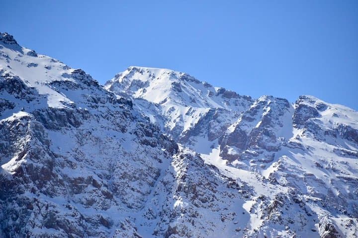
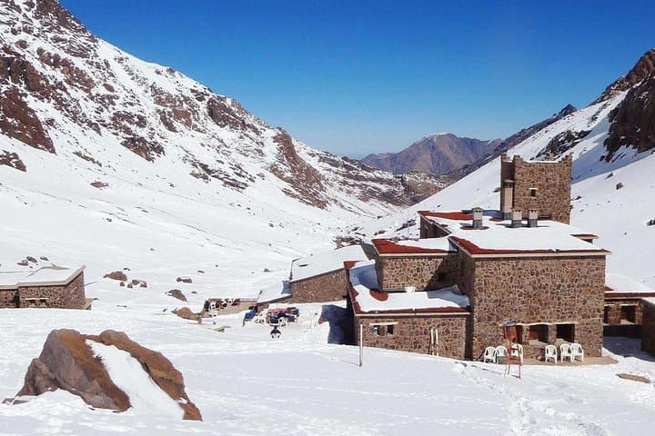
Before dawn, the trail out of Imlil is a thin braid of headlamps and soft boot strikes, the cold sky thinning to reveal the jagged silhouette of Toubkal. By first light the High Atlas catches color—red-brown scree, slate ridges and the scattered white roofs of Berber hamlets—while the refuge sits like a plain human outpost against a sharp alpine face.
Verified experiences and guided adventures in the surrounding area.
Operated by ATLAS VERTICAL TRAVEL · Imlil, Marrakesh-Safi
Before dawn, the trail out of Imlil is a thin braid of headlamps and soft boot strikes, the cold sky thinning to reveal the jagged silhouette of Toubkal. By first light the High Atlas catches color—red-brown scree, slate ridges and the scattered white roofs of Berber hamlets—while the refuge sits like a plain human outpost against a sharp alpine face.
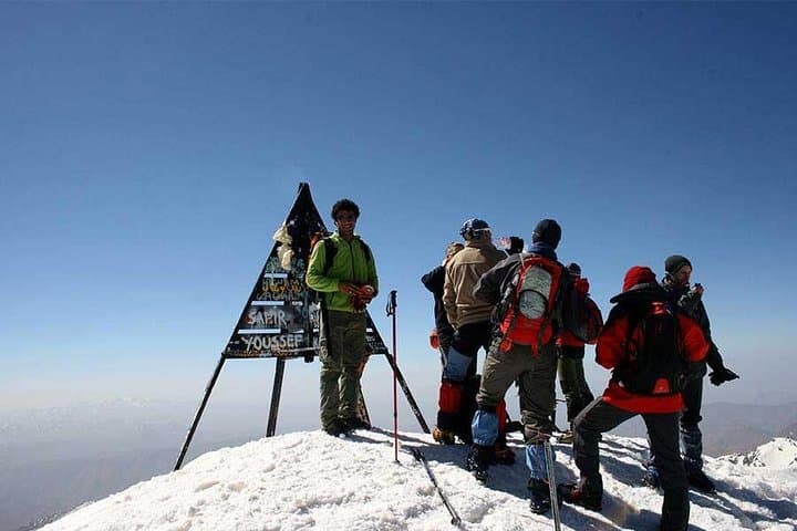
Toubkal (4,167 m) is North Africa’s highest point and part of the High Atlas, a range formed by the collision of the African and Eurasian plates. The route follows mule tracks, stone switchbacks and short scree fields; it’s non-technical but altitude and sustained ascent make it demanding. The valley around Imlil is long inhabited by Amazigh (Berber) communities whose terraced fields and guesthouses provide cultural bearings and practical support for climbers.
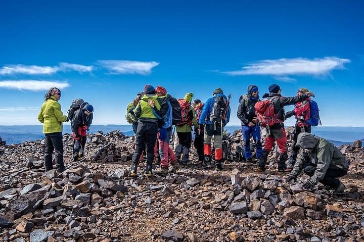
Expect about 5–6 hours of uphill to the Neltner refuge (3,207–3,210 m) on day one with ~1,400 m gain, then a 9–10 hour summit push and descent on day two with cumulative ascent and descent exceeding 2,000 m. Trails are rocky, occasionally steep and exposed to wind; early starts are standard to avoid afternoon weather.
Practical advice: pace conservatively, carry warm layers and a headlamp, and hydrate before and during ascent to reduce altitude effects. Local guides organize transfers from Marrakech, arrange refuge or tent stays, and provide meals—use that support for route-finding and local insight. Leave-no-trace principles matter here; alpine plants are fragile and water sources limited. A two-day climb to Toubkal is raw, accessible mountain travel that rewards steady effort with sweeping views over the Atlas and toward the Sahara margins.
challenging.
2 days.
Good aerobic fitness with experience on long uphill days; ability to handle sustained climbs and descents for 8–10+ hours.
No—standard summer routes are non-technical; crampons or ice axes may be needed in winter or early spring conditions.
You should be comfortable with back-to-back long days of hiking and sustained elevation gain (1,000–1,400 m+); regular uphill training is recommended.
Trips typically start in Marrakech with a transfer to Imlil; the route returns to Imlil for a drive back to Marrakech on day two.
Guides, refuge accommodation (or tents in summer) and meals are usually included as part of organized 2-day climbs—confirm specifics with the operator.
The High Atlas has been home to Amazigh (Berber) communities for centuries; Imlil has long served as a gateway village for caravans and modern climbers alike.
Trails above Imlil cross fragile alpine vegetation and limited water sources—practice leave-no-trace, use existing campsites, and pack out waste to limit impact.
ATLAS VERTICAL TRAVEL operates guided outdoor trips and adventures with an emphasis on safety, stewardship, and memorable experiences.
Before dawn, the trail out of Imlil is a thin braid of headlamps and soft boot strikes, the cold sky thinning to reveal the jagged silhouette of Toubkal. By first light the High Atlas catches color—red-brown scree, slate ridges and the scattered white roofs of Berber hamlets—while the refuge sits like a plain human outpost against a sharp alpine face.
Before dawn, the trail out of Imlil is a thin braid of headlamps and soft boot strikes, the cold sky thinning to reveal the jagged silhouette of Toubkal. By first light the High Atlas catches color—red-brown scree, slate ridges and the scattered white roofs of Berber hamlets—while the refuge sits like a plain human outpost against a sharp alpine face.
Toubkal (4,167 m) is North Africa’s highest point and part of the High Atlas, a range formed by the collision of the African and Eurasian plates. The route follows mule tracks, stone switchbacks and short scree fields; it’s non-technical but altitude and sustained ascent make it demanding. The valley around Imlil is long inhabited by Amazigh (Berber) communities whose terraced fields and guesthouses provide cultural bearings and practical support for climbers.
Expect about 5–6 hours of uphill to the Neltner refuge (3,207–3,210 m) on day one with ~1,400 m gain, then a 9–10 hour summit push and descent on day two with cumulative ascent and descent exceeding 2,000 m. Trails are rocky, occasionally steep and exposed to wind; early starts are standard to avoid afternoon weather.
Practical advice: pace conservatively, carry warm layers and a headlamp, and hydrate before and during ascent to reduce altitude effects. Local guides organize transfers from Marrakech, arrange refuge or tent stays, and provide meals—use that support for route-finding and local insight. Leave-no-trace principles matter here; alpine plants are fragile and water sources limited. A two-day climb to Toubkal is raw, accessible mountain travel that rewards steady effort with sweeping views over the Atlas and toward the Sahara margins.