THE ADVENTURE COLLECTIVE® · Independent discovery and booking for outdoor travel

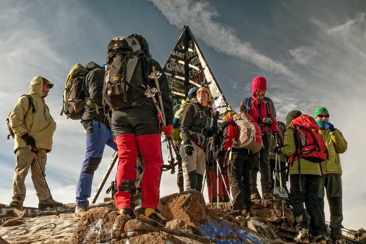
A two-day push from Marrakech to the 4,167 m summit of Mount Toubkal via Imlil and the Toubkal Refuge. Expect long ascents, mule tracks and a pre-dawn summit for sunrise views across the Atlas and Sahara.
A two-day push from Marrakech to the 4,167 m summit of Mount Toubkal via Imlil and the Toubkal Refuge. Expect long ascents, mule tracks and a pre-dawn summit for sunrise views across the Atlas and Sahara.
You step out of the minibus before dawn, the road cooling as Marrakech’s orange lights recede and the High Atlas rises ahead — a granite wall that seems to push the sky higher. The trail from Imlil cuts through terraced fields and mule tracks, the village roofs shrinking behind you as pine-scented air pulls you upward.
Verified experiences and guided adventures in the surrounding area.
Operated by Atlas Trips Tours · Imlil, Marrakesh-Safi
You step out of the minibus before dawn, the road cooling as Marrakech’s orange lights recede and the High Atlas rises ahead — a granite wall that seems to push the sky higher. The trail from Imlil cuts through terraced fields and mule tracks, the village roofs shrinking behind you as pine-scented air pulls you upward.
Toubkal (4,167 m) is North Africa’s highest point and a landmark of Berber land-use, carved by glacial action and centuries of shepherding. Along the route you’ll pass Aremd’s stone houses and the white-boulder shrine at Sidi Chamharouch — cultural pauses where local faith and mountain life meet. Geologically, the High Atlas is young and rugged: steep valleys, scree slopes and exposed rock that demand steady footing and respect for altitude.
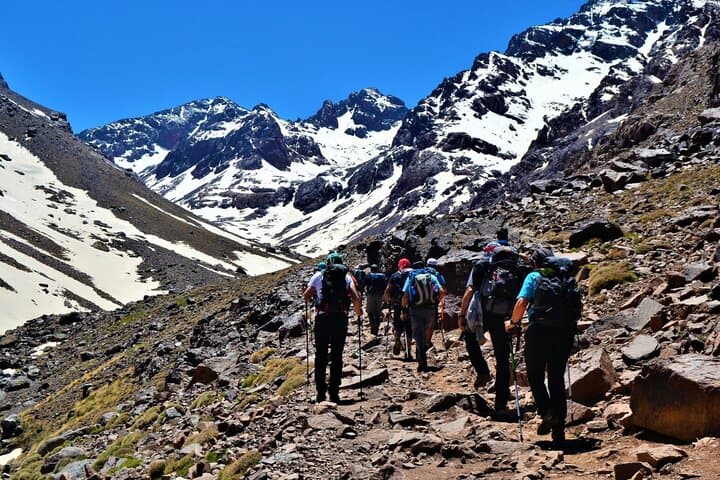
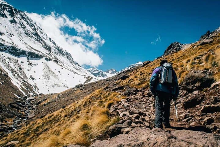
The itinerary typically covers ~10–12 km on Day 1 with 1,200–1,500 m of elevation gain to the refuge (≈3,200 m), then a pre-dawn 8–10 km summit loop with ~950–1,000 m of ascent from the refuge. Expect mixed terrain: mule tracks, loose scree, steeper rock sections near the summit and cold, thin air above 3,500 m.
Practical guidance: move slowly on steep pitches, use trekking poles, hydrate before and during the climb, and pack layers for temperature swings. The refuge offers basic dormitory lodging and hot meals; mule support carries luggage but your daypack should hold water, snacks, and a warm layer. Plan for early starts, short daylight at high altitude, and the simple reward of sunrise that makes the effort unmistakably worth it.
challenging.
2 days.
Good cardiovascular fitness and experience with sustained uphill hikes at altitude; able to carry a 6–10 kg daypack.
The final ascent is steep and exposed in places; expect 4–6 hours roundtrip from the refuge with nearly 1,000 m of elevation gain — fit hikers handle it, but altitude makes it tougher.
Toubkal Refuge offers basic dormitory rooms, shared facilities and hot meals — bring a warm sleeping liner and small cash for extras.
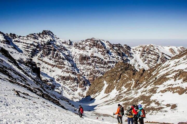
No technical gear is required in normal summer conditions; in winter, crampons and an ice axe may be necessary and guides will advise accordingly.
Yes — most operators include private round-trip transport between Marrakech and Imlil; confirm pickup location when booking.
The High Atlas is home to Amazigh (Berber) communities whose terraces and mule routes date back centuries; local guides often come from families that have guided these paths for generations.
Toubkal sits within a protected mountain landscape where trail erosion and litter are ongoing concerns; using licensed local guides and minimizing waste helps support conservation and community livelihoods.
Atlas Trips Tours operates guided outdoor trips and adventures with an emphasis on safety, stewardship, and memorable experiences.
You step out of the minibus before dawn, the road cooling as Marrakech’s orange lights recede and the High Atlas rises ahead — a granite wall that seems to push the sky higher. The trail from Imlil cuts through terraced fields and mule tracks, the village roofs shrinking behind you as pine-scented air pulls you upward.
You step out of the minibus before dawn, the road cooling as Marrakech’s orange lights recede and the High Atlas rises ahead — a granite wall that seems to push the sky higher. The trail from Imlil cuts through terraced fields and mule tracks, the village roofs shrinking behind you as pine-scented air pulls you upward.
Toubkal (4,167 m) is North Africa’s highest point and a landmark of Berber land-use, carved by glacial action and centuries of shepherding. Along the route you’ll pass Aremd’s stone houses and the white-boulder shrine at Sidi Chamharouch — cultural pauses where local faith and mountain life meet. Geologically, the High Atlas is young and rugged: steep valleys, scree slopes and exposed rock that demand steady footing and respect for altitude.
The itinerary typically covers ~10–12 km on Day 1 with 1,200–1,500 m of elevation gain to the refuge (≈3,200 m), then a pre-dawn 8–10 km summit loop with ~950–1,000 m of ascent from the refuge. Expect mixed terrain: mule tracks, loose scree, steeper rock sections near the summit and cold, thin air above 3,500 m.
Practical guidance: move slowly on steep pitches, use trekking poles, hydrate before and during the climb, and pack layers for temperature swings. The refuge offers basic dormitory lodging and hot meals; mule support carries luggage but your daypack should hold water, snacks, and a warm layer. Plan for early starts, short daylight at high altitude, and the simple reward of sunrise that makes the effort unmistakably worth it.