THE ADVENTURE COLLECTIVE® · Independent discovery and booking for outdoor travel

A demanding full-day ascent to La Malinche’s 4,460-meter summit, this guided mountaineering trip moves from pine forest to exposed ridgelines with panoramic views of Mexico’s major volcanoes. Expect long hiking hours, altitude gain and a culturally rich highland landscape.
A demanding full-day ascent to La Malinche’s 4,460-meter summit, this guided mountaineering trip moves from pine forest to exposed ridgelines with panoramic views of Mexico’s major volcanoes. Expect long hiking hours, altitude gain and a culturally rich highland landscape.
You start before dawn, headlights carving a ribbon of road through the high plain as the silhouette of La Malinche grows larger—cone rising out of pine forest, its summit already outlined against a thinning band of stars.
Verified experiences and guided adventures in the surrounding area.
Operated by México Travesías · Tlaxcala, Tlaxcala
You start before dawn, headlights carving a ribbon of road through the high plain as the silhouette of La Malinche grows larger—cone rising out of pine forest, its summit already outlined against a thinning band of stars.
La Malinche (Malintzin) is the fifth-highest peak in Mexico at about 4,460 meters, sitting on the Tlaxcala–Puebla border. Its slopes are volcanic tuff and andesitic lava, shaped by eruptions and long erosion; the mountain’s long, gentle flanks make for sustained ascent rather than steep technical climbing. Indigenous Nahua and Tlaxcaltec history threads the route—local stories link the peak to the figure Malintzin, and nearby villages preserve traditional crafts and seasonal ceremonies.
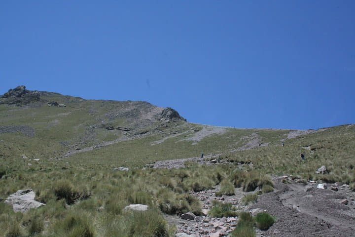
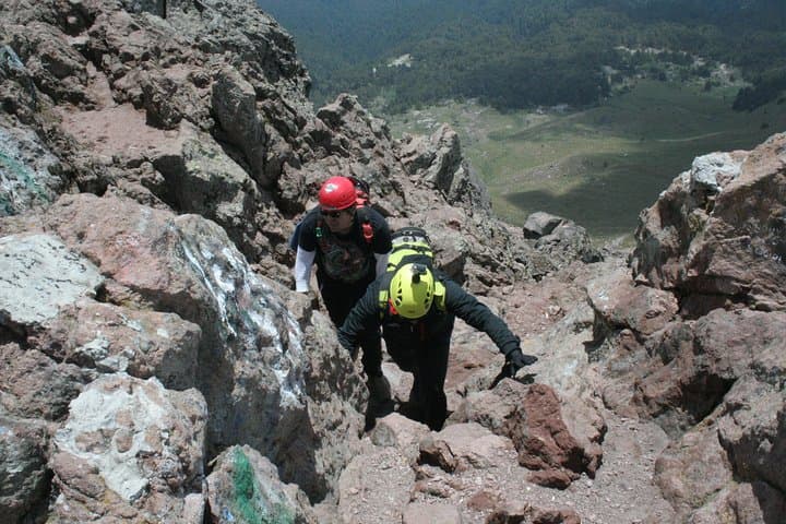
The approach moves through a cool coniferous forest, opens to flower-dotted meadows, then climbs exposed ridgelines where wind and altitude become actors, testing rhythm and breathing. On clear days, Pico de Orizaba, Popocatépetl and Iztaccíhuatl dominate the horizon, giving a layered view of Mexico’s volcanic spine.
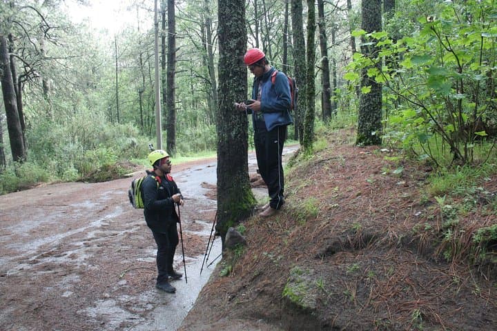
Practical edge: expect significant altitude gain and variable weather—sun to sudden wind and frost. Guides typically provide transport, a packed lunch and helmets; hikers should pace uphill, eat and hydrate often, and monitor for signs of altitude sickness. Good boots, layered clothing, sun protection and trekking poles make the day more efficient and safe.
This is a full-day mountaineering outing best for fit hikers who want a strenuous, non-technical summit with big highland views and cultural context—arrive acclimatized and ready for a long, rewarding push to the top.
challenging.
10–12 hours.
Good cardiovascular fitness and experience with long day hikes at altitude; able to sustain steady uphill hiking for several hours.
The route is non-technical but physically demanding due to sustained elevation gain and high altitude; expect a long day of hiking and some scrambling on rocky sections.
No technical mountaineering skills are required, but prior experience with multi-hour high-altitude hikes and good fitness is recommended.
Late fall through spring offer cooler, drier conditions; avoid the summer rainy season for lower risk of afternoon storms and mud.
Yes—acclimatization, slow pacing, hydration and recognizing symptoms (headache, nausea, dizziness) are important; guides can assist but serious symptoms require descent.
The mountain is culturally significant to Nahua peoples and carries the name Malintzin in local lore; colonial and indigenous histories converge in communities on its slopes.
La Malinche is a protected national park with grazing and recreation pressures; stick to trails, pack out waste and support local conservation initiatives.
México Travesías operates guided outdoor trips and adventures with an emphasis on safety, stewardship, and memorable experiences.
You start before dawn, headlights carving a ribbon of road through the high plain as the silhouette of La Malinche grows larger—cone rising out of pine forest, its summit already outlined against a thinning band of stars.
You start before dawn, headlights carving a ribbon of road through the high plain as the silhouette of La Malinche grows larger—cone rising out of pine forest, its summit already outlined against a thinning band of stars.
La Malinche (Malintzin) is the fifth-highest peak in Mexico at about 4,460 meters, sitting on the Tlaxcala–Puebla border. Its slopes are volcanic tuff and andesitic lava, shaped by eruptions and long erosion; the mountain’s long, gentle flanks make for sustained ascent rather than steep technical climbing. Indigenous Nahua and Tlaxcaltec history threads the route—local stories link the peak to the figure Malintzin, and nearby villages preserve traditional crafts and seasonal ceremonies.
The approach moves through a cool coniferous forest, opens to flower-dotted meadows, then climbs exposed ridgelines where wind and altitude become actors, testing rhythm and breathing. On clear days, Pico de Orizaba, Popocatépetl and Iztaccíhuatl dominate the horizon, giving a layered view of Mexico’s volcanic spine.
Practical edge: expect significant altitude gain and variable weather—sun to sudden wind and frost. Guides typically provide transport, a packed lunch and helmets; hikers should pace uphill, eat and hydrate often, and monitor for signs of altitude sickness. Good boots, layered clothing, sun protection and trekking poles make the day more efficient and safe.
This is a full-day mountaineering outing best for fit hikers who want a strenuous, non-technical summit with big highland views and cultural context—arrive acclimatized and ready for a long, rewarding push to the top.