THE ADVENTURE COLLECTIVE® · Independent discovery and booking for outdoor travel

Follow the classic Machame Route over six days from rainforest to the crater rim and Uhuru Peak. This guide covers what to expect on trail, key camps, and practical tips for altitude, gear, and timing.
Follow the classic Machame Route over six days from rainforest to the crater rim and Uhuru Peak. This guide covers what to expect on trail, key camps, and practical tips for altitude, gear, and timing.
A low cloud clings to the rainforest as porters shoulder bright duffels and guides call out in Kiswahili; you step through a narrow gate and the trail pulls you into the mountain. Early sections wind under giant trees where black-and-white colobus watch from branches, then the path opens onto heathland, a plateau of senecios, and finally the barren, wind-scoured alpine desert that prepares you for the long, thin air above.
Verified experiences and guided adventures in the surrounding area.
Operated by Mountain Warriors Tours and Safaris · Moshi, Kilimanjaro Region
A low cloud clings to the rainforest as porters shoulder bright duffels and guides call out in Kiswahili; you step through a narrow gate and the trail pulls you into the mountain. Early sections wind under giant trees where black-and-white colobus watch from branches, then the path opens onto heathland, a plateau of senecios, and finally the barren, wind-scoured alpine desert that prepares you for the long, thin air above.
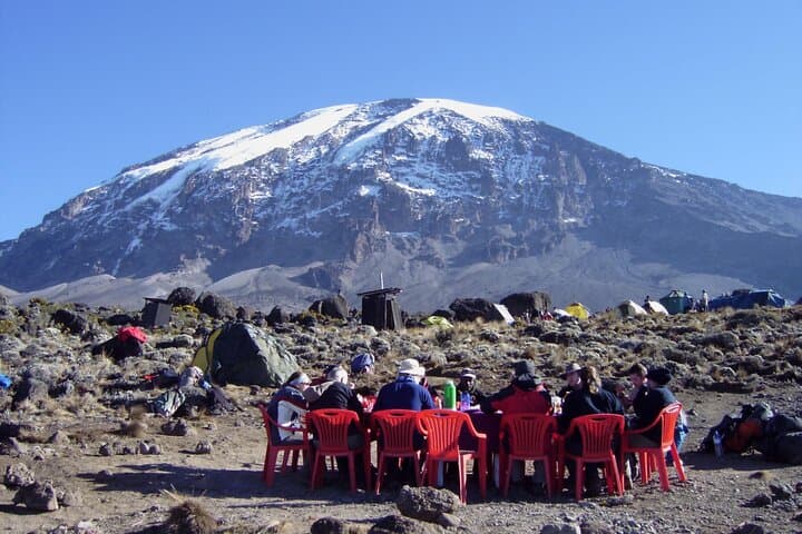
Kilimanjaro is a dormant stratovolcano made of three cones — Kibo, Mawenzi and Shira — its geologic layers revealing millennia of eruptions and glacial retreat. The Machame Route, sometimes called the Whiskey Route, is prized for varied scenery and strong acclimatization profile: rainforest, moorland, alpine desert, and the knife-edge crater ridge. Local Chagga communities on the southern flanks have guided climbers for generations; porters and guides provide essential support and local knowledge.
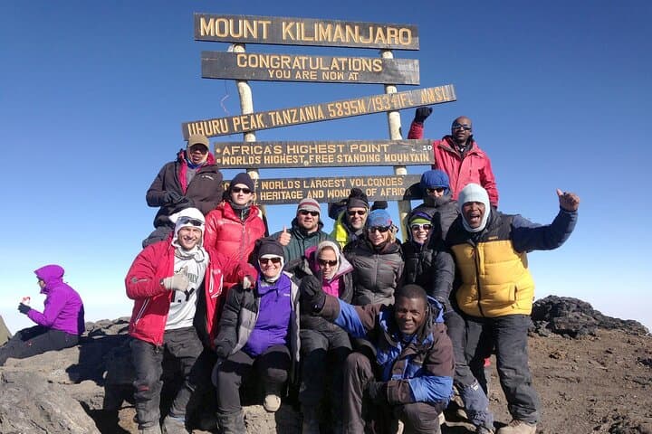
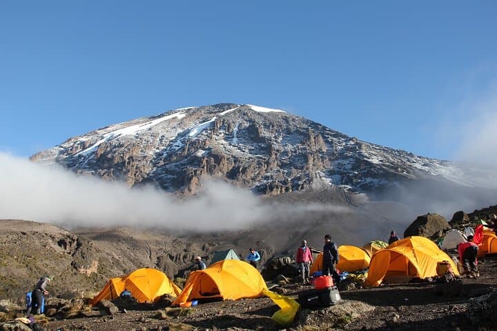
Expect steep ascents, rocky ridgelines and daytime hikes of 5–7 hours between camps. Key elevations: Machame Camp ~3,010 m, Shira ~3,845 m, Lava Tower ~4,640 m, Barafu ~4,640 m, Uhuru Peak 5,895 m. Summit night starts around midnight from Barafu; headlamps and steady pacing are the rules of the ridge. Acute mountain sickness is the primary objective hazard — acclimatization, adequate hydration, and honest pacing reduce risk. Practical essentials: break-in boots, layered insulation for summit night, sun protection, and a small, well-fitted daypack. Permits and park fees are required and typically handled by the operator. With realistic training and respect for the altitude, the Machame Route is a demanding but achievable path to the Roof of Africa.
challenging.
6 days.
Good aerobic fitness with experience in multi-day hiking; ability to carry a 6–8 kg daypack and tolerate long summit push.
The driest windows are January–March and June–October; weather can change quickly, but these months offer the most stable summit conditions.
It is the most demanding day: long hours, steep scree, and severe altitude; a slow steady pace and good acclimatization are critical.
Operators typically include park fees, rescue fees and camping permits; confirm inclusions when booking and carry a copy of your permit paperwork.
AMS is the primary risk; symptoms include headache, nausea, dizziness and poor sleep—descend if symptoms worsen and seek medical help immediately.
First recorded ascent to Kibo's summit was in 1889; the mountain sits within a national park established to protect its glaciers and unique alpine ecosystems.
Glacial retreat and trail erosion are ongoing issues; minimize impact by staying on established trails, using operator-provided toilets where available, and carrying out all personal waste.
Mountain Warriors Tours and Safaris operates guided outdoor trips and adventures with an emphasis on safety, stewardship, and memorable experiences.
A low cloud clings to the rainforest as porters shoulder bright duffels and guides call out in Kiswahili; you step through a narrow gate and the trail pulls you into the mountain. Early sections wind under giant trees where black-and-white colobus watch from branches, then the path opens onto heathland, a plateau of senecios, and finally the barren, wind-scoured alpine desert that prepares you for the long, thin air above.
A low cloud clings to the rainforest as porters shoulder bright duffels and guides call out in Kiswahili; you step through a narrow gate and the trail pulls you into the mountain. Early sections wind under giant trees where black-and-white colobus watch from branches, then the path opens onto heathland, a plateau of senecios, and finally the barren, wind-scoured alpine desert that prepares you for the long, thin air above.
Kilimanjaro is a dormant stratovolcano made of three cones — Kibo, Mawenzi and Shira — its geologic layers revealing millennia of eruptions and glacial retreat. The Machame Route, sometimes called the Whiskey Route, is prized for varied scenery and strong acclimatization profile: rainforest, moorland, alpine desert, and the knife-edge crater ridge. Local Chagga communities on the southern flanks have guided climbers for generations; porters and guides provide essential support and local knowledge.
Expect steep ascents, rocky ridgelines and daytime hikes of 5–7 hours between camps. Key elevations: Machame Camp ~3,010 m, Shira ~3,845 m, Lava Tower ~4,640 m, Barafu ~4,640 m, Uhuru Peak 5,895 m. Summit night starts around midnight from Barafu; headlamps and steady pacing are the rules of the ridge. Acute mountain sickness is the primary objective hazard — acclimatization, adequate hydration, and honest pacing reduce risk. Practical essentials: break-in boots, layered insulation for summit night, sun protection, and a small, well-fitted daypack. Permits and park fees are required and typically handled by the operator. With realistic training and respect for the altitude, the Machame Route is a demanding but achievable path to the Roof of Africa.