THE ADVENTURE COLLECTIVE® · Independent discovery and booking for outdoor travel

Walk the full perimeter of Stanley Park on a largely paved 9 km seawall loop that combines shoreline vistas with Indigenous history, colonial landmarks, and city skyline views. This self-guided tour via the On This Spot app suits most fitness levels and is wheelchair accessible.
Walk the full perimeter of Stanley Park on a largely paved 9 km seawall loop that combines shoreline vistas with Indigenous history, colonial landmarks, and city skyline views. This self-guided tour via the On This Spot app suits most fitness levels and is wheelchair accessible.
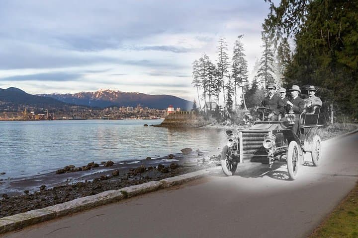
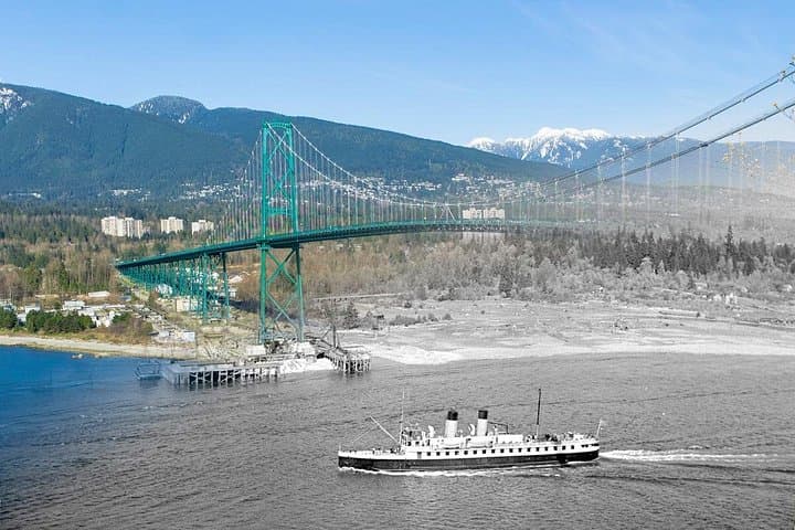
Morning light slices across Burrard Inlet as you step onto Vancouver’s seawall — the city slides behind you and the Salish Sea opens to the west. The path hugs a battered shoreline: cedar-shaded sections give way to exposed rock and open viewpoints where Lions Gate Bridge towers like a steel arch over moving water.
Verified experiences and guided adventures in the surrounding area.
Operated by On This Spot Enterprises Inc. · Vancouver, British Columbia
Morning light slices across Burrard Inlet as you step onto Vancouver’s seawall — the city slides behind you and the Salish Sea opens to the west. The path hugs a battered shoreline: cedar-shaded sections give way to exposed rock and open viewpoints where Lions Gate Bridge towers like a steel arch over moving water.
This self-guided walk traces a loop of roughly 9 km (5.5 miles) around Stanley Park, one of the largest urban old-growth parcels in North America. Geology here is coastal granite and glacially-scoured bedrock; the shoreline was reshaped by both ice and early reclamation work that created the gentle benches the seawall sits on. Culturally the route passes Coast Salish places and settler-era memorials — from totem poles and plaques to the Nine O’Clock Gun and Prospect Point — each stop offering a snapshot of Vancouver’s layered history.
The experience is sensory and deliberate: gulls quarrel overhead, waves nudge the breakwater, and currents around Point Grey tug with purpose. Expect mostly paved surfaces with occasional gravel sidings and short gentle grades near Prospect Point; total elevation change is modest, under 100 m cumulative, so it’s accessible to a wide range of walkers and wheelchairs.
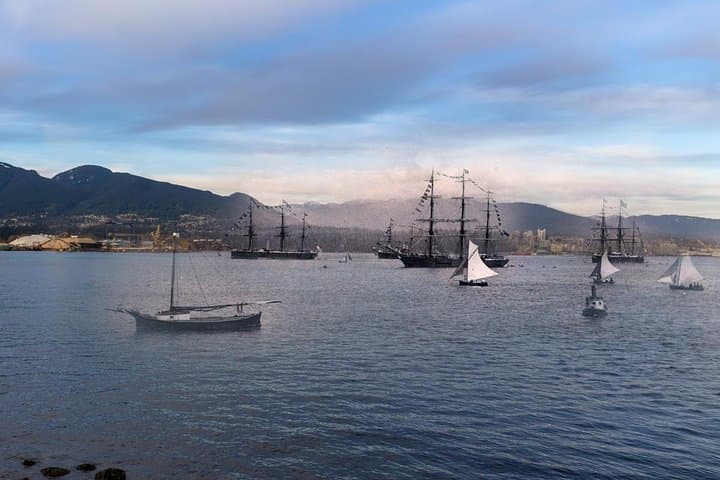
Plan for about 2 hours at a steady pace, longer if you linger at viewpoints or museums. Bring a wind layer (sea breezes can be cold year-round), water, good walking shoes, and a phone with the On This Spot app to unlock historical photos and narration. Aim for early morning or golden hour to avoid crowds and catch cleaner light for views of the North Shore mountains.
easy.
2 hours.
Suitable for most fitness levels; steady walking ability for 9 km recommended but sections are wheelchair/stroller accessible
The full seawall loop is about 9 km (5.5 miles) and typically takes around 2 hours at a steady walking pace.
Yes — most of the seawall is paved and wheelchair accessible; some viewpoints use ramps and accessible surfaces are noted on-site.
This is a self-guided tour via the On This Spot app; download the app to begin—no advance booking required for the walk itself.
Dogs are permitted but must follow Vancouver Park Board rules: keep dogs off beaches where posted and under control; check seasonal restrictions.
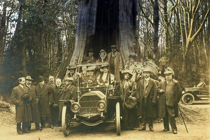
Stanley Park sits on traditional Coast Salish territories and developed into a public park in the late 19th century; the seawall was built in segments from the 1910s through the 1970s to protect the reclaimed shoreline.
Parks staff and volunteers actively restore shoreline habitats and enforce clean-water and wildlife protection measures—stay on trail and pack out waste to minimize impact.
On This Spot Enterprises Inc. operates guided outdoor trips and adventures with an emphasis on safety, stewardship, and memorable experiences.
Morning light slices across Burrard Inlet as you step onto Vancouver’s seawall — the city slides behind you and the Salish Sea opens to the west. The path hugs a battered shoreline: cedar-shaded sections give way to exposed rock and open viewpoints where Lions Gate Bridge towers like a steel arch over moving water.
Morning light slices across Burrard Inlet as you step onto Vancouver’s seawall — the city slides behind you and the Salish Sea opens to the west. The path hugs a battered shoreline: cedar-shaded sections give way to exposed rock and open viewpoints where Lions Gate Bridge towers like a steel arch over moving water.
This self-guided walk traces a loop of roughly 9 km (5.5 miles) around Stanley Park, one of the largest urban old-growth parcels in North America. Geology here is coastal granite and glacially-scoured bedrock; the shoreline was reshaped by both ice and early reclamation work that created the gentle benches the seawall sits on. Culturally the route passes Coast Salish places and settler-era memorials — from totem poles and plaques to the Nine O’Clock Gun and Prospect Point — each stop offering a snapshot of Vancouver’s layered history.
The experience is sensory and deliberate: gulls quarrel overhead, waves nudge the breakwater, and currents around Point Grey tug with purpose. Expect mostly paved surfaces with occasional gravel sidings and short gentle grades near Prospect Point; total elevation change is modest, under 100 m cumulative, so it’s accessible to a wide range of walkers and wheelchairs.
Plan for about 2 hours at a steady pace, longer if you linger at viewpoints or museums. Bring a wind layer (sea breezes can be cold year-round), water, good walking shoes, and a phone with the On This Spot app to unlock historical photos and narration. Aim for early morning or golden hour to avoid crowds and catch cleaner light for views of the North Shore mountains.