THE ADVENTURE COLLECTIVE® · Independent discovery and booking for outdoor travel

Turn Snowdonia into your own adventure map with a 7-day, app-guided treasure hunt through valleys, passes, and slate ruins. Drive scenic roads, hop out for short hikes, and rack up points at waterfalls and viewpoints—all on your schedule.
Turn Snowdonia into your own adventure map with a 7-day, app-guided treasure hunt through valleys, passes, and slate ruins. Drive scenic roads, hop out for short hikes, and rack up points at waterfalls and viewpoints—all on your schedule.
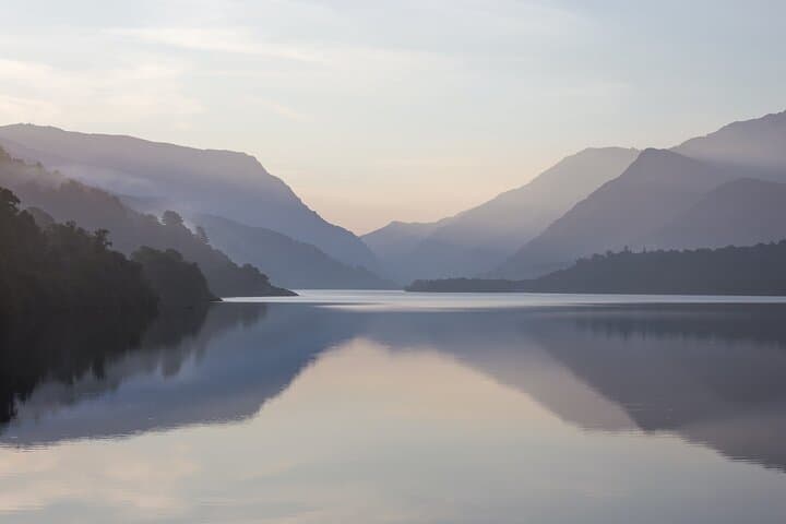
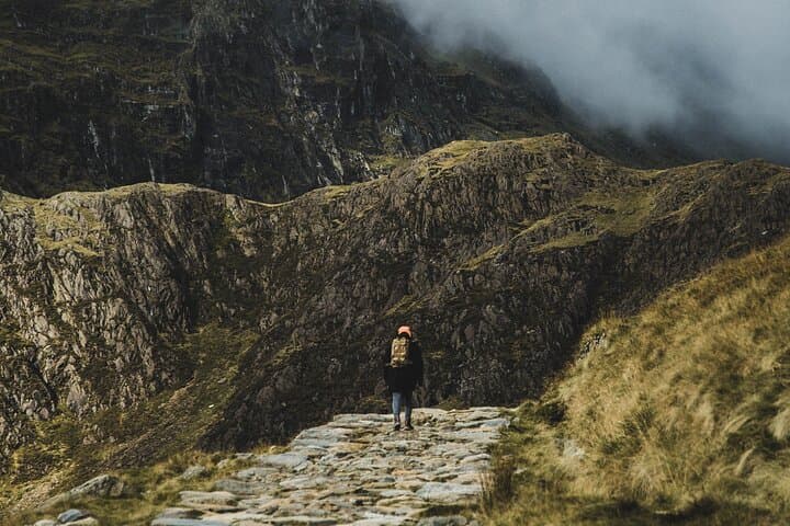
Wind pushes through the oaks of Betws-y-Coed and the Afon Llugwy chatters over rock as your phone blinks alive with map pins. The app dares you to choose a direction—up the Llanberis Pass where ridgelines stack like waves, or toward the Ogwen Valley where cliffs lean in and waterfalls hustle downslope. This is Snowdonia—Eryri in Welsh—a landscape that moves at its own pace, urging, testing, rewarding. With a 7-day pass, you set the rhythm: drive narrow roads between stone walls, step out for quick leg-stretching walks, or commit to longer rambles when the mountains call louder.
Verified experiences and guided adventures in the surrounding area.
Operated by City Break by Cluecation · Betws-y-Coed, Wales
Wind pushes through the oaks of Betws-y-Coed and the Afon Llugwy chatters over rock as your phone blinks alive with map pins. The app dares you to choose a direction—up the Llanberis Pass where ridgelines stack like waves, or toward the Ogwen Valley where cliffs lean in and waterfalls hustle downslope. This is Snowdonia—Eryri in Welsh—a landscape that moves at its own pace, urging, testing, rewarding. With a 7-day pass, you set the rhythm: drive narrow roads between stone walls, step out for quick leg-stretching walks, or commit to longer rambles when the mountains call louder.
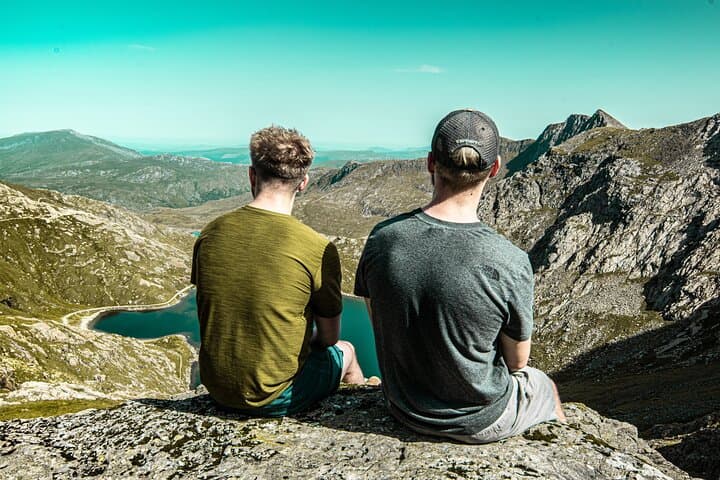
Geology does the heavy lifting here. Ice carved U-shaped valleys and left corries like Cwm Idwal cupping blue water and wind. Slate once cut from these hills powered the world; the UNESCO-listed Slate Landscape of Northwest Wales still shows in terraced quarries and roofless barracks—industrial bones reclaimed by moss. The language is alive too. Eryri’s road signs switch first to Welsh, and town names—Beddgelert, Llanberis, Trawsfynydd—ask the tongue to work a little. Steam railways whistle along old mineral lines, and pubs wrap day’s end with cask ale and bara brith.
The app turns the park into a game board: solve clues, nab points at viewpoints, and chase bonus challenges that pull you off the A-roads onto scenic spurs. It’s flexible by design. Start anywhere in the region and string together classics—the Llanberis Pass to Pen-y-Pass, the Ogwen lay-bys for Llyn Idwal, the Beddgelert loop along the Glaslyn—punctuated by short walks of 15–60 minutes. Expect single-track detours, sheep claiming right-of-way, and weather that shifts on a coin flip.
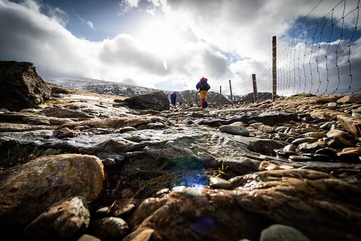
Plan like a mountaineer, play like a kid. Car parks fill quickly on fair weekends—arrive early for Pen-y-Pass and Ogwen. Download offline maps before signal fades in the valleys. Pack a waterproof shell; in Eryri, clouds lead. Shoes with grip turn spur-of-the-moment trails into safe fun, and a battery pack keeps the game rolling. Driving distances are modest—Betws-y-Coed to Ogwen is ~20 minutes, to Llanberis ~35—but mountain roads can slow to tractor pace. Leave space in the day for the unexpected: a slate ruin invites a detour; a break in cloud opens a ridge; a café in Beddgelert lures you with warm Welsh cakes.
By week’s end, the scoreboard tallies your clues and challenges, but it’s the park that wins: rivers push forward, ridges shoulder the sky, and you’ve earned a map of your own—stitched not from lines but from moments you chose to chase.
moderate.
4–8 hours per day (flexible over 7 days).
Comfortable walking town paths and moderate hill trails with steps and uneven ground; frequent in-and-out of the car.
No. Download the app and offline maps in advance; GPS works without data in most valleys, though some challenges may sync when you regain service.
Yes—challenges are family-friendly, with plenty of short stops and easy walks. Always supervise near water, cliffs, and roads.
Dogs are welcome on many paths but must be on a lead around livestock. Bring water and a towel for wet days.
Any standard car is fine. Expect narrow lanes with passing places; avoid oversized vehicles on minor mountain roads.
It’s up to you. Many locations are roadside viewpoints or short 15–60 minute walks; optional longer hikes are available for experienced walkers.
Yes, many popular car parks (Pen‑y‑Pass, Ogwen, Llanberis) charge. Carry a card and some coins; pay-by-phone may not work without signal.
Eryri’s slate industry shaped towns and transport here; in 2021 the Slate Landscape of Northwest Wales gained UNESCO World Heritage status.
Stick to established paths to protect fragile upland flora and peat. Respect seasonal bird nesting restrictions and follow local guidance on dogs around livestock.
City Break by Cluecation operates guided outdoor trips and adventures with an emphasis on safety, stewardship, and memorable experiences.
Wind pushes through the oaks of Betws-y-Coed and the Afon Llugwy chatters over rock as your phone blinks alive with map pins. The app dares you to choose a direction—up the Llanberis Pass where ridgelines stack like waves, or toward the Ogwen Valley where cliffs lean in and waterfalls hustle downslope. This is Snowdonia—Eryri in Welsh—a landscape that moves at its own pace, urging, testing, rewarding. With a 7-day pass, you set the rhythm: drive narrow roads between stone walls, step out for quick leg-stretching walks, or commit to longer rambles when the mountains call louder.
Wind pushes through the oaks of Betws-y-Coed and the Afon Llugwy chatters over rock as your phone blinks alive with map pins. The app dares you to choose a direction—up the Llanberis Pass where ridgelines stack like waves, or toward the Ogwen Valley where cliffs lean in and waterfalls hustle downslope. This is Snowdonia—Eryri in Welsh—a landscape that moves at its own pace, urging, testing, rewarding. With a 7-day pass, you set the rhythm: drive narrow roads between stone walls, step out for quick leg-stretching walks, or commit to longer rambles when the mountains call louder.
Geology does the heavy lifting here. Ice carved U-shaped valleys and left corries like Cwm Idwal cupping blue water and wind. Slate once cut from these hills powered the world; the UNESCO-listed Slate Landscape of Northwest Wales still shows in terraced quarries and roofless barracks—industrial bones reclaimed by moss. The language is alive too. Eryri’s road signs switch first to Welsh, and town names—Beddgelert, Llanberis, Trawsfynydd—ask the tongue to work a little. Steam railways whistle along old mineral lines, and pubs wrap day’s end with cask ale and bara brith.
The app turns the park into a game board: solve clues, nab points at viewpoints, and chase bonus challenges that pull you off the A-roads onto scenic spurs. It’s flexible by design. Start anywhere in the region and string together classics—the Llanberis Pass to Pen-y-Pass, the Ogwen lay-bys for Llyn Idwal, the Beddgelert loop along the Glaslyn—punctuated by short walks of 15–60 minutes. Expect single-track detours, sheep claiming right-of-way, and weather that shifts on a coin flip.
Plan like a mountaineer, play like a kid. Car parks fill quickly on fair weekends—arrive early for Pen-y-Pass and Ogwen. Download offline maps before signal fades in the valleys. Pack a waterproof shell; in Eryri, clouds lead. Shoes with grip turn spur-of-the-moment trails into safe fun, and a battery pack keeps the game rolling. Driving distances are modest—Betws-y-Coed to Ogwen is ~20 minutes, to Llanberis ~35—but mountain roads can slow to tractor pace. Leave space in the day for the unexpected: a slate ruin invites a detour; a break in cloud opens a ridge; a café in Beddgelert lures you with warm Welsh cakes.
By week’s end, the scoreboard tallies your clues and challenges, but it’s the park that wins: rivers push forward, ridges shoulder the sky, and you’ve earned a map of your own—stitched not from lines but from moments you chose to chase.