THE ADVENTURE COLLECTIVE® · Independent discovery and booking for outdoor travel

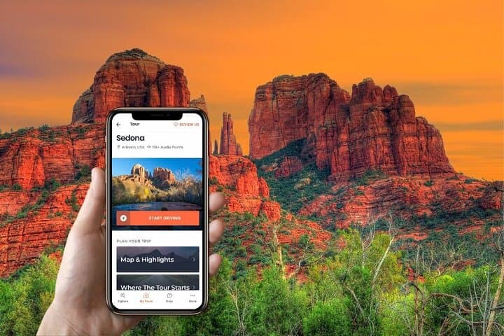
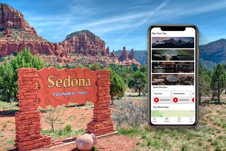
Drive the red-rock loops of Sedona with a location-triggered audio guide that points out hikes, vortex sites and hidden viewpoints. Pre-download the tour, bring a charger and plan for a half- to full-day self-paced exploration.
Drive the red-rock loops of Sedona with a location-triggered audio guide that points out hikes, vortex sites and hidden viewpoints. Pre-download the tour, bring a charger and plan for a half- to full-day self-paced exploration.
You pull off Highway 89A and the red walls of Sedona rise like slow-moving weather, their layers daring you to slow down. The car windows frame pinnacles, slickrock slopes and the occasional stand of piñon, while an audio voice eases you through the turns—pointing out a cliff-face arch, a creek that catches the light, or a quiet spot where a vortex is said to hum.
Verified experiences and guided adventures in the surrounding area.
Operated by GuideAlong (GyPSy Guide) · Sedona, Arizona
You pull off Highway 89A and the red walls of Sedona rise like slow-moving weather, their layers daring you to slow down. The car windows frame pinnacles, slickrock slopes and the occasional stand of piñon, while an audio voice eases you through the turns—pointing out a cliff-face arch, a creek that catches the light, or a quiet spot where a vortex is said to hum.
Sedona’s landscape is the product of 300 million years of uplift and erosion; sandstone cliffs, sedimentary banding and scattered limestone shelves tell that geological story. Human history here ranges from Ancestral Puebloan sites tucked in canyons to modern spiritual communities and the Chapel of the Holy Cross, a mid-20th-century structure cut into the rock face.
The driving route puts you within reach of classic hikes and viewpoints: West Fork (roughly 3 miles each way), Devil’s Bridge (short 0.5-mile approach), Boynton Canyon (1–6 miles options) and several pullouts along the Red Rock Scenic Byway. Wildlife—javelina, mule deer and raptors—are common near dawn and dusk.
Practical guide: pre-download the GuideAlong tour and maps over Wi‑Fi and keep a car charger handy; the audio is GPS-triggered so no cell service is needed. Start early to beat parking crowds at popular trailheads and respect posted signs at sacred sites and fragile riparian areas. Comfortable shoes, water and patience for photo queues will expand your options—park, walk a 20‑minute viewpoint loop, then drive on. With the audio app guiding you, Sedona becomes a flexible, self-paced exploration that pairs dramatic geology with practical directions and local stories.
easy.
3–8 hours (flexible half-, full- or multi-day).
Suitable for most fitness levels—mostly driving with optional short hikes ranging from 0.5 to 6 miles.
No—you must pre-download the GuideAlong app and the Sedona audio tour over Wi‑Fi or cell before you leave; the audio triggers via your phone’s GPS offline.
The product supports half-day, full-day or multi-day use—most visitors do 3–8 hours to see highlights; you control the pace and stops.
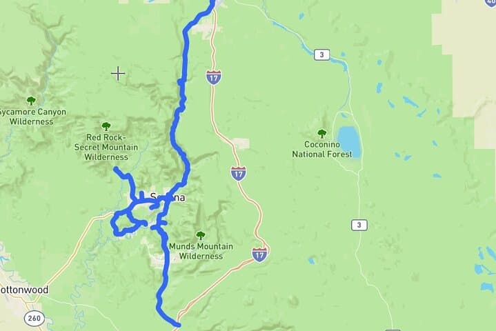
You can begin anywhere along the route. Suggested start points include I‑17 Exit 337 (near Flagstaff) or Exit 298 from Phoenix; the app shows start locations.
Parking exists but fills early for popular spots like Devil’s Bridge and Cathedral Rock—arrive early, use public lots in Uptown Sedona, or plan a mid-week visit.
Ancestral Puebloan ruins and trading routes dot the region; modern Sedona grew as a tourist and arts hub in the early 20th century, later gaining spiritual tourism tied to its vortex sites.
Stick to roads and marked trails, pack out trash, and avoid disturbing riparian zones—water sources and thin soils in Sedona are fragile and easily damaged.
GuideAlong (GyPSy Guide) operates guided outdoor trips and adventures with an emphasis on safety, stewardship, and memorable experiences.

You pull off Highway 89A and the red walls of Sedona rise like slow-moving weather, their layers daring you to slow down. The car windows frame pinnacles, slickrock slopes and the occasional stand of piñon, while an audio voice eases you through the turns—pointing out a cliff-face arch, a creek that catches the light, or a quiet spot where a vortex is said to hum.
You pull off Highway 89A and the red walls of Sedona rise like slow-moving weather, their layers daring you to slow down. The car windows frame pinnacles, slickrock slopes and the occasional stand of piñon, while an audio voice eases you through the turns—pointing out a cliff-face arch, a creek that catches the light, or a quiet spot where a vortex is said to hum.
Sedona’s landscape is the product of 300 million years of uplift and erosion; sandstone cliffs, sedimentary banding and scattered limestone shelves tell that geological story. Human history here ranges from Ancestral Puebloan sites tucked in canyons to modern spiritual communities and the Chapel of the Holy Cross, a mid-20th-century structure cut into the rock face.
The driving route puts you within reach of classic hikes and viewpoints: West Fork (roughly 3 miles each way), Devil’s Bridge (short 0.5-mile approach), Boynton Canyon (1–6 miles options) and several pullouts along the Red Rock Scenic Byway. Wildlife—javelina, mule deer and raptors—are common near dawn and dusk.
Practical guide: pre-download the GuideAlong tour and maps over Wi‑Fi and keep a car charger handy; the audio is GPS-triggered so no cell service is needed. Start early to beat parking crowds at popular trailheads and respect posted signs at sacred sites and fragile riparian areas. Comfortable shoes, water and patience for photo queues will expand your options—park, walk a 20‑minute viewpoint loop, then drive on. With the audio app guiding you, Sedona becomes a flexible, self-paced exploration that pairs dramatic geology with practical directions and local stories.