THE ADVENTURE COLLECTIVE® · Independent discovery and booking for outdoor travel

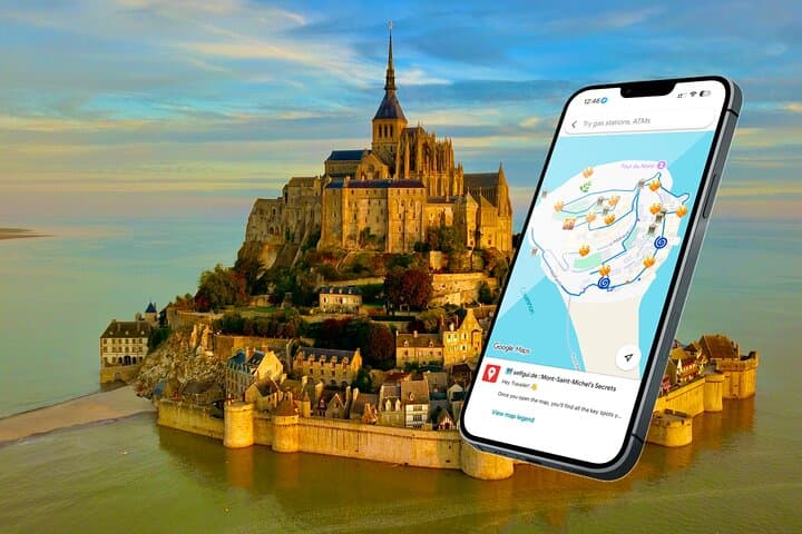
Explore Mont-Saint-Michel on your own terms with a ready-to-use Google Maps e‑guide that pins must-see viewpoints, quieter lanes, and the best time to visit the abbey. Skip the rigid schedule and discover both the island’s main highlights and its offbeat corners.
Explore Mont-Saint-Michel on your own terms with a ready-to-use Google Maps e‑guide that pins must-see viewpoints, quieter lanes, and the best time to visit the abbey. Skip the rigid schedule and discover both the island’s main highlights and its offbeat corners.
You arrive across the causeway with the island’s silhouette rising from the salt flats — a compact village crowned by a stone abbey that has watched the tides for more than a millennium.
Verified experiences and guided adventures in the surrounding area.
Operated by Selfgui.de International · Le Mont-Saint-Michel, Normandy
You arrive across the causeway with the island’s silhouette rising from the salt flats — a compact village crowned by a stone abbey that has watched the tides for more than a millennium.
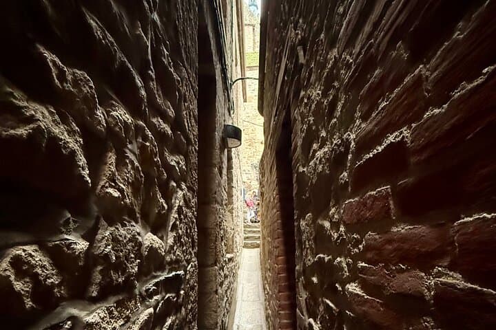
Follow the main lane, Grand Rue, and the crowds thin into crooked alleys where shutters and steep staircases funnel you up toward the abbey’s terraces. The abbey itself sits like a perched citadel; its ramparts give sweeping views across mudflats that change color with the light, and the shells of boats rest like punctuation on the sand.
Founded in the 8th century and expanded through the Middle Ages, Mont-Saint-Michel served as a pilgrimage site and defensive stronghold. The bay’s unique geology — vast tidal flats and shifting sediments — has shaped local life for centuries and prompted modern restoration projects to restore tidal flow and protect the island’s silhouette.
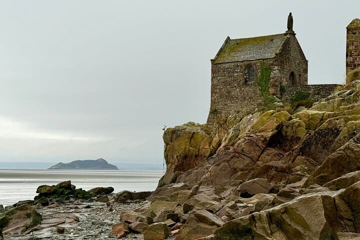
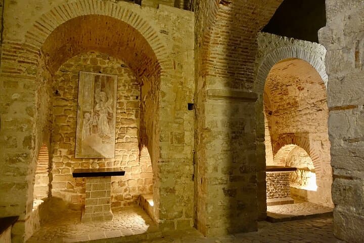
Culture here is compact: bakeries with long-standing recipes, Hôtel Mère Poulard’s omelette lore, and quiet cloisters meant for reflection. Nearby Île Tombelaine offers a distant marker against the horizon and seasonal flocks of shorebirds.
Practical guidance: a self-guided e-map lets you pin these stops on Google Maps, time your climb to the abbey, and detour to quieter viewpoints. Wear sturdy shoes for uneven stone and slick steps, check tide times before leaving the mainland, and plan 3–4 hours to move at a relaxed pace with time for the abbey visit. Carry water, a light rain layer, and a charged phone — the map works offline if preloaded. Move deliberately: tides can change the framing of the bay in an hour, and the best light often comes in the first morning or late afternoon.
easy.
3–4 hours.
Suitable for most fitness levels; involves stair climbing and uneven stone surfaces
Expect 3–4 hours to cover Grand Rue, the abbey (optional visit), cloisters, and viewpoints at a relaxed pace.
Tickets can be purchased on-site, but during high season pre-booking the abbey helps avoid queues; admission is around €16 for adults.
The main streets are accessible but the abbey has many stairs; visitors with limited mobility should plan accordingly and consider remaining on lower levels.
Access is via the modern causeway; walking across the tidal flats is dangerous and discouraged unless with an authorized guide familiar with the tides.
Mont-Saint-Michel developed as a major medieval pilgrimage site after an 8th-century sanctuary and later became a fortified abbey with significant strategic value.
Recent engineering work restored tidal flow to limit silting; visitors are asked to stay on marked paths and minimize impact on the fragile bay ecosystem.
Selfgui.de International operates guided outdoor trips and adventures with an emphasis on safety, stewardship, and memorable experiences.
You arrive across the causeway with the island’s silhouette rising from the salt flats — a compact village crowned by a stone abbey that has watched the tides for more than a millennium.
You arrive across the causeway with the island’s silhouette rising from the salt flats — a compact village crowned by a stone abbey that has watched the tides for more than a millennium.
Follow the main lane, Grand Rue, and the crowds thin into crooked alleys where shutters and steep staircases funnel you up toward the abbey’s terraces. The abbey itself sits like a perched citadel; its ramparts give sweeping views across mudflats that change color with the light, and the shells of boats rest like punctuation on the sand.
Founded in the 8th century and expanded through the Middle Ages, Mont-Saint-Michel served as a pilgrimage site and defensive stronghold. The bay’s unique geology — vast tidal flats and shifting sediments — has shaped local life for centuries and prompted modern restoration projects to restore tidal flow and protect the island’s silhouette.
Culture here is compact: bakeries with long-standing recipes, Hôtel Mère Poulard’s omelette lore, and quiet cloisters meant for reflection. Nearby Île Tombelaine offers a distant marker against the horizon and seasonal flocks of shorebirds.
Practical guidance: a self-guided e-map lets you pin these stops on Google Maps, time your climb to the abbey, and detour to quieter viewpoints. Wear sturdy shoes for uneven stone and slick steps, check tide times before leaving the mainland, and plan 3–4 hours to move at a relaxed pace with time for the abbey visit. Carry water, a light rain layer, and a charged phone — the map works offline if preloaded. Move deliberately: tides can change the framing of the bay in an hour, and the best light often comes in the first morning or late afternoon.