THE ADVENTURE COLLECTIVE® · Independent discovery and booking for outdoor travel

Walk a 2.5 km, wheelchair‑friendly route from Carihuela to Bajondillo solving 24 clues by murals, statues and seaside landmarks. This self‑guided hunt mixes local history, street art and easy coastal walking—ideal for families and small groups.
Walk a 2.5 km, wheelchair‑friendly route from Carihuela to Bajondillo solving 24 clues by murals, statues and seaside landmarks. This self‑guided hunt mixes local history, street art and easy coastal walking—ideal for families and small groups.
The Mediterranean air carries the tang of sea salt and frying fish as you tap the first clue at the Carihuela Tourist Office and step onto the promenade. Bright murals and low white buildings slide past while the boardwalk hums—sunbathers, fishermen, and scooters marking a steady coastal rhythm. The route follows roughly 2.5 km of flat pavement, moving from old fishing-quarter alleys to the wide beachfront of Bajondillo.
Verified experiences and guided adventures in the surrounding area.
Operated by Adventure Hunt · Torremolinos, Andalusia
The Mediterranean air carries the tang of sea salt and frying fish as you tap the first clue at the Carihuela Tourist Office and step onto the promenade. Bright murals and low white buildings slide past while the boardwalk hums—sunbathers, fishermen, and scooters marking a steady coastal rhythm. The route follows roughly 2.5 km of flat pavement, moving from old fishing-quarter alleys to the wide beachfront of Bajondillo.
Torremolinos began as a working fishing village; its narrow streets and seafood cafés still point to that past even as 20th‑century tourism reshaped the shore. Geologically the walk sits on the coastal plain of the Costa del Sol, where sandy spits and human‑built promenades meet the Mediterranean, whose currents seem to insist you slow down and look.
Culturally this hunt highlights local markers—murals, statues and community plazas—placing modern street art beside remnants of maritime life. The app supplies 24 clues designed to sharpen observation rather than speed: read plaques, scan facades, count tiles and compare details.
Practical guide: expect 1–3 hours depending on pauses for coffee or tapas. The route is level and wheelchair- and stroller-friendly; there are no stairs. The app saves progress and supports multiple languages, so groups can split or reconvene. Bring a charged smartphone, sun protection in summer, and comfortable shoes for mixed pavement. Start early to avoid peak sun and busy beach crowds, and use pauses to enjoy seafood in Carihuela or a quiet viewpoint toward the sea. This is less an endurance test and more an urban scavenger stroll that rewards curiosity and steady feet.
easy.
1–3 hours.
Suitable for most fitness levels; requires the ability to walk 2–3 km on flat paved surfaces.
Yes—the Adventure Hunt app provides the clues, tracks progress and supports multiple languages; a mobile ticket is required.
Yes—the 2.5 km route is level with no stairs and accessible surfaces, suitable for wheelchairs and strollers.
Most groups take 1–3 hours depending on how often you stop for food, photos or to solve tougher clues.
Yes—the app remembers your progress so you can stop and pick up where you left off later.
Torremolinos grew from a 19th-century fishing village into one of the first mass-tourism resorts on the Costa del Sol in the mid-20th century; Carihuela preserves much of that maritime heritage.
High visitor use strains coastal habitats—keep to paved areas, carry out trash and support local businesses that follow sustainable practices.
Adventure Hunt operates guided outdoor trips and adventures with an emphasis on safety, stewardship, and memorable experiences.
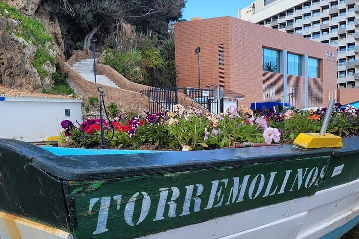
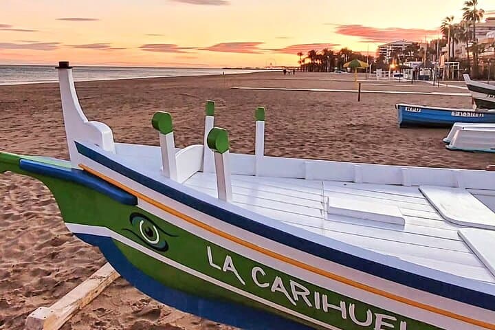
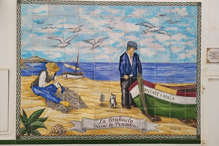
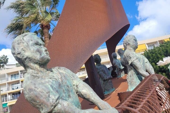
The Mediterranean air carries the tang of sea salt and frying fish as you tap the first clue at the Carihuela Tourist Office and step onto the promenade. Bright murals and low white buildings slide past while the boardwalk hums—sunbathers, fishermen, and scooters marking a steady coastal rhythm. The route follows roughly 2.5 km of flat pavement, moving from old fishing-quarter alleys to the wide beachfront of Bajondillo.
The Mediterranean air carries the tang of sea salt and frying fish as you tap the first clue at the Carihuela Tourist Office and step onto the promenade. Bright murals and low white buildings slide past while the boardwalk hums—sunbathers, fishermen, and scooters marking a steady coastal rhythm. The route follows roughly 2.5 km of flat pavement, moving from old fishing-quarter alleys to the wide beachfront of Bajondillo.
Torremolinos began as a working fishing village; its narrow streets and seafood cafés still point to that past even as 20th‑century tourism reshaped the shore. Geologically the walk sits on the coastal plain of the Costa del Sol, where sandy spits and human‑built promenades meet the Mediterranean, whose currents seem to insist you slow down and look.
Culturally this hunt highlights local markers—murals, statues and community plazas—placing modern street art beside remnants of maritime life. The app supplies 24 clues designed to sharpen observation rather than speed: read plaques, scan facades, count tiles and compare details.
Practical guide: expect 1–3 hours depending on pauses for coffee or tapas. The route is level and wheelchair- and stroller-friendly; there are no stairs. The app saves progress and supports multiple languages, so groups can split or reconvene. Bring a charged smartphone, sun protection in summer, and comfortable shoes for mixed pavement. Start early to avoid peak sun and busy beach crowds, and use pauses to enjoy seafood in Carihuela or a quiet viewpoint toward the sea. This is less an endurance test and more an urban scavenger stroll that rewards curiosity and steady feet.