THE ADVENTURE COLLECTIVE® · Independent discovery and booking for outdoor travel

Explore central Adelaide at your own pace with a self-guided scavenger hunt that sends 17 clues to your phone as you walk. Expect 2–3 hours of observation-based challenges across city streets, arcades and park edges ending in Rundle St Mall.
Explore central Adelaide at your own pace with a self-guided scavenger hunt that sends 17 clues to your phone as you walk. Expect 2–3 hours of observation-based challenges across city streets, arcades and park edges ending in Rundle St Mall.
You step out onto King William Street with a phone in your hand and a quiet challenge in your pocket: 17 clues, two to three hours, and the city ready to respond. Streets hum with trams, cafes exhale coffee, and the River Torrens dares you to cross its bridges as you follow the next hint toward Rundle Street Mall.
Verified experiences and guided adventures in the surrounding area.
Operated by Trixity Trails · Adelaide, South Australia
You step out onto King William Street with a phone in your hand and a quiet challenge in your pocket: 17 clues, two to three hours, and the city ready to respond. Streets hum with trams, cafes exhale coffee, and the River Torrens dares you to cross its bridges as you follow the next hint toward Rundle Street Mall.
Adelaide’s grid was laid out by Colonel William Light in 1836; its wide streets and ringed parklands reflect that planned logic. Geologically the city sits on the flat plain above the St Vincent Gulf, with the Torrens cutting a green ribbon through urban blocks. Cultural notes matter here: this is Kaurna land — pay attention to place names and public art that reference Indigenous history while you solve each clue.
The route threads arcades, laneways, civic buildings and park fringes; clues reward observation more than speed. Expect a mix of paved sidewalks, pedestrian malls and occasional steps; the final waypoint is Rundle St Mall, a lively commercial spine.
Practical guidance: start mid-morning to avoid extreme summer heat and give cafes time to open. A fully charged smartphone and local transport card make logistics easy; the trail pauses the leaderboard clock when you solve a clue, so you can linger. Use public transport to reach the start, wear supportive walking shoes, and carry a lightweight rain layer in winter. If you’re traveling with kids or a mixed group, use hints liberally — the game is as much about seeing the city as racing it.
easy.
2–3 hours.
Suitable for most fitness levels; expect continuous walking for a few hours with regular stops for clues.
No — this is a self-guided, app-based trail. Clues arrive on your device and you move at your own pace; 'Help' and 'Hint' options are available.
Expect about 2–3 hours for the full 17-clue route, though teams that linger at cafes or museums may take longer.
Much of central Adelaide is flat with accessible sidewalks and ramps, but some laneways or older arcades may have steps—check specific sections if full wheelchair access is required.
You can use the hint system or look up information on your device; the app will let you try again and move forward once you submit the correct answer.
Adelaide was founded in 1836 with a distinctive grid-and-parklands design by Colonel William Light; many civic buildings reflect 19th-century planning.
The city’s parklands and the River Torrens have active conservation programs—stay on paths, avoid disturbing flora, and use bins for waste to protect urban ecology.
Trixity Trails operates guided outdoor trips and adventures with an emphasis on safety, stewardship, and memorable experiences.

You step out onto King William Street with a phone in your hand and a quiet challenge in your pocket: 17 clues, two to three hours, and the city ready to respond. Streets hum with trams, cafes exhale coffee, and the River Torrens dares you to cross its bridges as you follow the next hint toward Rundle Street Mall.
You step out onto King William Street with a phone in your hand and a quiet challenge in your pocket: 17 clues, two to three hours, and the city ready to respond. Streets hum with trams, cafes exhale coffee, and the River Torrens dares you to cross its bridges as you follow the next hint toward Rundle Street Mall.
Adelaide’s grid was laid out by Colonel William Light in 1836; its wide streets and ringed parklands reflect that planned logic. Geologically the city sits on the flat plain above the St Vincent Gulf, with the Torrens cutting a green ribbon through urban blocks. Cultural notes matter here: this is Kaurna land — pay attention to place names and public art that reference Indigenous history while you solve each clue.
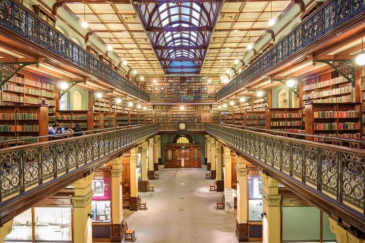
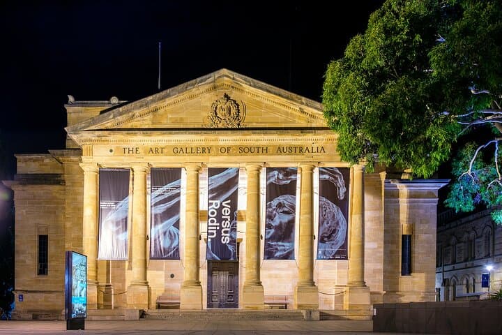
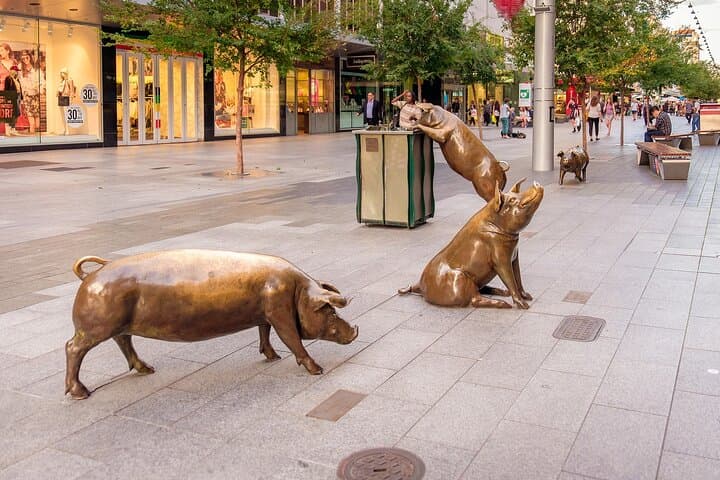
The route threads arcades, laneways, civic buildings and park fringes; clues reward observation more than speed. Expect a mix of paved sidewalks, pedestrian malls and occasional steps; the final waypoint is Rundle St Mall, a lively commercial spine.
Practical guidance: start mid-morning to avoid extreme summer heat and give cafes time to open. A fully charged smartphone and local transport card make logistics easy; the trail pauses the leaderboard clock when you solve a clue, so you can linger. Use public transport to reach the start, wear supportive walking shoes, and carry a lightweight rain layer in winter. If you’re traveling with kids or a mixed group, use hints liberally — the game is as much about seeing the city as racing it.