THE ADVENTURE COLLECTIVE® · Independent discovery and booking for outdoor travel

Drive a curated loop of San Diego’s best viewpoints and neighborhoods with a GPS audio guide that works offline. From Mission Bay to Mt. Soledad, this two- to three-hour route blends coastal geology, Spanish colonial history, and practical local tips.
Drive a curated loop of San Diego’s best viewpoints and neighborhoods with a GPS audio guide that works offline. From Mission Bay to Mt. Soledad, this two- to three-hour route blends coastal geology, Spanish colonial history, and practical local tips.
You slow into a wide turn at Mission Bay as gulls cackle above the water and the GPS voice drops into conversation—local stories, architecture notes, and a nudge toward the next vista.
Verified experiences and guided adventures in the surrounding area.
Operated by VoiceMap Audio Tours · San Diego, California
You slow into a wide turn at Mission Bay as gulls cackle above the water and the GPS voice drops into conversation—local stories, architecture notes, and a nudge toward the next vista.
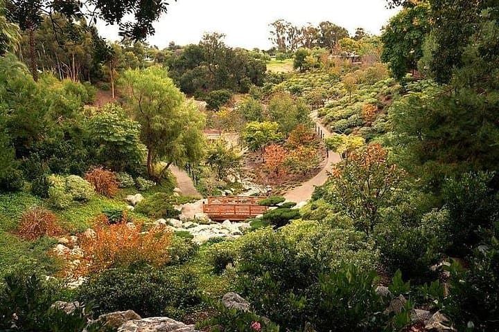
This two- to three-hour self-guided drive stitches together San Diego’s coastal cliffs, military headlands, and urban green spaces. The route moves from Mission Bay past SeaWorld and Ocean Beach, threads along Sunset Cliffs and Point Loma where the ocean feels like it’s pressing the city forward, then climbs to the panoramic memorial at Mt. Soledad. You’ll cross the historic Cabrillo Bridge into Balboa Park and pass the eclectic Gaslamp Quarter and Old Town, hearing context about Spanish colonial settlement, naval history and the city’s 20th-century civic growth.
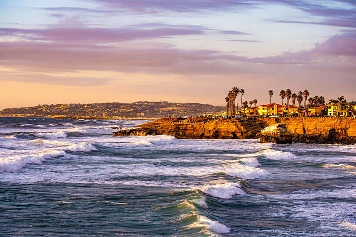
Geology appears in the cliffs and tidepools at Point Loma—shelves of sandstone and volcanic outcrops where currents shape edges and kelp forests anchor offshore. Culture arrives in the missions, presidios, and the mid-century modern homes on La Jolla’s Camino de la Costa.
Practical notes: the audio runs in the VoiceMap app with an eight-character code and works offline. Expect roughly 40–50 miles of driving depending on stops, with a brief elevation gain up to Mt. Soledad (~820 ft) for the best 360° view. Start early to beat traffic and secure parking at popular pullouts; bring headphones, a charged phone, and a printed backup of directions. This tour gives control—pause, linger, and shape the day to your pace.
easy.
2–3 hours.
Minimal physical exertion required—mostly driving with short walks at viewpoints; able-bodied travelers fine for short climbs.
No—download the tour in the VoiceMap app before you go and it will run offline with GPS-triggered audio and maps.
The itinerary begins around Mission Bay and concludes at Mt. Soledad National Veterans Memorial in La Jolla, offering a 360° view.
Yes—the eight-character code provided can be redeemed by all members of your party to download the tour on separate devices.
Early morning or late afternoon avoids peak traffic and offers softer light for views and photos; sunset at Sunset Cliffs or Mt. Soledad is especially scenic but busier.
San Diego grew from Spanish colonial presidios and missions; Juan Rodriguez Cabrillo’s 1542 landing at Point Loma is a key early European contact point on the West Coast.
Coastal areas are sensitive—respect tidepool signs and stay behind fences at La Jolla Underwater Park; support local marine protected areas by keeping a distance from wildlife and disposing of trash properly.
VoiceMap Audio Tours operates guided outdoor trips and adventures with an emphasis on safety, stewardship, and memorable experiences.

You slow into a wide turn at Mission Bay as gulls cackle above the water and the GPS voice drops into conversation—local stories, architecture notes, and a nudge toward the next vista.
You slow into a wide turn at Mission Bay as gulls cackle above the water and the GPS voice drops into conversation—local stories, architecture notes, and a nudge toward the next vista.
This two- to three-hour self-guided drive stitches together San Diego’s coastal cliffs, military headlands, and urban green spaces. The route moves from Mission Bay past SeaWorld and Ocean Beach, threads along Sunset Cliffs and Point Loma where the ocean feels like it’s pressing the city forward, then climbs to the panoramic memorial at Mt. Soledad. You’ll cross the historic Cabrillo Bridge into Balboa Park and pass the eclectic Gaslamp Quarter and Old Town, hearing context about Spanish colonial settlement, naval history and the city’s 20th-century civic growth.
Geology appears in the cliffs and tidepools at Point Loma—shelves of sandstone and volcanic outcrops where currents shape edges and kelp forests anchor offshore. Culture arrives in the missions, presidios, and the mid-century modern homes on La Jolla’s Camino de la Costa.
Practical notes: the audio runs in the VoiceMap app with an eight-character code and works offline. Expect roughly 40–50 miles of driving depending on stops, with a brief elevation gain up to Mt. Soledad (~820 ft) for the best 360° view. Start early to beat traffic and secure parking at popular pullouts; bring headphones, a charged phone, and a printed backup of directions. This tour gives control—pause, linger, and shape the day to your pace.