THE ADVENTURE COLLECTIVE® · Independent discovery and booking for outdoor travel

Drive 188 miles of North Wales coast and borderlands on a flexible, self-guided plan that links Anglesey’s lighthouses and copper scars to medieval castles and the rolling Clwydian hills. Downloadable maps and suggested itineraries let you shape 3–14 day trips without a guide.
Drive 188 miles of North Wales coast and borderlands on a flexible, self-guided plan that links Anglesey’s lighthouses and copper scars to medieval castles and the rolling Clwydian hills. Downloadable maps and suggested itineraries let you shape 3–14 day trips without a guide.
You push across the Menai Strait and the suspension bridge hums under the tyres; gulls wheel and a briny wind pushes you toward angling headlands and ruined towers. The route unfurls 188 miles (302 km) of sea-cliff drives, market towns and upland ridges—from the flat, wind-swept beaches of Anglesey to the folded hills of the Clwydian Range.
Verified experiences and guided adventures in the surrounding area.
Operated by Uncover Britain Road Trips · Bangor, Gwynedd
You push across the Menai Strait and the suspension bridge hums under the tyres; gulls wheel and a briny wind pushes you toward angling headlands and ruined towers. The route unfurls 188 miles (302 km) of sea-cliff drives, market towns and upland ridges—from the flat, wind-swept beaches of Anglesey to the folded hills of the Clwydian Range.
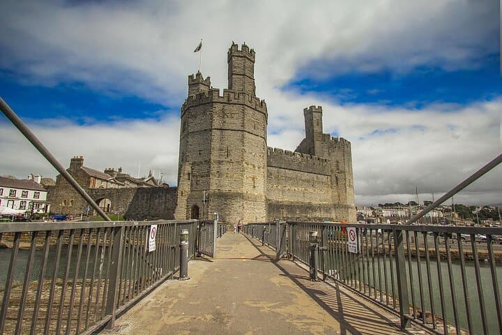
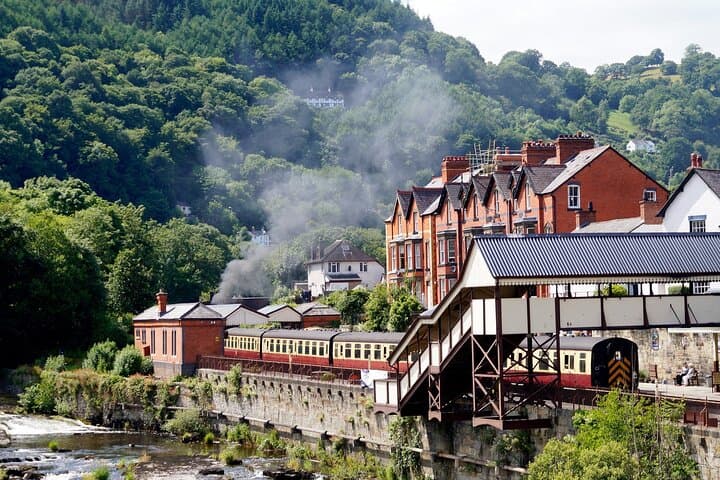
Castles of Edward I—Caernarfon, Conwy and Beaumaris—mark the medieval imprint on a landscape shaped much earlier by Ordovician and Silurian rocks and later scoured by ice. Parys Mountain’s oxidised slopes recall an industrial chapter when copper reshaped towns on Anglesey; inland, the Dee Valley and Llangollen show glacially carved profiles and limestone scarps. Welsh language, seasonal agricultural shows and lively market days give the route a strong local cadence.
The guide delivers three flexible sections so you can craft 3–14 day itineraries: coastal promenades, cliff-path walks and short upland hikes. Expect narrow lanes, single-track roads with passing places, ferry links at Holyhead and Cadw-managed admission for major castles. Practical moves: allow time for tidal accesses (South Stack), reserve parking near popular viewpoints in summer, and download the provided Google Map pins for offline use.
This trip is as much about rhythm—tea rooms after a cliff walk, an evening harbour stroll—as it is about mileage. Plan for changeable weather, respect protected coastal habitats, and pace driving days to leave room for the small, stubborn places that make North Wales memorable.
moderate.
3–14 days.
Low-to-moderate; suitable for walkers who can handle short coastal hikes and stairs (e.g., South Stack).
No — the guide is self-guided so you can begin and end where convenient; common bases include Bangor, Caernarfon or Llandudno.
No — some castles are Cadw-managed with separate admission fees; the guide lists opening times and fees where applicable.
Yes, but check local parking restrictions and narrow lanes; some historic town centres have limited access for large vehicles.
The plan includes a single account licence with 12 months’ access from purchase for your trip planning.
The north coast is studded with 13th-century Edward I fortifications built during the conquest of Gwynedd; later, Anglesey became an industrial hub for copper and slate extraction.
Much of the coastline and upland fringe is protected (AONB and parts of Snowdonia National Park); stick to paths to prevent erosion and respect seabird colonies, especially in breeding season.
Uncover Britain Road Trips operates guided outdoor trips and adventures with an emphasis on safety, stewardship, and memorable experiences.
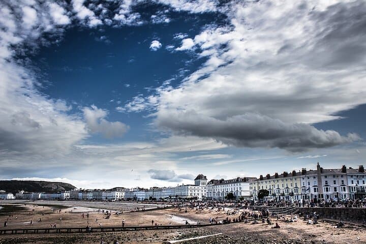
You push across the Menai Strait and the suspension bridge hums under the tyres; gulls wheel and a briny wind pushes you toward angling headlands and ruined towers. The route unfurls 188 miles (302 km) of sea-cliff drives, market towns and upland ridges—from the flat, wind-swept beaches of Anglesey to the folded hills of the Clwydian Range.
You push across the Menai Strait and the suspension bridge hums under the tyres; gulls wheel and a briny wind pushes you toward angling headlands and ruined towers. The route unfurls 188 miles (302 km) of sea-cliff drives, market towns and upland ridges—from the flat, wind-swept beaches of Anglesey to the folded hills of the Clwydian Range.
Castles of Edward I—Caernarfon, Conwy and Beaumaris—mark the medieval imprint on a landscape shaped much earlier by Ordovician and Silurian rocks and later scoured by ice. Parys Mountain’s oxidised slopes recall an industrial chapter when copper reshaped towns on Anglesey; inland, the Dee Valley and Llangollen show glacially carved profiles and limestone scarps. Welsh language, seasonal agricultural shows and lively market days give the route a strong local cadence.
The guide delivers three flexible sections so you can craft 3–14 day itineraries: coastal promenades, cliff-path walks and short upland hikes. Expect narrow lanes, single-track roads with passing places, ferry links at Holyhead and Cadw-managed admission for major castles. Practical moves: allow time for tidal accesses (South Stack), reserve parking near popular viewpoints in summer, and download the provided Google Map pins for offline use.
This trip is as much about rhythm—tea rooms after a cliff walk, an evening harbour stroll—as it is about mileage. Plan for changeable weather, respect protected coastal habitats, and pace driving days to leave room for the small, stubborn places that make North Wales memorable.