THE ADVENTURE COLLECTIVE® · Independent discovery and booking for outdoor travel

A downloadable map of 20 local favorites across Puerto Rico—hidden beaches, river pools, caves and Old San Juan spots with click-to-navigate directions. Perfect for travelers with a rental car who want flexible, self-paced exploration.
A downloadable map of 20 local favorites across Puerto Rico—hidden beaches, river pools, caves and Old San Juan spots with click-to-navigate directions. Perfect for travelers with a rental car who want flexible, self-paced exploration.
You arrive in San Juan, fuelled and ready, map downloaded to your phone and rental keys in hand. The first waypoint is a quiet coastal shelf where turquoise water dares you to wade in; later that day a trailhead slips into rainforest shade and a river’s current nudges you toward a natural pool.
Verified experiences and guided adventures in the surrounding area.
Operated by El Yunque Tours - The most AMAZING adventure in Puerto Rico (Private tour / transportation included) · San Juan, Puerto Rico
You arrive in San Juan, fuelled and ready, map downloaded to your phone and rental keys in hand. The first waypoint is a quiet coastal shelf where turquoise water dares you to wade in; later that day a trailhead slips into rainforest shade and a river’s current nudges you toward a natural pool.
This self-guided PDF collects 20 local favorites across Puerto Rico—five beaches, five rivers, five caves and five Old San Juan highlights—organized with click-to-navigate Google links so you move from coral-splashed shorelines to limestone canyons at your own pace.
Geology here is loud and clear: karst limestone carves caves and sinkholes in the north, while volcanic and alluvial soils feed lush interior rivers. History appears in Old San Juan’s 16th–18th century forts and cobbled streets, and in petroglyphs tucked into coastal caves carved by early inhabitants.
Practical edge: expect short-to-moderate hikes of 0.5–3 miles at many river and cave sites, with parking usually roadside or small municipal lots. Drive times between highlights can be 30–90 minutes; plan routes to avoid backtracking. Rivers spike quickly after rain—check local forecasts and avoid basin crossings when clouds are building.
Pack sturdy shoes, reef-safe sunscreen, and a waterproof phone case; keep a physical photocopy of the map if you’ll be offline. The product is digital and instant—perfect for travelers who value flexible itineraries, local tips, and the independence to pause where the island’s scenery compels them to stay longer.
moderate.
4 days (self-paced).
Moderate fitness: comfortable with short hikes (up to 3 miles), scrambling over rocks, and several flights of stairs in historic areas.
No—this is a digital, self-guided map with photos, local tips and click-to-navigate links so you plan and visit sites independently.
Yes—most locations are dispersed across the island and public transport is limited; a rental car is recommended.
River safety varies—only swim when water is clear and levels are normal; never enter after rain due to flash currents and debris.
You receive an instant download link by email; save a local copy to your device or print one if you expect limited cell service.
Old San Juan’s forts—Castillo San Felipe del Morro and San Cristóbal—reflect Spanish colonial military architecture dating from the 16th–18th centuries.
Avoid entering rivers after rain, use reef-safe sunscreen at beaches, and follow Leave No Trace principles to protect fragile coastal and karst environments.
El Yunque Tours - The most AMAZING adventure in Puerto Rico (Private tour / transportation included) operates guided outdoor trips and adventures with an emphasis on safety, stewardship, and memorable experiences.

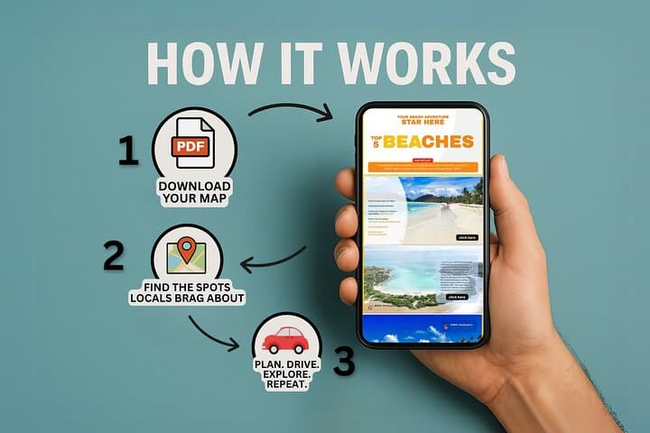


You arrive in San Juan, fuelled and ready, map downloaded to your phone and rental keys in hand. The first waypoint is a quiet coastal shelf where turquoise water dares you to wade in; later that day a trailhead slips into rainforest shade and a river’s current nudges you toward a natural pool.
You arrive in San Juan, fuelled and ready, map downloaded to your phone and rental keys in hand. The first waypoint is a quiet coastal shelf where turquoise water dares you to wade in; later that day a trailhead slips into rainforest shade and a river’s current nudges you toward a natural pool.
This self-guided PDF collects 20 local favorites across Puerto Rico—five beaches, five rivers, five caves and five Old San Juan highlights—organized with click-to-navigate Google links so you move from coral-splashed shorelines to limestone canyons at your own pace.
Geology here is loud and clear: karst limestone carves caves and sinkholes in the north, while volcanic and alluvial soils feed lush interior rivers. History appears in Old San Juan’s 16th–18th century forts and cobbled streets, and in petroglyphs tucked into coastal caves carved by early inhabitants.
Practical edge: expect short-to-moderate hikes of 0.5–3 miles at many river and cave sites, with parking usually roadside or small municipal lots. Drive times between highlights can be 30–90 minutes; plan routes to avoid backtracking. Rivers spike quickly after rain—check local forecasts and avoid basin crossings when clouds are building.
Pack sturdy shoes, reef-safe sunscreen, and a waterproof phone case; keep a physical photocopy of the map if you’ll be offline. The product is digital and instant—perfect for travelers who value flexible itineraries, local tips, and the independence to pause where the island’s scenery compels them to stay longer.