THE ADVENTURE COLLECTIVE® · Independent discovery and booking for outdoor travel

Drive the Million Dollar Highway at your own pace with a location-triggered audio guide. From Durango to Ouray the route threads high passes, old mining towns, and dramatic overlooks—download before you go and plan for high-altitude weather and narrow shoulders.
Drive the Million Dollar Highway at your own pace with a location-triggered audio guide. From Durango to Ouray the route threads high passes, old mining towns, and dramatic overlooks—download before you go and plan for high-altitude weather and narrow shoulders.
You round a blind hairpin and the canyon opens: the Animas River below, wind scalloping the cliffs, and a sweep of peaks that hold winter like a secret. The Million Dollar Highway pushes you through the San Juan Mountains with a driver’s rhythm—slow climbs, sudden views, and roadside pullouts that insist you stop.
Verified experiences and guided adventures in the surrounding area.
Operated by Gypsy Guide GPS LLC · Durango, Colorado
You round a blind hairpin and the canyon opens: the Animas River below, wind scalloping the cliffs, and a sweep of peaks that hold winter like a secret. The Million Dollar Highway pushes you through the San Juan Mountains with a driver’s rhythm—slow climbs, sudden views, and roadside pullouts that insist you stop.
This stretch of US 550 traces hard-rock mining history and bold 19th-century engineering. Red Mountain Pass, once carved by miners and early wagon trains, now crowns the route at just over 11,000 ft; beneath its talus, telltale veins of ore and layered volcanic tuff show a violent geologic past. Small towns—Durango’s rail-town grit, Silverton’s mining facades, Ouray’s spa-town character—carry different chapters of regional culture: grit, commerce, and the later lure of recreation.
Expect a compact driving adventure: roughly 65–75 miles between Durango and Ouray depending on your stops, steep grades, narrow shoulders and alpine passes. Notable on-road highlights include Baker’s Bridge, Crystal Lake’s mirror surface, Bear Creek Falls’ 200-foot drop, and Molas Lake’s high-country wetland. Rivers dare you with rapids and calm pools; winds will steer your concentration.
Practical notes: pre-download the audio, plan half- to full-day timings to include hikes or photography stops, and factor altitude—sudden weather shifts and tight turns demand focused driving. Bring a charged phone and charger, binoculars, layers, and patience: slow travel yields the best views on this historic, high-elevation corridor.
easy.
2–4 hours (self-paced; allow a full day to explore stops).
Minimal fitness required for the driving portions; short walks or boardwalks at viewpoints may require light mobility.
No—download the GuideAlong app and the specific audio tour over Wi‑Fi or cell before you leave; the commentary runs offline via your phone’s GPS.
The purchase covers one vehicle but the audio file can be used repeatedly without time limits; check provider terms for multiple-vehicle use.
Large RVs and long trailers can navigate the route but should be driven by experienced operators; tight turns and steep grades require caution—consider shorter vehicles for comfort.
The direct drive takes about 2–3 hours, but budgeting a half to full day lets you sample hikes, overlooks, and towns along the way.
The route follows late-19th-century mining roads; towns like Silverton and Ouray grew around mines and supply networks for the San Juan Mountains.
Stay on pavement and designated pullouts, pack out trash, and avoid trampling fragile alpine vegetation—high‑elevation ecosystems recover slowly from disturbance.
Gypsy Guide GPS LLC operates guided outdoor trips and adventures with an emphasis on safety, stewardship, and memorable experiences.

You round a blind hairpin and the canyon opens: the Animas River below, wind scalloping the cliffs, and a sweep of peaks that hold winter like a secret. The Million Dollar Highway pushes you through the San Juan Mountains with a driver’s rhythm—slow climbs, sudden views, and roadside pullouts that insist you stop.
You round a blind hairpin and the canyon opens: the Animas River below, wind scalloping the cliffs, and a sweep of peaks that hold winter like a secret. The Million Dollar Highway pushes you through the San Juan Mountains with a driver’s rhythm—slow climbs, sudden views, and roadside pullouts that insist you stop.
This stretch of US 550 traces hard-rock mining history and bold 19th-century engineering. Red Mountain Pass, once carved by miners and early wagon trains, now crowns the route at just over 11,000 ft; beneath its talus, telltale veins of ore and layered volcanic tuff show a violent geologic past. Small towns—Durango’s rail-town grit, Silverton’s mining facades, Ouray’s spa-town character—carry different chapters of regional culture: grit, commerce, and the later lure of recreation.
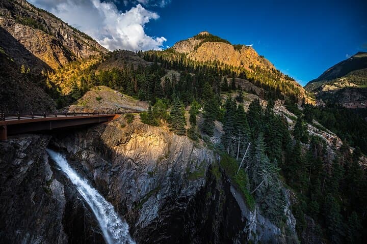
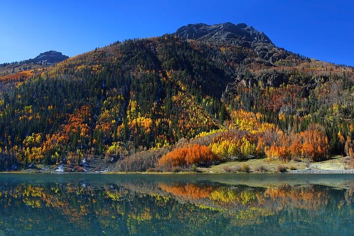
Expect a compact driving adventure: roughly 65–75 miles between Durango and Ouray depending on your stops, steep grades, narrow shoulders and alpine passes. Notable on-road highlights include Baker’s Bridge, Crystal Lake’s mirror surface, Bear Creek Falls’ 200-foot drop, and Molas Lake’s high-country wetland. Rivers dare you with rapids and calm pools; winds will steer your concentration.
Practical notes: pre-download the audio, plan half- to full-day timings to include hikes or photography stops, and factor altitude—sudden weather shifts and tight turns demand focused driving. Bring a charged phone and charger, binoculars, layers, and patience: slow travel yields the best views on this historic, high-elevation corridor.