THE ADVENTURE COLLECTIVE® · Independent discovery and booking for outdoor travel

Drive through the Smokies with a location‑aware audio guide that narrates Cherokee legends, settler history, and geological highlights as you arrive at each stop. Download before departure and plan for 90–120 minutes with optional hikes.
Drive through the Smokies with a location‑aware audio guide that narrates Cherokee legends, settler history, and geological highlights as you arrive at each stop. Download before departure and plan for 90–120 minutes with optional hikes.
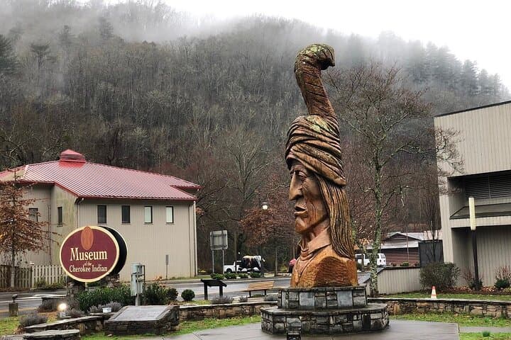
You pull off US‑19 into a narrow pullout, phone secure in the dash, and the app picks up your location. A narrator’s voice fills the car, not replacing the wind through the windows but giving context—who lived here, why a ridge is called Chimney Tops, and the Cherokee legends that still trace the hollows.
Verified experiences and guided adventures in the surrounding area.
Operated by WalknTours · Cherokee, North Carolina
You pull off US‑19 into a narrow pullout, phone secure in the dash, and the app picks up your location. A narrator’s voice fills the car, not replacing the wind through the windows but giving context—who lived here, why a ridge is called Chimney Tops, and the Cherokee legends that still trace the hollows.
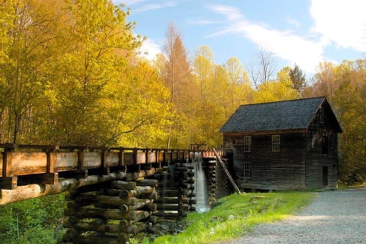
The route follows valley floors and saddle roads carved by ancient rivers and folded mountains from the Appalachian orogeny. Expect stops at Oconaluftee, overlooks with Precambrian sandstone outcrops, and historic sites where settlers and Cherokee lives intersected. The tour points out the Rockefeller donation that helped form the park and explains local syrup‑making traditions at Sugarlands.
Culturally, this drive stitches together Cherokee stories, 19th‑century mountain settlement, and 20th‑century conservation history—each audio segment calibrated to where you are so context arrives as the scene does.
Practically, this is a low‑impact way to cover miles without missing nuance: the app plays automatically as you approach waypoints, so you can keep hands on the wheel. Download the WalknTours app and the tour before you lose cell signal, allow 90–120 minutes for the core route, and budget extra time to stop and hike short trails at overlooks. Watch for narrow shoulders and passing vehicles on two‑lane sections; parking at popular pullouts fills early in peak season.
Bring water, a map or downloaded GPX, and patience for wildlife crossings—bears and deer move across the roadway on their schedule. This driving tour is an invitation to move slowly through deep geologic time and layered human history while staying comfortably in your car.
easy.
1.5–2 hours.
Suitable for all fitness levels; minimal walking required unless you choose to hike at stops
No—unlock and download the tour in the WalknTours app before you enter the park; once downloaded it will play without signal.
The tour starts at the Cherokee Welcome Center and the main suggested route concludes near Sugarlands Visitor Center, with multiple optional stops in between.
Entrance to Great Smoky Mountains National Park is free, but some parking areas may require a paid parking pass—check the park website or visitor centers.
Yes—most waypoints are at pullouts, trailheads, or visitor centers; the audio indicates optional stops and recommended short hikes.
The park blends Cherokee ancestral lands with 19th‑century Appalachian settlement and 20th‑century conservation efforts funded in part by private donations like the Rockefellers.
The park emphasizes Leave No Trace practices and seasonal road management to protect habitats; staying on designated pullouts and trails reduces erosion and wildlife disturbance.
WalknTours operates guided outdoor trips and adventures with an emphasis on safety, stewardship, and memorable experiences.


You pull off US‑19 into a narrow pullout, phone secure in the dash, and the app picks up your location. A narrator’s voice fills the car, not replacing the wind through the windows but giving context—who lived here, why a ridge is called Chimney Tops, and the Cherokee legends that still trace the hollows.
You pull off US‑19 into a narrow pullout, phone secure in the dash, and the app picks up your location. A narrator’s voice fills the car, not replacing the wind through the windows but giving context—who lived here, why a ridge is called Chimney Tops, and the Cherokee legends that still trace the hollows.
The route follows valley floors and saddle roads carved by ancient rivers and folded mountains from the Appalachian orogeny. Expect stops at Oconaluftee, overlooks with Precambrian sandstone outcrops, and historic sites where settlers and Cherokee lives intersected. The tour points out the Rockefeller donation that helped form the park and explains local syrup‑making traditions at Sugarlands.
Culturally, this drive stitches together Cherokee stories, 19th‑century mountain settlement, and 20th‑century conservation history—each audio segment calibrated to where you are so context arrives as the scene does.
Practically, this is a low‑impact way to cover miles without missing nuance: the app plays automatically as you approach waypoints, so you can keep hands on the wheel. Download the WalknTours app and the tour before you lose cell signal, allow 90–120 minutes for the core route, and budget extra time to stop and hike short trails at overlooks. Watch for narrow shoulders and passing vehicles on two‑lane sections; parking at popular pullouts fills early in peak season.
Bring water, a map or downloaded GPX, and patience for wildlife crossings—bears and deer move across the roadway on their schedule. This driving tour is an invitation to move slowly through deep geologic time and layered human history while staying comfortably in your car.