THE ADVENTURE COLLECTIVE® · Independent discovery and booking for outdoor travel

Turn your car into a storytelling vehicle and let a GPS-driven audio guide lead you through Goblin Valley’s otherworldly hoodoos. This 15+ mile, 1–2 hour self-guided driving tour pairs geology, rock art and landmark stops with hands-free narration you can use offline.
Turn your car into a storytelling vehicle and let a GPS-driven audio guide lead you through Goblin Valley’s otherworldly hoodoos. This 15+ mile, 1–2 hour self-guided driving tour pairs geology, rock art and landmark stops with hands-free narration you can use offline.
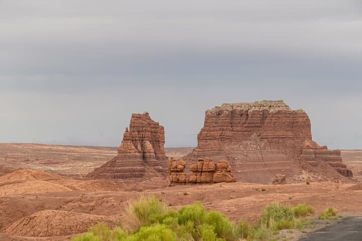
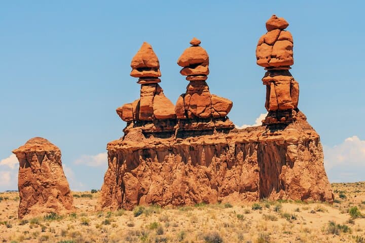
You pull off Temple Mountain Road into a wide gravel turnout, the car engine cooling as a voice begins to speak through your phone. Ahead, the desert floor folds into clusters of squat, mushroom-shaped hoodoos—goblins in orange and rust—waiting for the light to define their faces.
Verified experiences and guided adventures in the surrounding area.
Operated by Travel with Action · Hanksville, Utah
You pull off Temple Mountain Road into a wide gravel turnout, the car engine cooling as a voice begins to speak through your phone. Ahead, the desert floor folds into clusters of squat, mushroom-shaped hoodoos—goblins in orange and rust—waiting for the light to define their faces.
Goblin Valley occupies a pocket of the larger San Rafael Swell, an uplifted expanse of Entrada sandstone and other Mesozoic layers carved by wind and intermittent water over millions of years. The tour points out landmarks by name—Molly’s Castle and Wild Horse Butte—while looping you past the Temple Mountain Wash pictograph panel, where Barrier Canyon-style images and later Fremont-period art record human presence across centuries.
The route runs roughly 15+ miles and is designed to take 1–2 hours, letting you stop, hike short side trails, or climb viewpoints like Goblin Overlook. Expect high desert conditions: strong sun, thin air at elevations around 5,000–5,700 ft, and sparse shade.
Practicalities are straightforward: download Action Tour Guide’s app and the specific tour (you’ll need the password sent after booking) while you have cell or Wi‑Fi; the content works offline once stored. The tour is self-guided—no meeting point—and does not include park admission. Start at the recommended pullout near the junction with UT‑24 and follow the audio cues; the narration triggers by GPS and guides you from stop to stop.
Pack water, sun protection, and extra phone power. Drive slowly through viewpoints, respect fragile rock and rock art, and plan for changing temperatures between midday and evening for the safest, most rewarding visit.
easy.
1–2 hours.
Suitable for all fitness levels—minimal walking required unless you choose to hike viewpoints.
Yes. The audio tour does not include park entrance; purchase a park pass separately and verify operating hours before arrival.
Action recommends iOS 15+ or Android 9+ with GPS; download the tour over Wi‑Fi or cellular before you arrive so it works offline.
Yes. The tour is self‑guided and can be paused; audio triggers by GPS so you can stop, hike a viewpoint, and resume when ready.
Yes. It’s family‑friendly—kids enjoy the unusual formations—but supervise children around fragile rocks and pictograph sites.
The San Rafael Swell and surrounding canyons preserve layers of Mesozoic sandstone and rock art styles—Barrier Canyon pictographs predate later Fremont habitations—and the area has long housed travelers and Indigenous peoples.
Stick to established pullouts and trails to protect delicate sandstone and rock art; avoid touching pictographs and carry out all trash to minimize human impact.
Travel with Action operates guided outdoor trips and adventures with an emphasis on safety, stewardship, and memorable experiences.

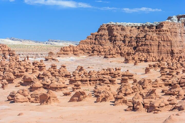
You pull off Temple Mountain Road into a wide gravel turnout, the car engine cooling as a voice begins to speak through your phone. Ahead, the desert floor folds into clusters of squat, mushroom-shaped hoodoos—goblins in orange and rust—waiting for the light to define their faces.
You pull off Temple Mountain Road into a wide gravel turnout, the car engine cooling as a voice begins to speak through your phone. Ahead, the desert floor folds into clusters of squat, mushroom-shaped hoodoos—goblins in orange and rust—waiting for the light to define their faces.
Goblin Valley occupies a pocket of the larger San Rafael Swell, an uplifted expanse of Entrada sandstone and other Mesozoic layers carved by wind and intermittent water over millions of years. The tour points out landmarks by name—Molly’s Castle and Wild Horse Butte—while looping you past the Temple Mountain Wash pictograph panel, where Barrier Canyon-style images and later Fremont-period art record human presence across centuries.
The route runs roughly 15+ miles and is designed to take 1–2 hours, letting you stop, hike short side trails, or climb viewpoints like Goblin Overlook. Expect high desert conditions: strong sun, thin air at elevations around 5,000–5,700 ft, and sparse shade.
Practicalities are straightforward: download Action Tour Guide’s app and the specific tour (you’ll need the password sent after booking) while you have cell or Wi‑Fi; the content works offline once stored. The tour is self-guided—no meeting point—and does not include park admission. Start at the recommended pullout near the junction with UT‑24 and follow the audio cues; the narration triggers by GPS and guides you from stop to stop.
Pack water, sun protection, and extra phone power. Drive slowly through viewpoints, respect fragile rock and rock art, and plan for changing temperatures between midday and evening for the safest, most rewarding visit.