THE ADVENTURE COLLECTIVE® · Independent discovery and booking for outdoor travel

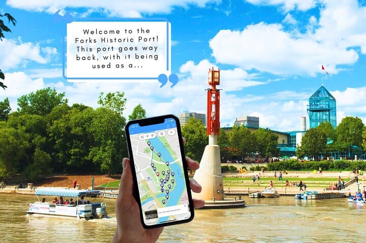
Walk the Forks at your own pace with a GPS-triggered audio tour that narrates Indigenous history, fur-trade era stories, and modern public art. Download the guide, follow the riverside boardwalks, and explore the market stalls and quiet historical corners on a 90–120 minute loop.
Walk the Forks at your own pace with a GPS-triggered audio tour that narrates Indigenous history, fur-trade era stories, and modern public art. Download the guide, follow the riverside boardwalks, and explore the market stalls and quiet historical corners on a 90–120 minute loop.
You step off the boardwalk and the city opens into a long, layered room — river to your left, brick warehouses to your right, and the hum of people threading between public art and market stalls. The Forks feels like a place with a memory: mudflats turned port, meeting place, and now a public spine that invites you to walk it at your own pace.
Verified experiences and guided adventures in the surrounding area.
Operated by Tripvia Tours · Winnipeg, Manitoba
You step off the boardwalk and the city opens into a long, layered room — river to your left, brick warehouses to your right, and the hum of people threading between public art and market stalls. The Forks feels like a place with a memory: mudflats turned port, meeting place, and now a public spine that invites you to walk it at your own pace.
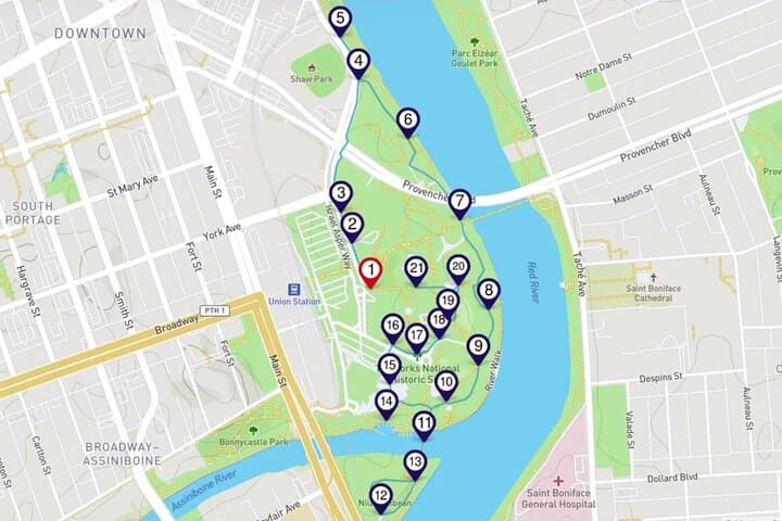
This 2–2.5 km self-guided smartphone audio tour traces centuries: Indigenous trade and seasonal gatherings, the fur trade’s river crossroads, the coming of rail, and contemporary revitalization that added Esplanade Riel, Shaw Park, and the Forks Market. Geologically the site sits where the Red and Assiniboine rivers meet; expect flat riverine terrain, channel deposits, and wide open sightlines that change with the season.
Culturally the Forks is layered — Ojibwe and Métis histories are interpreted alongside industrial-era architecture and modern public art like Niimaamaa. The route threads parks, plazas, and waterfront piers, with brief detours to the Johnston Terminal and the public orchard.
Practical guidance: download the Tripvia app and tour files on Wi‑Fi before you go; GPS triggers commentary automatically but offline playback relies on the downloaded content. Wear supportive shoes for paved and timber boardwalks; bring a waterproof layer if riverside winds pick up. The tour is flexible — pause, retake stops, and answer optional trivia as you move. Aim for morning or golden hour to avoid large crowds and to see the river light, and leave at least 90 minutes to take in exhibits and market stalls.
easy.
1.5–2 hours.
Minimal fitness required — suitable for most walkers who can handle 2–3 km on flat terrain
Plan 90–120 minutes to experience the full route with time to browse exhibits or markets.
No — download the audio and map files on Wi‑Fi beforehand and the tour will play without data.
Much of the Forks area uses level pavement and boardwalks; accessibility is good on main paths, but check specific ramps and seasonal conditions.
Yes — the tour is self-guided: you can pause, skip, or replay stops and complete it at your own pace.
The Forks has been a gathering place for Indigenous peoples for thousands of years and later became a major fur-trade and railway hub before its modern revitalization as a cultural district.
Riverbank restoration and public-art stewardship are ongoing; stay on designated paths, respect cultural sites, and pack out trash to protect shoreline habitats.
Tripvia Tours operates guided outdoor trips and adventures with an emphasis on safety, stewardship, and memorable experiences.

You step off the boardwalk and the city opens into a long, layered room — river to your left, brick warehouses to your right, and the hum of people threading between public art and market stalls. The Forks feels like a place with a memory: mudflats turned port, meeting place, and now a public spine that invites you to walk it at your own pace.
You step off the boardwalk and the city opens into a long, layered room — river to your left, brick warehouses to your right, and the hum of people threading between public art and market stalls. The Forks feels like a place with a memory: mudflats turned port, meeting place, and now a public spine that invites you to walk it at your own pace.
This 2–2.5 km self-guided smartphone audio tour traces centuries: Indigenous trade and seasonal gatherings, the fur trade’s river crossroads, the coming of rail, and contemporary revitalization that added Esplanade Riel, Shaw Park, and the Forks Market. Geologically the site sits where the Red and Assiniboine rivers meet; expect flat riverine terrain, channel deposits, and wide open sightlines that change with the season.
Culturally the Forks is layered — Ojibwe and Métis histories are interpreted alongside industrial-era architecture and modern public art like Niimaamaa. The route threads parks, plazas, and waterfront piers, with brief detours to the Johnston Terminal and the public orchard.
Practical guidance: download the Tripvia app and tour files on Wi‑Fi before you go; GPS triggers commentary automatically but offline playback relies on the downloaded content. Wear supportive shoes for paved and timber boardwalks; bring a waterproof layer if riverside winds pick up. The tour is flexible — pause, retake stops, and answer optional trivia as you move. Aim for morning or golden hour to avoid large crowds and to see the river light, and leave at least 90 minutes to take in exhibits and market stalls.