THE ADVENTURE COLLECTIVE® · Independent discovery and booking for outdoor travel

Walk the fields where the 1794 Battle of Fallen Timbers was decided. This self-guided audio tour combines local scholarship, on-site archaeology, and clear directions to lead visitors through the Northwest Territory Trail in roughly 35–50 minutes.
Walk the fields where the 1794 Battle of Fallen Timbers was decided. This self-guided audio tour combines local scholarship, on-site archaeology, and clear directions to lead visitors through the Northwest Territory Trail in roughly 35–50 minutes.
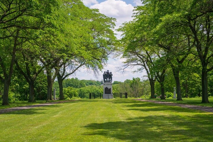
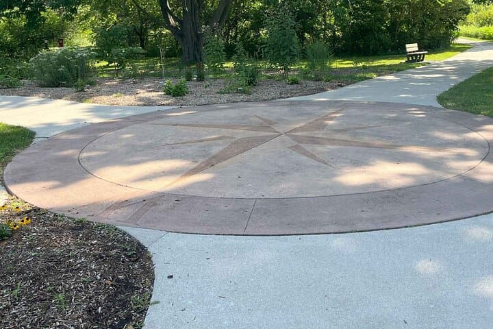
The path opens on a cool Ohio morning: grass flattened by dew, the compass at the trailhead like an old mapmaker’s mark. You press play and a voice — Tedd Long’s — slips into your ear, placing you where muskets and decisions once met. The Northwest Territory Trail leads across low ridges and open fields; wind moves through tallgrass as if carrying fragments of 1794.
Verified experiences and guided adventures in the surrounding area.
Operated by VoiceMap Audio Tours · Maumee, Ohio
The path opens on a cool Ohio morning: grass flattened by dew, the compass at the trailhead like an old mapmaker’s mark. You press play and a voice — Tedd Long’s — slips into your ear, placing you where muskets and decisions once met. The Northwest Territory Trail leads across low ridges and open fields; wind moves through tallgrass as if carrying fragments of 1794.
This parcel of land witnessed the climactic Battle of Fallen Timbers on August 20, 1794, when the Western Confederacy’s resistance to U.S. expansion ended and the Treaty of Greenville followed the next year. Geologically, the terrain is glacially derived: modest rolling moraines and drained wetlands that once shaped travel and tactics. Culturally the site sits at the intersection of Euro-American expansion and Native American sovereignty — a place to consider both strategy and consequence.
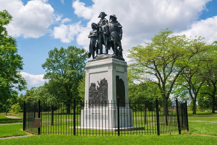
The audio tour blends narrative, archival detail, and modern archaeological findings; it identifies the Fallen Timbers Monument, troop approaches, and key skirmish points along a well-marked walk. Expect about 35–50 minutes on mostly level, compacted-earth trails with short paved sections and interpretive signage.
Practical guidance: download the VoiceMap file beforehand and bring headphones, water, and weather-appropriate layers. The route is wheelchair accessible in parts but includes unpaved stretches. Peak visits are mornings and late afternoons for softer light and fewer crowds. Keep to marked paths to protect archaeological deposits and native grasses — the landscape still holds stories underfoot.
easy.
35–50 minutes.
Suitable for most fitness levels; short, mostly level walking with occasional uneven footing
The tour runs about 35–50 minutes depending on stops and walking pace; you can pause the audio to linger at key spots.
Begin at the large compass embedded at the head of the Northwest Territory Trail near the Fallen Timbers Battlefield Metropark parking area on Jerome Road.
Sections of the trail and the visitors area are wheelchair accessible, but some unpaved stretches may be uneven; check the app’s accessibility notes.
One downloadable code covers your entire booking; every member of your party can download the tour using the same code.
The battle in 1794 ended large-scale Native American resistance in the region and directly led to the 1795 Treaty of Greenville, reshaping settlement patterns in the Northwest Territory.
The park balances public access with preservation of archaeological deposits and native grassland; stay on trails and pack out waste to minimize impact.
VoiceMap Audio Tours operates guided outdoor trips and adventures with an emphasis on safety, stewardship, and memorable experiences.
The path opens on a cool Ohio morning: grass flattened by dew, the compass at the trailhead like an old mapmaker’s mark. You press play and a voice — Tedd Long’s — slips into your ear, placing you where muskets and decisions once met. The Northwest Territory Trail leads across low ridges and open fields; wind moves through tallgrass as if carrying fragments of 1794.
The path opens on a cool Ohio morning: grass flattened by dew, the compass at the trailhead like an old mapmaker’s mark. You press play and a voice — Tedd Long’s — slips into your ear, placing you where muskets and decisions once met. The Northwest Territory Trail leads across low ridges and open fields; wind moves through tallgrass as if carrying fragments of 1794.
This parcel of land witnessed the climactic Battle of Fallen Timbers on August 20, 1794, when the Western Confederacy’s resistance to U.S. expansion ended and the Treaty of Greenville followed the next year. Geologically, the terrain is glacially derived: modest rolling moraines and drained wetlands that once shaped travel and tactics. Culturally the site sits at the intersection of Euro-American expansion and Native American sovereignty — a place to consider both strategy and consequence.
The audio tour blends narrative, archival detail, and modern archaeological findings; it identifies the Fallen Timbers Monument, troop approaches, and key skirmish points along a well-marked walk. Expect about 35–50 minutes on mostly level, compacted-earth trails with short paved sections and interpretive signage.
Practical guidance: download the VoiceMap file beforehand and bring headphones, water, and weather-appropriate layers. The route is wheelchair accessible in parts but includes unpaved stretches. Peak visits are mornings and late afternoons for softer light and fewer crowds. Keep to marked paths to protect archaeological deposits and native grasses — the landscape still holds stories underfoot.