THE ADVENTURE COLLECTIVE® · Independent discovery and booking for outdoor travel

Walk Canmore your way with a GPS-triggered audio guide that narrates mining history, public art and mountain geology. Download on Wi‑Fi, follow the 5 km route and stop at any exhibit on your own schedule.
Walk Canmore your way with a GPS-triggered audio guide that narrates mining history, public art and mountain geology. Download on Wi‑Fi, follow the 5 km route and stop at any exhibit on your own schedule.
You step off Main Street with the Rockies pressing in from the north, and a smartphone voice begins to speak. The map pins your position; the river dares you to follow its curve. Over the next 5 km (return) the route alternates between paved sidewalks and the boardwalk along Policeman's Creek, passing sculptures, soldiered stone buildings and sudden mountain views that frame the town like stage scenery.
Verified experiences and guided adventures in the surrounding area.
Operated by Tripvia Tours · Canmore, Alberta
You step off Main Street with the Rockies pressing in from the north, and a smartphone voice begins to speak. The map pins your position; the river dares you to follow its curve. Over the next 5 km (return) the route alternates between paved sidewalks and the boardwalk along Policeman's Creek, passing sculptures, soldiered stone buildings and sudden mountain views that frame the town like stage scenery.
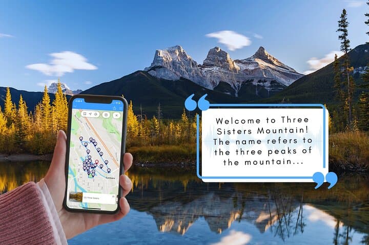
Canmore grew from 19th‑century coal mines and the arrival of the Canadian Pacific Railway; the tour names the Miner's Union Hall, NWMP barracks and the coal-car monument that mark those roots. Geologically the Bow Valley is a carved corridor of glacial action — peaks such as Mount Rundle and the Three Sisters expose layers of limestone and shale that hikers know well. Culturally you’ll hear about local festivals in Centennial Park, the Canmore Museum’s artifact collection and the civic stories behind murals and inukshuk installations.
Practical guidance blends with narration: download the tour on Wi‑Fi, keep headphones handy, and let GPS trigger commentary automatically. The path is mostly level and wheelchair‑accessible, but surfaces change from smooth boardwalk to town pavement. Plan 1.5–2 hours at a relaxed pace; expect stops for photos, trivia prompts and coffee on Main Street. Bring a charged phone or power bank, dress in layers against sudden alpine breezes, and carry water — the Bow River will be waiting, moving fast and indifferent to your timing.
easy.
1.5–2 hours.
Suitable for most fitness levels; route is mostly flat with short stops for interpretation
The route covers about 5 km round trip and typically takes 90–120 minutes at a relaxed pace.
No—download the tour on Wi‑Fi before you start; the app uses GPS and won't require mobile data.
Yes—most of the tour follows paved sidewalks and the Policeman's Creek boardwalk and is listed as wheelchair accessible.
Yes—the self‑guided format allows you to pause, skip or resume commentary at any point along the route.
Canmore’s growth was driven by coal mining and the Canadian Pacific Railway; many downtown buildings and monuments reference that industrial past.
Stick to designated walkways, avoid feeding wildlife and pack out any trash—Canmore manages sensitive riparian zones along the Bow River.
Tripvia Tours operates guided outdoor trips and adventures with an emphasis on safety, stewardship, and memorable experiences.
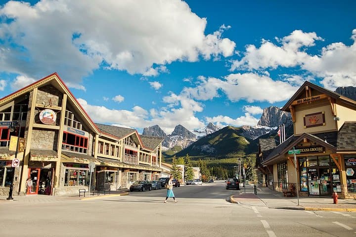
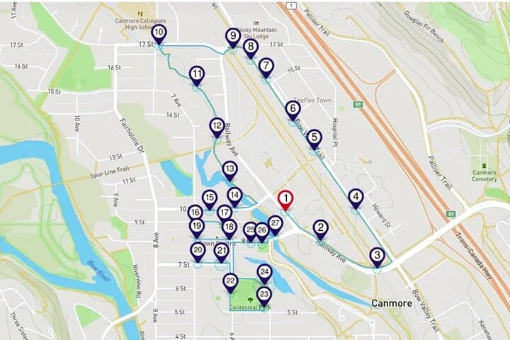

You step off Main Street with the Rockies pressing in from the north, and a smartphone voice begins to speak. The map pins your position; the river dares you to follow its curve. Over the next 5 km (return) the route alternates between paved sidewalks and the boardwalk along Policeman's Creek, passing sculptures, soldiered stone buildings and sudden mountain views that frame the town like stage scenery.
You step off Main Street with the Rockies pressing in from the north, and a smartphone voice begins to speak. The map pins your position; the river dares you to follow its curve. Over the next 5 km (return) the route alternates between paved sidewalks and the boardwalk along Policeman's Creek, passing sculptures, soldiered stone buildings and sudden mountain views that frame the town like stage scenery.
Canmore grew from 19th‑century coal mines and the arrival of the Canadian Pacific Railway; the tour names the Miner's Union Hall, NWMP barracks and the coal-car monument that mark those roots. Geologically the Bow Valley is a carved corridor of glacial action — peaks such as Mount Rundle and the Three Sisters expose layers of limestone and shale that hikers know well. Culturally you’ll hear about local festivals in Centennial Park, the Canmore Museum’s artifact collection and the civic stories behind murals and inukshuk installations.
Practical guidance blends with narration: download the tour on Wi‑Fi, keep headphones handy, and let GPS trigger commentary automatically. The path is mostly level and wheelchair‑accessible, but surfaces change from smooth boardwalk to town pavement. Plan 1.5–2 hours at a relaxed pace; expect stops for photos, trivia prompts and coffee on Main Street. Bring a charged phone or power bank, dress in layers against sudden alpine breezes, and carry water — the Bow River will be waiting, moving fast and indifferent to your timing.