THE ADVENTURE COLLECTIVE® · Independent discovery and booking for outdoor travel

Drive a classic southern Utah loop with GPS-activated audio narration that brings Zion, Bryce, Capitol Reef, Grand Staircase–Escalante and Goblin Valley to life. Learn geology, history, and local tips while following turn-by-turn routes you can pause and customize.
Drive a classic southern Utah loop with GPS-activated audio narration that brings Zion, Bryce, Capitol Reef, Grand Staircase–Escalante and Goblin Valley to life. Learn geology, history, and local tips while following turn-by-turn routes you can pause and customize.
You start before sunrise, tires crunching on red dust as the first light slides over sheer Navajo sandstone. The road unfurls—high mesas to your left, a ribbon canyon to your right—and the audio guide clicks on, placing you at a specific overlook: towers and hoodoos breathing heat into the morning sky.
Verified experiences and guided adventures in the surrounding area.
Operated by Shaka Guide Apps · Springdale, Utah
You start before sunrise, tires crunching on red dust as the first light slides over sheer Navajo sandstone. The road unfurls—high mesas to your left, a ribbon canyon to your right—and the audio guide clicks on, placing you at a specific overlook: towers and hoodoos breathing heat into the morning sky.
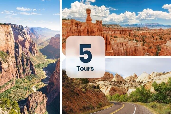
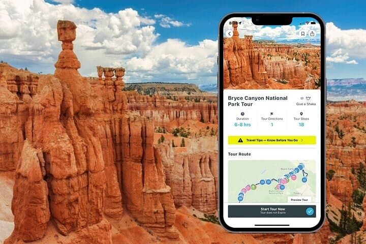
This route threads through five distinct landscapes: Zion’s steep-walled canyons and the river-carved Narrows, Bryce’s amphitheater of hoodoos rising from 6,600–9,100 ft (Rainbow Point), Capitol Reef’s Waterpocket Fold, the wild byways of Grand Staircase–Escalante, and the mushroomed alcoves of Goblin Valley. Geology here reads like a layered novel—Navajo sandstone, cross-bedded cliffs, frost-wedging that sculpts hoodoos, and sedimentary folds that forced pioneers to skirt the “reef.” Fremont petroglyphs and Mormon orchards in Fruita add human chapters to the rock record.
The tour’s strength is practical: GPS-activated narration, offline maps, and suggested turnouts let you explore at your own pace while learning the backstory of each stop. Expect options—family-friendly walks like Riverside Walk and Mossy Cave, moderate ascents such as Canyon Overlook, and technical routes (Angel’s Landing requires a permit; The Narrows demands river-ready shoes).
Plan for early starts to avoid mid-day crowds, download the Shaka Guide content on Wi‑Fi, and carry extra water and fuel—Torrey is the last full-service town before Hanksville. Footwear with traction, sun protection, and layered clothing will keep you comfortable across the elevation and temperature swings. Drive slowly on spur roads, watch for flash-flood warnings, and leave sites as you found them—the rocks have been telling their stories here for millions of years; don’t interrupt the next chapter.
moderate.
4–5 days.
Suitable for travelers with general fitness who can handle short hikes up to 5 miles and uneven terrain; you can tailor daily effort to your group.
Yes—Angel’s Landing in Zion requires a permit; other trails typically don’t but some backcountry routes and popular hikes may need reservations or permits at busy times.
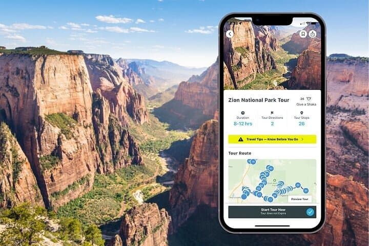
Yes—redeem and download the tour via the Shaka Guide app on Wi‑Fi before you go; the GPS narration and offline maps then work without mobile data.
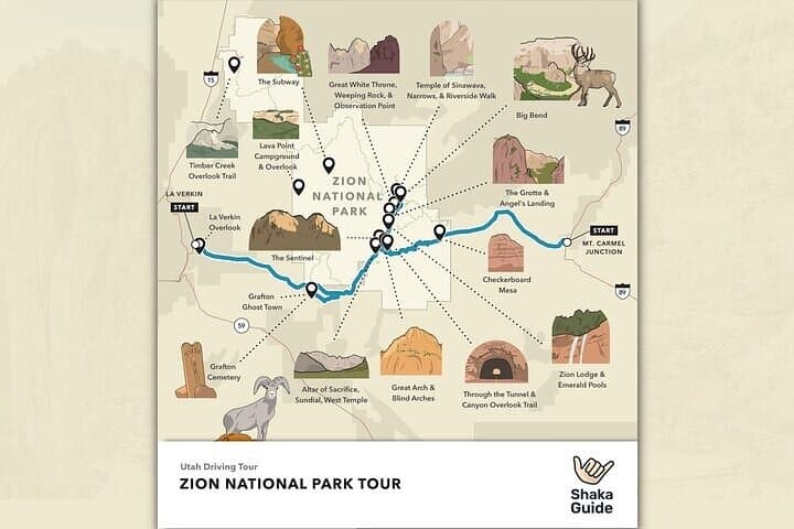
Daily driving varies; Zion loop in the itinerary is about 50 miles through the canyon, and the full bundle is best enjoyed over 4–5 days with flexible stop times for hikes and viewpoints.
Yes—many stops and short trails are family-friendly (Lower Emerald Pools, Mossy Cave, Goblin Valley), but supervise kids at overlooks and avoid technical hikes with exposure.
The region bears both Fremont and Pioneer marks—ancient petroglyphs and 19th‑century Mormon settlements shaped trails, orchards, and place names such as Fruita and Virgin.
Stay on established trails to protect cryptobiotic soil and fragile desert crusts; pack out waste and follow park rules to minimize erosion and wildlife disturbance.
Shaka Guide Apps operates guided outdoor trips and adventures with an emphasis on safety, stewardship, and memorable experiences.
You start before sunrise, tires crunching on red dust as the first light slides over sheer Navajo sandstone. The road unfurls—high mesas to your left, a ribbon canyon to your right—and the audio guide clicks on, placing you at a specific overlook: towers and hoodoos breathing heat into the morning sky.
You start before sunrise, tires crunching on red dust as the first light slides over sheer Navajo sandstone. The road unfurls—high mesas to your left, a ribbon canyon to your right—and the audio guide clicks on, placing you at a specific overlook: towers and hoodoos breathing heat into the morning sky.
This route threads through five distinct landscapes: Zion’s steep-walled canyons and the river-carved Narrows, Bryce’s amphitheater of hoodoos rising from 6,600–9,100 ft (Rainbow Point), Capitol Reef’s Waterpocket Fold, the wild byways of Grand Staircase–Escalante, and the mushroomed alcoves of Goblin Valley. Geology here reads like a layered novel—Navajo sandstone, cross-bedded cliffs, frost-wedging that sculpts hoodoos, and sedimentary folds that forced pioneers to skirt the “reef.” Fremont petroglyphs and Mormon orchards in Fruita add human chapters to the rock record.
The tour’s strength is practical: GPS-activated narration, offline maps, and suggested turnouts let you explore at your own pace while learning the backstory of each stop. Expect options—family-friendly walks like Riverside Walk and Mossy Cave, moderate ascents such as Canyon Overlook, and technical routes (Angel’s Landing requires a permit; The Narrows demands river-ready shoes).
Plan for early starts to avoid mid-day crowds, download the Shaka Guide content on Wi‑Fi, and carry extra water and fuel—Torrey is the last full-service town before Hanksville. Footwear with traction, sun protection, and layered clothing will keep you comfortable across the elevation and temperature swings. Drive slowly on spur roads, watch for flash-flood warnings, and leave sites as you found them—the rocks have been telling their stories here for millions of years; don’t interrupt the next chapter.