THE ADVENTURE COLLECTIVE® · Independent discovery and booking for outdoor travel

Plug in and let a GPS‑activated audio guide lead you through Guadalupe Mountains National Park. Drive between scenic pullouts, learn about ancient reef limestone and ranching history, then hike options range from short springs to the strenuous Guadalupe Peak summit.
Plug in and let a GPS‑activated audio guide lead you through Guadalupe Mountains National Park. Drive between scenic pullouts, learn about ancient reef limestone and ranching history, then hike options range from short springs to the strenuous Guadalupe Peak summit.
You pull off US‑62 into a pullout and a wind‑scoured view opens: jagged limestone ridgelines rise above scrub and piñon, El Capitan standing like a weathered guardian. Headphones on, the audio guide cues up—stories, directions, and geology timed to your GPS. The road becomes a sequence of staged moments: picnic overlooks with panoramas, a small visitor center with exhibits, and trailheads where singletrack threads into pinyon‑oak forest.
Verified experiences and guided adventures in the surrounding area.
Operated by Shaka Guide Apps · Van Horn, Texas
You pull off US‑62 into a pullout and a wind‑scoured view opens: jagged limestone ridgelines rise above scrub and piñon, El Capitan standing like a weathered guardian. Headphones on, the audio guide cues up—stories, directions, and geology timed to your GPS. The road becomes a sequence of staged moments: picnic overlooks with panoramas, a small visitor center with exhibits, and trailheads where singletrack threads into pinyon‑oak forest.
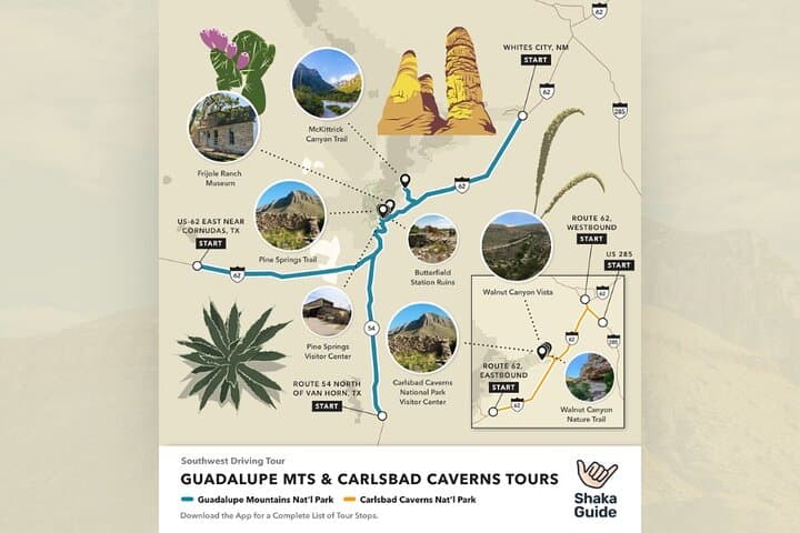
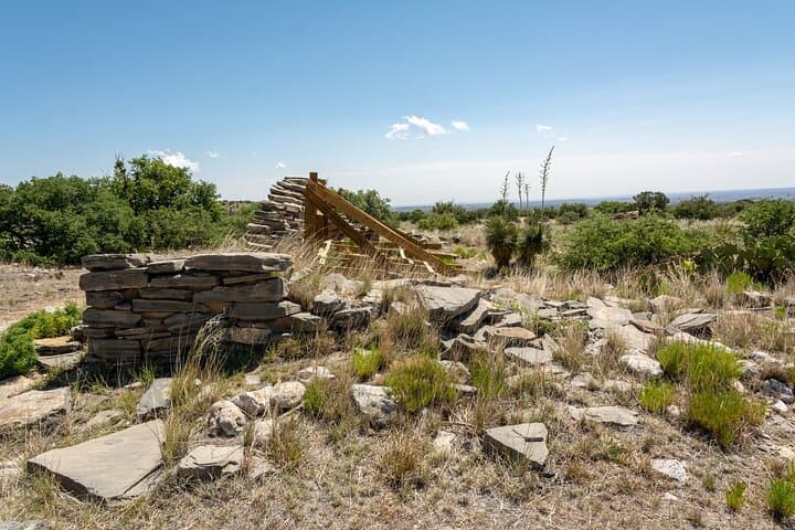
Geologically this is Permian reef country—ancient sea life fossilized into the Guadalupe Mountains’ ramparts. Human history presses here too: ranching homesteads like Frijole Ranch and remnants of overland mail stations mark routes of early travelers. Cultural ties run across state lines into New Mexico and to Native American uses of springs and mountain passes. In autumn, McKittrick Canyon’s maples add an unexpected wash of color.
Practically, this self‑guided audio tour is a driveable framework—downloaded to the Shaka Guide app, it plays automatically as you move between stops. Use Pine Springs as your launching point for hard hikes (Guadalupe Peak is 8.4 miles round trip with ~3,000 ft gain) or choose shorter options like Devil’s Hall (~4 miles) and Pratt Cabin (~4.8 miles). Carry extra water—desert daylight and elevation can spike exertion—and allow four to six hours to follow the suggested stops at a relaxed pace.
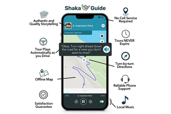
Expect limited cell service, desert winds, and quiet backcountry. The app gives turn‑by‑turn prompts and offline maps; combine that with paper maps at the visitor center, leave no trace, and plan your timing around daylight and weather for the best experience.
moderate.
4–6 hours.
Be comfortable with sustained walking and some steep sections; summit options require good cardiovascular fitness and endurance.
No—redeem and download the tour in the Shaka Guide app on Wi‑Fi before you arrive; GPS‑activated narration and offline maps run without cell data.
Yes—pay park fees at the visitor center or self‑service stations; the audio tour notes the visitor center stop where fees are collected.
Yes—the tour includes directions to Pine Springs trailhead; plan for an 8.4‑mile round trip with about 3,000 ft elevation gain and allow a full day.
Pets are restricted in developed areas and most trails; service animals are allowed—check current park regulations before bringing pets.
The Guadalupe range preserves Permian reef limestone and was traversed by mail and ranching routes; Frijole Ranch reflects 19th‑century settlement history.
The park protects fragile desert springs and fossil reef structures; stay on trails, pack out waste, and avoid collecting fossils to preserve the landscape.
Shaka Guide Apps operates guided outdoor trips and adventures with an emphasis on safety, stewardship, and memorable experiences.
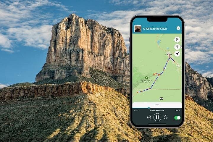
You pull off US‑62 into a pullout and a wind‑scoured view opens: jagged limestone ridgelines rise above scrub and piñon, El Capitan standing like a weathered guardian. Headphones on, the audio guide cues up—stories, directions, and geology timed to your GPS. The road becomes a sequence of staged moments: picnic overlooks with panoramas, a small visitor center with exhibits, and trailheads where singletrack threads into pinyon‑oak forest.
You pull off US‑62 into a pullout and a wind‑scoured view opens: jagged limestone ridgelines rise above scrub and piñon, El Capitan standing like a weathered guardian. Headphones on, the audio guide cues up—stories, directions, and geology timed to your GPS. The road becomes a sequence of staged moments: picnic overlooks with panoramas, a small visitor center with exhibits, and trailheads where singletrack threads into pinyon‑oak forest.
Geologically this is Permian reef country—ancient sea life fossilized into the Guadalupe Mountains’ ramparts. Human history presses here too: ranching homesteads like Frijole Ranch and remnants of overland mail stations mark routes of early travelers. Cultural ties run across state lines into New Mexico and to Native American uses of springs and mountain passes. In autumn, McKittrick Canyon’s maples add an unexpected wash of color.
Practically, this self‑guided audio tour is a driveable framework—downloaded to the Shaka Guide app, it plays automatically as you move between stops. Use Pine Springs as your launching point for hard hikes (Guadalupe Peak is 8.4 miles round trip with ~3,000 ft gain) or choose shorter options like Devil’s Hall (~4 miles) and Pratt Cabin (~4.8 miles). Carry extra water—desert daylight and elevation can spike exertion—and allow four to six hours to follow the suggested stops at a relaxed pace.
Expect limited cell service, desert winds, and quiet backcountry. The app gives turn‑by‑turn prompts and offline maps; combine that with paper maps at the visitor center, leave no trace, and plan your timing around daylight and weather for the best experience.