THE ADVENTURE COLLECTIVE® · Independent discovery and booking for outdoor travel

Drive the Catalina Highway from Tucson to Mount Lemmon with a location-triggered audio guide that explains the region’s history, geology and viewpoints. Download the tour, follow the narration at your own pace, and stop for short hikes, overlooks and alpine vistas.
Drive the Catalina Highway from Tucson to Mount Lemmon with a location-triggered audio guide that explains the region’s history, geology and viewpoints. Download the tour, follow the narration at your own pace, and stop for short hikes, overlooks and alpine vistas.
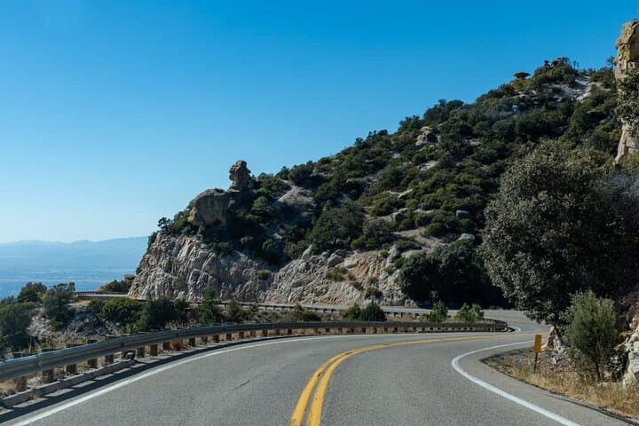
You climb out of Tucson’s warm desert into a changing world: saguaros give way to ocotillo, then chaparral, and finally stands of tall pines as the Catalina Highway climbs roughly 6,000 feet to Mount Lemmon’s summit.
Verified experiences and guided adventures in the surrounding area.
Operated by GuideAlong (GyPSy Guide) · Mount Lemmon, Arizona
You climb out of Tucson’s warm desert into a changing world: saguaros give way to ocotillo, then chaparral, and finally stands of tall pines as the Catalina Highway climbs roughly 6,000 feet to Mount Lemmon’s summit.
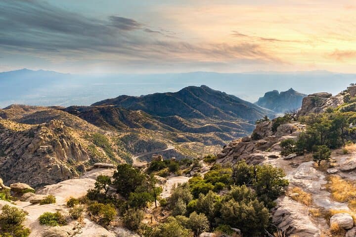
This self-guided audio drive maps that vertical journey, pausing at pullouts with broad desert views, canyon mouths, and high-elevation meadows. Along the route the narration explains local history — from Tohono O'odham connections to the land to the road’s construction in the 1930s — and points to the geology that creates these “sky islands,” isolated mountain habitats rising above the Sonoran Desert.
Expect varied stops: Molino Canyon overlooks, Thimble Peak viewpoints, alpine lakes and the southernmost ski area in the U.S., plus a mountaintop observatory that caps the route. Wildlife is discreet but present; raptors wheel over ridgelines while mule deer move in the dusk.
Practically, the tour is delivered through the GuideAlong app and uses your phone’s GPS to play location-based stories automatically — download the tour over Wi‑Fi before you go. Plan 3–4 hours for a relaxed out-and-back with short hikes; allow more time for photo stops or seasonal attractions like waterfalls after monsoon rains. Bring water, layered clothing for rapid temperature shifts, and a reliable car charger. Roads are paved but narrow in places; use pullouts for photos and watch for wildlife, cyclists and changing weather as you gain altitude. The combination of rich narration and flexible pacing makes this an accessible way to experience Mount Lemmon’s dramatic transition from desert to alpine forest.
easy.
3–4 hours.
Suitable for all fitness levels — driving is the primary activity; short, moderate hikes are optional for those who want to explore on foot.
No — download the GuideAlong app and the Mount Lemmon audio tour over Wi‑Fi before you go; the narration plays via your phone’s GPS offline.
Allocate 3–4 hours for a relaxed one-way drive with several stops; extend time if you plan hikes, picnics, or stargazing.
Catalina Highway is paved and suitable for most vehicles, but expect narrow stretches and steep grades; drive cautiously and use pullouts to stop.
Yes — the audio tour points out these stops; check operating hours for the observatory and seasonal access for the ski area before you go.
The Catalina Mountains are part of the Sky Islands region; Tohono O'odham and earlier residents used these uplands for seasonal resources long before the highway was built in the 1930s.
The Sky Islands host fragile montane ecosystems — stay on roads and trails, pack out trash, and avoid disturbing wildlife to protect rare habitats.
GuideAlong (GyPSy Guide) operates guided outdoor trips and adventures with an emphasis on safety, stewardship, and memorable experiences.

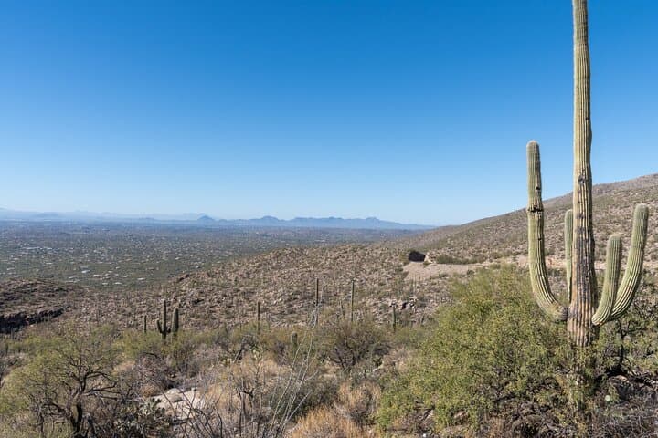
You climb out of Tucson’s warm desert into a changing world: saguaros give way to ocotillo, then chaparral, and finally stands of tall pines as the Catalina Highway climbs roughly 6,000 feet to Mount Lemmon’s summit.
You climb out of Tucson’s warm desert into a changing world: saguaros give way to ocotillo, then chaparral, and finally stands of tall pines as the Catalina Highway climbs roughly 6,000 feet to Mount Lemmon’s summit.
This self-guided audio drive maps that vertical journey, pausing at pullouts with broad desert views, canyon mouths, and high-elevation meadows. Along the route the narration explains local history — from Tohono O'odham connections to the land to the road’s construction in the 1930s — and points to the geology that creates these “sky islands,” isolated mountain habitats rising above the Sonoran Desert.
Expect varied stops: Molino Canyon overlooks, Thimble Peak viewpoints, alpine lakes and the southernmost ski area in the U.S., plus a mountaintop observatory that caps the route. Wildlife is discreet but present; raptors wheel over ridgelines while mule deer move in the dusk.
Practically, the tour is delivered through the GuideAlong app and uses your phone’s GPS to play location-based stories automatically — download the tour over Wi‑Fi before you go. Plan 3–4 hours for a relaxed out-and-back with short hikes; allow more time for photo stops or seasonal attractions like waterfalls after monsoon rains. Bring water, layered clothing for rapid temperature shifts, and a reliable car charger. Roads are paved but narrow in places; use pullouts for photos and watch for wildlife, cyclists and changing weather as you gain altitude. The combination of rich narration and flexible pacing makes this an accessible way to experience Mount Lemmon’s dramatic transition from desert to alpine forest.