THE ADVENTURE COLLECTIVE® · Independent discovery and booking for outdoor travel

Drive the Trans‑Canada with an offline audio guide that narrates prairie geology, local history and roadside curiosities between Moose Jaw and the Alberta border. Flexible and family-friendly, the tour runs automatically as you drive and lets you stop wherever you want.
Drive the Trans‑Canada with an offline audio guide that narrates prairie geology, local history and roadside curiosities between Moose Jaw and the Alberta border. Flexible and family-friendly, the tour runs automatically as you drive and lets you stop wherever you want.
Pull onto the Trans‑Canada and let the prairie open up—low horizons, wind farms turning like slow metronomes, and the highway pulling you through towns that grew around the railroad. The car becomes a small theater: your smartphone supplies a raconteur, cueing stories as mile markers pass and inviting detours where the road narrows and the land gets older.
Verified experiences and guided adventures in the surrounding area.
Operated by Tripvia Tours · Moose Jaw, Saskatchewan
Pull onto the Trans‑Canada and let the prairie open up—low horizons, wind farms turning like slow metronomes, and the highway pulling you through towns that grew around the railroad. The car becomes a small theater: your smartphone supplies a raconteur, cueing stories as mile markers pass and inviting detours where the road narrows and the land gets older.
This route tracks landscapes carved by an ancient inland sea and later shaped by glacial melt and wind. You’ll hear about the Big Muddy Badlands’ eroded coulees, the Cypress Hills’ lonely rise (the highest ground for miles), and cultural flashes—from the Northwest Mounted Police and Red Coat Trail to Saskatchewan icons like Tommy Douglas and the T‑Rex discoveries of Eastend. Small prairie towns and roadside oddities—windmills, grain elevators, and community murals—tell a quieter history of settlement, agriculture, and adaptation.
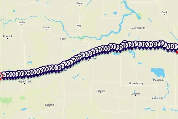
Practically: the tour runs about 3–4 hours of commentary and covers roughly 250–300 km depending on your start point. Download the audio over Wi‑Fi before you go; the guide works offline and uses GPS to trigger segments, so no data is consumed while driving. Start anywhere along the route and stop as often as you like—museums, lookouts, and short hikes are sprinkled throughout. Services can be sparse between towns—fill the tank, carry water, and plan restroom breaks. Wildlife is most active at dawn and dusk; keep speeds sensible on rural stretches. The experience is low‑impact, accessible, and especially good for travelers who want flexible pacing and regional context without a scheduled shuttle or guide.
easy.
3–4 hours.
Suitable for all fitness levels since activity is seated driving with optional short walks at stops
No—download the audio and map over Wi‑Fi before you leave; GPS triggers play commentary offline during the drive.
Yes—the tour is designed to start anywhere between Moose Jaw and the Alberta border and plays the same content in either direction.
Yes—commentary includes trivia questions and family‑friendly stories; stops vary in length so you can pace the day around kids.
Many roadside pullouts and some museums are accessible, but access varies—check specific sites (e.g., T‑Rex Discovery Centre) before visiting.
This corridor follows historic trails used by Indigenous peoples, the North-West Mounted Police and early settlers; fossil finds and badland geology document a much older inland sea.
Prairie grasslands and saline lakes are ecologically fragile—stay on roads and designated trails, respect bird nesting sites, and pack out all waste.
Tripvia Tours operates guided outdoor trips and adventures with an emphasis on safety, stewardship, and memorable experiences.
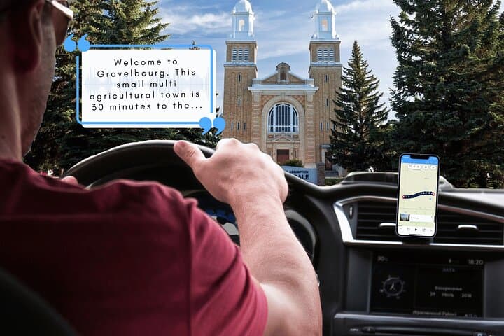


Pull onto the Trans‑Canada and let the prairie open up—low horizons, wind farms turning like slow metronomes, and the highway pulling you through towns that grew around the railroad. The car becomes a small theater: your smartphone supplies a raconteur, cueing stories as mile markers pass and inviting detours where the road narrows and the land gets older.
Pull onto the Trans‑Canada and let the prairie open up—low horizons, wind farms turning like slow metronomes, and the highway pulling you through towns that grew around the railroad. The car becomes a small theater: your smartphone supplies a raconteur, cueing stories as mile markers pass and inviting detours where the road narrows and the land gets older.
This route tracks landscapes carved by an ancient inland sea and later shaped by glacial melt and wind. You’ll hear about the Big Muddy Badlands’ eroded coulees, the Cypress Hills’ lonely rise (the highest ground for miles), and cultural flashes—from the Northwest Mounted Police and Red Coat Trail to Saskatchewan icons like Tommy Douglas and the T‑Rex discoveries of Eastend. Small prairie towns and roadside oddities—windmills, grain elevators, and community murals—tell a quieter history of settlement, agriculture, and adaptation.
Practically: the tour runs about 3–4 hours of commentary and covers roughly 250–300 km depending on your start point. Download the audio over Wi‑Fi before you go; the guide works offline and uses GPS to trigger segments, so no data is consumed while driving. Start anywhere along the route and stop as often as you like—museums, lookouts, and short hikes are sprinkled throughout. Services can be sparse between towns—fill the tank, carry water, and plan restroom breaks. Wildlife is most active at dawn and dusk; keep speeds sensible on rural stretches. The experience is low‑impact, accessible, and especially good for travelers who want flexible pacing and regional context without a scheduled shuttle or guide.