THE ADVENTURE COLLECTIVE® · Independent discovery and booking for outdoor travel

Short, steep and panoramic, the Doe Mountain private hike telegraphs Sedona’s most famous rock formations from a single mesa-top viewpoint. This concise guide explains what to expect, how to prepare, and why timing and footing matter for the best photos and safest summit.
Short, steep and panoramic, the Doe Mountain private hike telegraphs Sedona’s most famous rock formations from a single mesa-top viewpoint. This concise guide explains what to expect, how to prepare, and why timing and footing matter for the best photos and safest summit.
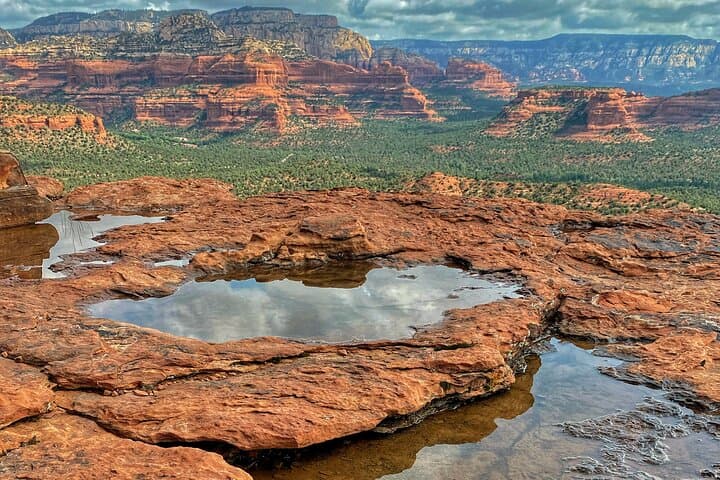
You climb out of the scrub and the mesa rises like a flat-top island against the wide Arizona sky. The switchbacks bite quickly, then the trail eases and the plateau opens; from the summit of Doe Mountain every red fin and butte reads clearly across the basin. Wind presses at the rim, and the scattered pinyon and juniper lean into the view as you move toward wide photographic frames of Cathedral Rock, Bell Rock and distant Wilson Mountain.
Verified experiences and guided adventures in the surrounding area.
Operated by Trail Lovers Excursions · Sedona, Arizona
You climb out of the scrub and the mesa rises like a flat-top island against the wide Arizona sky. The switchbacks bite quickly, then the trail eases and the plateau opens; from the summit of Doe Mountain every red fin and butte reads clearly across the basin. Wind presses at the rim, and the scattered pinyon and juniper lean into the view as you move toward wide photographic frames of Cathedral Rock, Bell Rock and distant Wilson Mountain.
Doe Mountain sits on Permian-age red sandstone that lifts abruptly from the Upper Sonoran Desert floor, carved by faulting and wind. For millennia the area has been traversed by Indigenous peoples — the Sinagua left pottery and trails — and later by ranchers and early travelers who used these landmarks for navigation. Today the mesa’s flat top provides a compact sky island with views across Secret Mountain, Munds Mountain and Sycamore Canyon Wilderness areas.
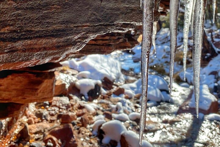
Practically, the hike is short and steep: expect a firm ascent to the plateau with loose sections and exposed edges at the summit. Guides on private outings supply water, snacks, and gear and can tailor pacing for photographers or families. Start early to avoid midday heat and monsoon storms in summer; in cooler months bring warm layers and traction for icy patches.
Plan for 2–3 hours round-trip, carry at least 1–2 liters of water per person, and respect Red Rock Pass parking rules. Stay on the marked trail to protect fragile soils and vegetation; the payoff at the top is a concentrated, panoramic primer on everything that makes Sedona’s red rock country distinctive.
moderate.
2–3 hours.
Good for hikers with a moderate base level of fitness; involves a steady, sometimes steep climb and short sections of loose rock.
The guided outing is about 2–3 hours total with roughly a 0.7–1.5 mile steep ascent onto the mesa; it’s short but moderately strenuous due to the sustained uphill sections.
Yes — private guides supply bottled water, packaged trail snacks, and basic hiking gear; many tours include transport options and extras like sunscreen or cooling spray in warm weather.
Parking in the Red Rock area typically requires a Red Rock Pass; many guided trips cover the fee for you, but confirm at booking.
Families with school-age children can manage the route, but anyone with a fear of heights or vertigo should avoid summit edge sections; guides can adapt pacing and viewing distance.
The Sedona region bears traces of Sinagua culture and later ranching; landmarks like Doe Mountain served as navigation points for Native peoples and early settlers.
Stay on marked trails to protect fragile cryptobiotic soils and desert vegetation; the Red Rock Pass system funds trail maintenance and conservation efforts.
Trail Lovers Excursions operates guided outdoor trips and adventures with an emphasis on safety, stewardship, and memorable experiences.
You climb out of the scrub and the mesa rises like a flat-top island against the wide Arizona sky. The switchbacks bite quickly, then the trail eases and the plateau opens; from the summit of Doe Mountain every red fin and butte reads clearly across the basin. Wind presses at the rim, and the scattered pinyon and juniper lean into the view as you move toward wide photographic frames of Cathedral Rock, Bell Rock and distant Wilson Mountain.
You climb out of the scrub and the mesa rises like a flat-top island against the wide Arizona sky. The switchbacks bite quickly, then the trail eases and the plateau opens; from the summit of Doe Mountain every red fin and butte reads clearly across the basin. Wind presses at the rim, and the scattered pinyon and juniper lean into the view as you move toward wide photographic frames of Cathedral Rock, Bell Rock and distant Wilson Mountain.
Doe Mountain sits on Permian-age red sandstone that lifts abruptly from the Upper Sonoran Desert floor, carved by faulting and wind. For millennia the area has been traversed by Indigenous peoples — the Sinagua left pottery and trails — and later by ranchers and early travelers who used these landmarks for navigation. Today the mesa’s flat top provides a compact sky island with views across Secret Mountain, Munds Mountain and Sycamore Canyon Wilderness areas.
Practically, the hike is short and steep: expect a firm ascent to the plateau with loose sections and exposed edges at the summit. Guides on private outings supply water, snacks, and gear and can tailor pacing for photographers or families. Start early to avoid midday heat and monsoon storms in summer; in cooler months bring warm layers and traction for icy patches.
Plan for 2–3 hours round-trip, carry at least 1–2 liters of water per person, and respect Red Rock Pass parking rules. Stay on the marked trail to protect fragile soils and vegetation; the payoff at the top is a concentrated, panoramic primer on everything that makes Sedona’s red rock country distinctive.