THE ADVENTURE COLLECTIVE® · Independent discovery and booking for outdoor travel

Drive the Trans‑Canada between Kamloops and Revelstoke with a GPS‑triggered audio guide that highlights geology, railway history and wildlife. Download once, follow the route and stop where the road invites you for viewpoints, parks and small BC towns.
Drive the Trans‑Canada between Kamloops and Revelstoke with a GPS‑triggered audio guide that highlights geology, railway history and wildlife. Download once, follow the route and stop where the road invites you for viewpoints, parks and small BC towns.
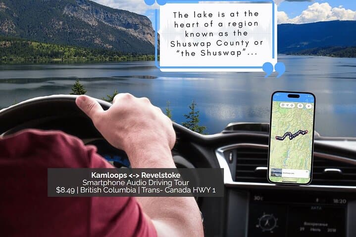
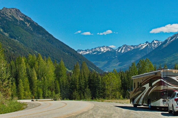
You pull onto the Trans‑Canada Highway and the mountains close ranks: cedar slopes, glinting river corridors and blue pockets of Shuswap Lake rushing past the passenger window. The app speaks up as the car flows through Eagle Pass and Larch Hills, cueing stories about the Last Spike, Death Rapids and the railway engineers who shaped this corridor. The narration maps places to stop while the road keeps moving.
Verified experiences and guided adventures in the surrounding area.
Operated by Tripvia Tours · Kamloops, British Columbia
You pull onto the Trans‑Canada Highway and the mountains close ranks: cedar slopes, glinting river corridors and blue pockets of Shuswap Lake rushing past the passenger window. The app speaks up as the car flows through Eagle Pass and Larch Hills, cueing stories about the Last Spike, Death Rapids and the railway engineers who shaped this corridor. The narration maps places to stop while the road keeps moving.
This drive traces tectonic and human history—rugged bedrock folded by ancient glaciation, volcanic knolls like Mount Begbie, and Indigenous and settler routes that later became the CPR. Small communities—Chase, Squilax, Sicamous—and sites such as Three Valley Gap and Mount Revelstoke National Park each carry local stories about trade, rail construction and conservation efforts.
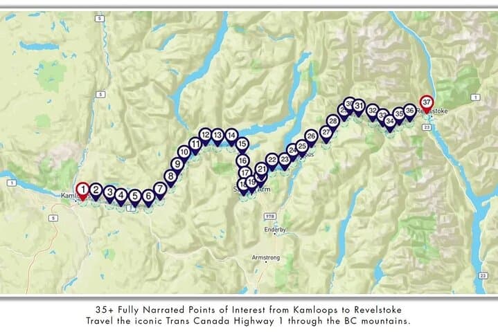
Expect an audio program that triggers by GPS with more than 30 commentary points, trivia questions and no data usage once downloaded. The format is private, flexible and accessible: you can pause, detour to wildlife-viewing pullouts or linger at viewpoints.
Practical guidance: test the app and audio connection before you leave, top up fuel in Kamloops or Sicamous, and allow extra time for photo stops and park entrances. Watch for variable weather—mountain passes can change quickly—and for wildlife at dawn and dusk. Bring a reliable phone mount, car charger, printed route notes, and plan overnight stays in Kamloops, Salmon Arm or Revelstoke if you want to explore beyond the highway. This is a low‑intensity, high‑reward way to read the landscape while keeping the road as your timetable.
easy.
2–3 hours.
Minimal physical fitness required; activity is seated driving with optional short walks at stops
No—once downloaded the tour uses GPS on the device and does not require data to play commentary.
Yes, one booking covers a single vehicle and audio can play through the car stereo for all occupants.
Absolutely—this self‑guided tour is designed for flexible stops at viewpoints, parks and towns along the highway.
Yes; the Trans‑Canada is paved and regularly maintained, but drivers should be comfortable with mountain driving and potential weather changes.
The corridor follows Indigenous travel routes later used by the Canadian Pacific Railway; the Last Spike site and railway heritage shaped settlement and industry here.
Sections of the drive border provincial parks and ecological reserves—respect trail closures, pack out waste, and use designated pullouts to reduce roadside impact.
Tripvia Tours operates guided outdoor trips and adventures with an emphasis on safety, stewardship, and memorable experiences.
You pull onto the Trans‑Canada Highway and the mountains close ranks: cedar slopes, glinting river corridors and blue pockets of Shuswap Lake rushing past the passenger window. The app speaks up as the car flows through Eagle Pass and Larch Hills, cueing stories about the Last Spike, Death Rapids and the railway engineers who shaped this corridor. The narration maps places to stop while the road keeps moving.
You pull onto the Trans‑Canada Highway and the mountains close ranks: cedar slopes, glinting river corridors and blue pockets of Shuswap Lake rushing past the passenger window. The app speaks up as the car flows through Eagle Pass and Larch Hills, cueing stories about the Last Spike, Death Rapids and the railway engineers who shaped this corridor. The narration maps places to stop while the road keeps moving.
This drive traces tectonic and human history—rugged bedrock folded by ancient glaciation, volcanic knolls like Mount Begbie, and Indigenous and settler routes that later became the CPR. Small communities—Chase, Squilax, Sicamous—and sites such as Three Valley Gap and Mount Revelstoke National Park each carry local stories about trade, rail construction and conservation efforts.
Expect an audio program that triggers by GPS with more than 30 commentary points, trivia questions and no data usage once downloaded. The format is private, flexible and accessible: you can pause, detour to wildlife-viewing pullouts or linger at viewpoints.
Practical guidance: test the app and audio connection before you leave, top up fuel in Kamloops or Sicamous, and allow extra time for photo stops and park entrances. Watch for variable weather—mountain passes can change quickly—and for wildlife at dawn and dusk. Bring a reliable phone mount, car charger, printed route notes, and plan overnight stays in Kamloops, Salmon Arm or Revelstoke if you want to explore beyond the highway. This is a low‑intensity, high‑reward way to read the landscape while keeping the road as your timetable.