THE ADVENTURE COLLECTIVE® · Independent discovery and booking for outdoor travel

A long, high-alpine day hike from Sofia to Malyovitsa explores seven mineral lakes and the dramatic Scary Lake at 2,451 m. Expect 7–8 hours on trail, steep sections, and vivid glacial basins shaped by granite and history.
A long, high-alpine day hike from Sofia to Malyovitsa explores seven mineral lakes and the dramatic Scary Lake at 2,451 m. Expect 7–8 hours on trail, steep sections, and vivid glacial basins shaped by granite and history.
You step out of the minivan into thin, cool air; the pine scent sharpens and a craggy skyline over Malyovitsa makes a promise. Footsteps on the trail answer with stone and root — the mountain pushes you upward, the wind testing resolve as much as calf muscles.
Verified experiences and guided adventures in the surrounding area.
Operated by Bulgarian Fairy Tale · Malyovitsa, Sofia Province
You step out of the minivan into thin, cool air; the pine scent sharpens and a craggy skyline over Malyovitsa makes a promise. Footsteps on the trail answer with stone and root — the mountain pushes you upward, the wind testing resolve as much as calf muscles.
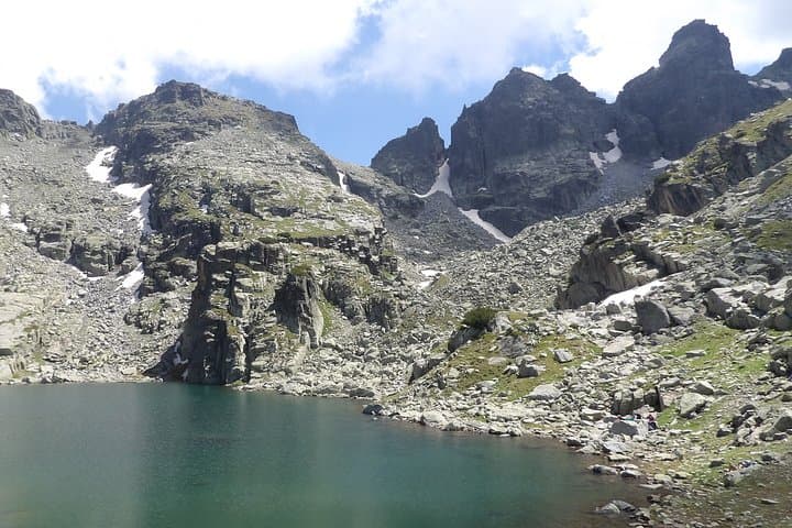
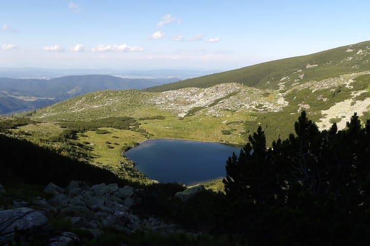
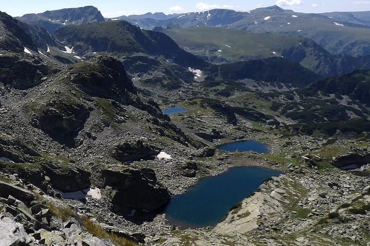
Rila is Bulgaria’s highest range and a slow geological workbench of granite and glacial basins. The route moves through subalpine meadows and moraine-carved bowls that hold pools known locally as the Mineral Lakes; one of these, the Scary Lake (Strashno ezero, ~2,451 m), sits under the buttresses of Kupenite and Priest’s Head and carries old legends told by shepherds and hut-keepers. The area has long been a crossroads for seasonal grazing and, more recently, mountain rescue and conservation efforts centered on preserving fragile alpine lakes.
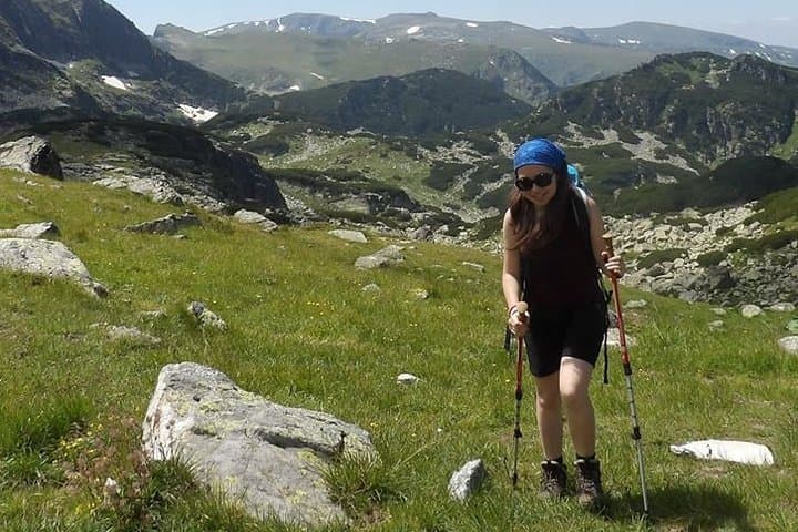
Expect steady uphill: the program outlines roughly 730 m of elevation change and 7–8 hours on trail, with a 2‑hour transfer each way from Sofia. Terrain alternates packed dirt, scree and short steep sections; boots with ankle support and trekking poles will matter on the descent. Plan for strong sun on exposed ridgelines, sudden weather swings, and an hour or more at Scary Lake to rest and take photos.
Practical notes: start early to avoid afternoon storms, carry 2–3 L of water, and leave no trace by packing out waste. The day delivers high alpine character, a compact dose of Rila’s geology and folklore, and views that make the steady climb feel earned.
challenging.
8–10 hours (including transfers).
Expect sustained uphill and 730 m of elevation gain; good cardiovascular fitness and hiking experience required.
The guided program lists about 7–8 hours of hiking with roughly 730 m of cumulative elevation gain; transfers to and from Sofia add about 4 hours total.
This is a demanding day with steep sections and high altitude—beginners should be in good shape or consider an easier route or overnight option.
You pass the Malyovitsa hut early in the day where you can rest or buy simple provisions, but carry snacks and lunch for the main alpine section.
Mountain weather changes rapidly: warm sun can switch to wind, rain or lightning within hours—check forecasts and plan to start early.
Rila has been a pastoral and spiritual landscape for centuries; mountain huts and shepherding routes evolved alongside wartime and conservation history.
Alpine lakes are fragile; stick to marked trails, avoid bathing in small tarns, and pack out all waste to protect water quality and vegetation.
Bulgarian Fairy Tale operates guided outdoor trips and adventures with an emphasis on safety, stewardship, and memorable experiences.
You step out of the minivan into thin, cool air; the pine scent sharpens and a craggy skyline over Malyovitsa makes a promise. Footsteps on the trail answer with stone and root — the mountain pushes you upward, the wind testing resolve as much as calf muscles.
You step out of the minivan into thin, cool air; the pine scent sharpens and a craggy skyline over Malyovitsa makes a promise. Footsteps on the trail answer with stone and root — the mountain pushes you upward, the wind testing resolve as much as calf muscles.
Rila is Bulgaria’s highest range and a slow geological workbench of granite and glacial basins. The route moves through subalpine meadows and moraine-carved bowls that hold pools known locally as the Mineral Lakes; one of these, the Scary Lake (Strashno ezero, ~2,451 m), sits under the buttresses of Kupenite and Priest’s Head and carries old legends told by shepherds and hut-keepers. The area has long been a crossroads for seasonal grazing and, more recently, mountain rescue and conservation efforts centered on preserving fragile alpine lakes.
Expect steady uphill: the program outlines roughly 730 m of elevation change and 7–8 hours on trail, with a 2‑hour transfer each way from Sofia. Terrain alternates packed dirt, scree and short steep sections; boots with ankle support and trekking poles will matter on the descent. Plan for strong sun on exposed ridgelines, sudden weather swings, and an hour or more at Scary Lake to rest and take photos.
Practical notes: start early to avoid afternoon storms, carry 2–3 L of water, and leave no trace by packing out waste. The day delivers high alpine character, a compact dose of Rila’s geology and folklore, and views that make the steady climb feel earned.