THE ADVENTURE COLLECTIVE® · Independent discovery and booking for outdoor travel

Straddling the highlands above Abha, the Sawda Mountains Trail is an 8 km, moderate hike up to about 3,000 m through ancient juniper forests. Expect steep, rocky walking, striking cloud inversions, and a route rich in local landscape history.
Straddling the highlands above Abha, the Sawda Mountains Trail is an 8 km, moderate hike up to about 3,000 m through ancient juniper forests. Expect steep, rocky walking, striking cloud inversions, and a route rich in local landscape history.
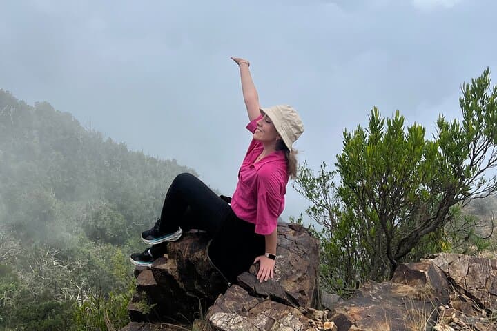
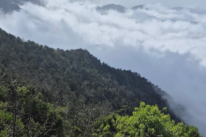
You step out of the air‑conditioned vehicle and the mountain pulls you upward — clouds sitting low like a restless sea beneath the ridge. The trail climbs through perennial juniper groves, the trees scraping the wind as if urging you onward, and opens to sweeping views from about 3,000 meters above sea level.
Verified experiences and guided adventures in the surrounding area.
Operated by Abha Trips · Abha, Asir
You step out of the air‑conditioned vehicle and the mountain pulls you upward — clouds sitting low like a restless sea beneath the ridge. The trail climbs through perennial juniper groves, the trees scraping the wind as if urging you onward, and opens to sweeping views from about 3,000 meters above sea level.
This route follows a path used for roughly 250 years, originally a local route between highland settlements. Geologically the Asir highlands are folded volcanic and sedimentary rock, carved by wind and seasonal runoff into steep faces and sheltered hollows where moisture allows juniper and grasses to persist. Locally the highlands are a cultural space — Bedouin and highland village traditions meet government conservation efforts around Al Soudah and nearby Abha.
Expect an 8 km out‑and‑back or loop option on mixed dirt and rocky trail with moderate sustained climbing; elevation and thinner air make sections feel harder than distance alone suggests. The route favors mid‑day breaks in shaded juniper pockets and early starts to avoid midday sun or clouds that can roll in quickly.
Practical notes: moderate fitness and good footwear are required; bring water (2–3 liters), snacks provided by the operator, and layered clothing for rapid temperature change. Mobile reception is intermittent; download maps and share your pickup point. Guided options typically include pickup from Abha and return by mid‑afternoon. The trail rewards steady pacing: watch your footing, respect local signage, and leave no trace — the junipers here are both fragile and slow growing.
moderate.
6 hours.
Be in good, regular aerobic shape — able to sustain steady uphill hiking for several hours and handle 3000 m altitude effects.
The advertised route is about 8 km with steady climbing to roughly 3,000 m and takes around 6 hours; it’s rated moderate — altitude makes it more strenuous than flat hikes of the same distance.
Closely fit beginners who train beforehand can complete it, but participants should have moderate fitness and be comfortable on uneven terrain.
Typical inclusions are pickup from Abha, an air‑conditioned vehicle, and snacks; confirm exact inclusions and baggage limits when booking.
No special permits are generally required for the trail itself, but organized tours provide pickup, local guidance, and improved safety at high elevation.
The trail follows a centuries‑old highland route used by local communities; the juniper groves have cultural importance for local village livelihoods and traditional crafts.
The highland junipers regenerate slowly; stick to established paths, avoid collecting wood, and pack out all trash to protect fragile soils and vegetation.
Abha Trips operates guided outdoor trips and adventures with an emphasis on safety, stewardship, and memorable experiences.


You step out of the air‑conditioned vehicle and the mountain pulls you upward — clouds sitting low like a restless sea beneath the ridge. The trail climbs through perennial juniper groves, the trees scraping the wind as if urging you onward, and opens to sweeping views from about 3,000 meters above sea level.
You step out of the air‑conditioned vehicle and the mountain pulls you upward — clouds sitting low like a restless sea beneath the ridge. The trail climbs through perennial juniper groves, the trees scraping the wind as if urging you onward, and opens to sweeping views from about 3,000 meters above sea level.
This route follows a path used for roughly 250 years, originally a local route between highland settlements. Geologically the Asir highlands are folded volcanic and sedimentary rock, carved by wind and seasonal runoff into steep faces and sheltered hollows where moisture allows juniper and grasses to persist. Locally the highlands are a cultural space — Bedouin and highland village traditions meet government conservation efforts around Al Soudah and nearby Abha.
Expect an 8 km out‑and‑back or loop option on mixed dirt and rocky trail with moderate sustained climbing; elevation and thinner air make sections feel harder than distance alone suggests. The route favors mid‑day breaks in shaded juniper pockets and early starts to avoid midday sun or clouds that can roll in quickly.
Practical notes: moderate fitness and good footwear are required; bring water (2–3 liters), snacks provided by the operator, and layered clothing for rapid temperature change. Mobile reception is intermittent; download maps and share your pickup point. Guided options typically include pickup from Abha and return by mid‑afternoon. The trail rewards steady pacing: watch your footing, respect local signage, and leave no trace — the junipers here are both fragile and slow growing.