THE ADVENTURE COLLECTIVE® · Independent discovery and booking for outdoor travel

Walk Muong Hoa Valley from Cat Cat to Ta Van across rice terraces and village trails, returning to a mountain‑view hotel each night. This two‑day trek blends moderate hiking with up‑close cultural encounters among H’mong and Giay communities.
Walk Muong Hoa Valley from Cat Cat to Ta Van across rice terraces and village trails, returning to a mountain‑view hotel each night. This two‑day trek blends moderate hiking with up‑close cultural encounters among H’mong and Giay communities.
Morning mist lifts off Muong Hoa Valley as the bus drops you on Sapa’s narrow main street; rice terraces step down the slopes like carved shelves, and a stream dares you to follow its route toward remote villages. Over two days you trace the valley from Cat Cat’s waterfall to Ta Van bridge, moving through H’mong and Giay communities and sleeping in a three‑star hotel that opens onto mountain views.
Verified experiences and guided adventures in the surrounding area.
Operated by Vietnam Tours · Sapa, Lao Cai Province
Morning mist lifts off Muong Hoa Valley as the bus drops you on Sapa’s narrow main street; rice terraces step down the slopes like carved shelves, and a stream dares you to follow its route toward remote villages. Over two days you trace the valley from Cat Cat’s waterfall to Ta Van bridge, moving through H’mong and Giay communities and sleeping in a three‑star hotel that opens onto mountain views.
The Hoang Lien Son range, a young, rugged spur of limestone and metamorphic rock, frames much of the trek; Fansipan — Vietnam’s highest peak — looms beyond ridgelines and fuels local weather that can flip from bright sun to wind‑driven fog. The valley has long been home to Black H’mong, Zay (Dzay) and Giay minorities whose terraced rice systems and stilt houses reflect centuries of adaptation to steep ground and seasonal monsoon cycles.
Expect dirt trails, stone steps cut into terraces, and farm tracks that can be slick after rain. Short walks (2–3 km) introduce village life; the longer Y Linh Ho–Lao Chai–Ta Van leg covers roughly 9 km and about 200–300 m cumulative ascent spread over uneven terrain.
Practical tips: start early to avoid midday crowds and cloud cover, carry layered rain protection, and also bring cash for small purchases in villages. Hydrate on the bus and at stops; sturdy walking shoes with grip are recommended. The overnight hotel gives hot showers and luggage storage, letting you travel light on the second‑day trek. Weather is changeable—plan clothing and expectations accordingly.
moderate.
2 days (approx. 48 hours).
Suitable for moderately fit travelers who can manage uneven terrain, repeated short climbs, and several hours of hiking across two days.
The first day includes a short 2–3 km walk; the second day’s main trek is about 9 km with uneven terrain and modest elevation change—suitable for most moderately fit travelers.
This itinerary includes one night in a three‑star hotel with hot showers and luggage storage, not a homestay.
A local English‑speaking guide is provided; while paths are used by villagers, the guide helps navigate village tracks and cultural interactions.
Bring Vietnamese dong for small purchases; basic Vietnamese or English will be enough in tourist areas, but local ethnic languages are spoken in villages.
Cat Cat contains the remains of a French hydraulic power project and farming patterns in Muong Hoa reflect centuries of terrace agriculture by local ethnic groups.
Terraces are maintained by local communities; stick to trails, avoid litter, and buy locally made goods to support village economies and reduce environmental impact.
Vietnam Tours operates guided outdoor trips and adventures with an emphasis on safety, stewardship, and memorable experiences.


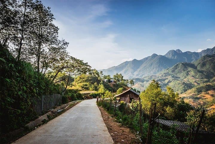
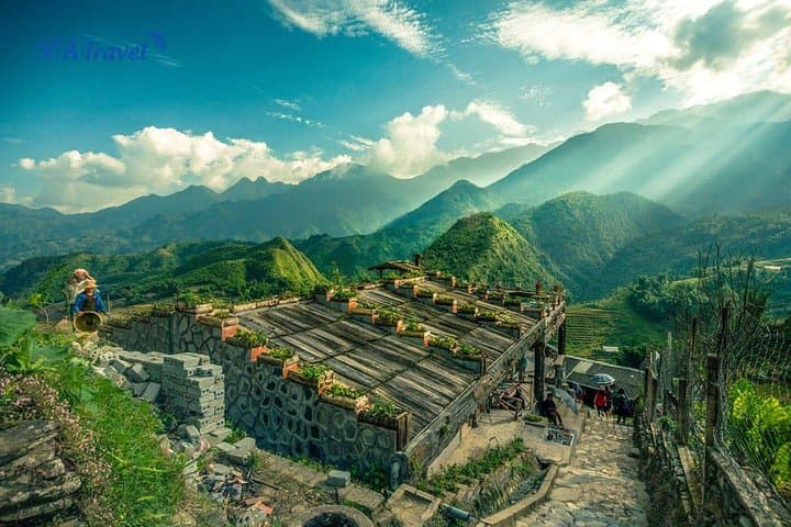
Morning mist lifts off Muong Hoa Valley as the bus drops you on Sapa’s narrow main street; rice terraces step down the slopes like carved shelves, and a stream dares you to follow its route toward remote villages. Over two days you trace the valley from Cat Cat’s waterfall to Ta Van bridge, moving through H’mong and Giay communities and sleeping in a three‑star hotel that opens onto mountain views.
Morning mist lifts off Muong Hoa Valley as the bus drops you on Sapa’s narrow main street; rice terraces step down the slopes like carved shelves, and a stream dares you to follow its route toward remote villages. Over two days you trace the valley from Cat Cat’s waterfall to Ta Van bridge, moving through H’mong and Giay communities and sleeping in a three‑star hotel that opens onto mountain views.
The Hoang Lien Son range, a young, rugged spur of limestone and metamorphic rock, frames much of the trek; Fansipan — Vietnam’s highest peak — looms beyond ridgelines and fuels local weather that can flip from bright sun to wind‑driven fog. The valley has long been home to Black H’mong, Zay (Dzay) and Giay minorities whose terraced rice systems and stilt houses reflect centuries of adaptation to steep ground and seasonal monsoon cycles.
Expect dirt trails, stone steps cut into terraces, and farm tracks that can be slick after rain. Short walks (2–3 km) introduce village life; the longer Y Linh Ho–Lao Chai–Ta Van leg covers roughly 9 km and about 200–300 m cumulative ascent spread over uneven terrain.
Practical tips: start early to avoid midday crowds and cloud cover, carry layered rain protection, and also bring cash for small purchases in villages. Hydrate on the bus and at stops; sturdy walking shoes with grip are recommended. The overnight hotel gives hot showers and luggage storage, letting you travel light on the second‑day trek. Weather is changeable—plan clothing and expectations accordingly.