THE ADVENTURE COLLECTIVE® · Independent discovery and booking for outdoor travel

Follow carved footpaths through sweeping rice terraces and rural H’Mong villages in the Muong Hoa valley. This full-day trek mixes dramatic mountain scenery with living cultural landscapes and practical, accessible hiking.
Follow carved footpaths through sweeping rice terraces and rural H’Mong villages in the Muong Hoa valley. This full-day trek mixes dramatic mountain scenery with living cultural landscapes and practical, accessible hiking.
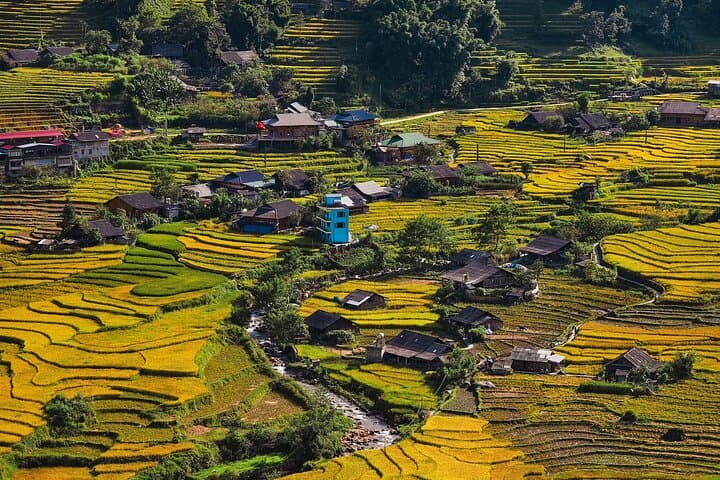
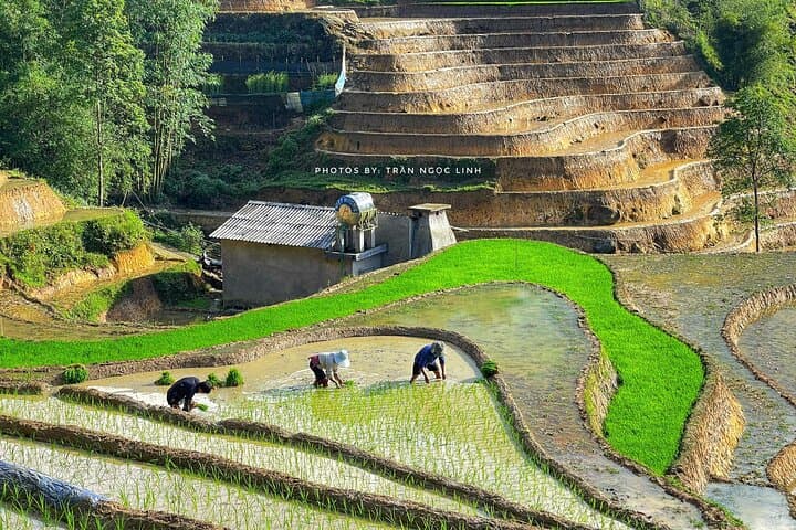
The morning air in Sapa bites with mountain cool; you step out of town onto a narrow path and the Muong Hoa valley opens like a living map—emerald tiers of rice slipping away toward a ribbon of stream. Your guide points the way: a stone bridge, a scattering of wooden houses, and terraces that curve with the slope as if the mountains themselves are breathing.
Verified experiences and guided adventures in the surrounding area.
Operated by Authenitc Travel DA NANG · Sapa, Lao Cai
The morning air in Sapa bites with mountain cool; you step out of town onto a narrow path and the Muong Hoa valley opens like a living map—emerald tiers of rice slipping away toward a ribbon of stream. Your guide points the way: a stone bridge, a scattering of wooden houses, and terraces that curve with the slope as if the mountains themselves are breathing.
This trek follows centuries-old cultivation on the lower flanks of the Hoang Lien Son range. The Black H’mong and Red Dao communities settled here generations ago, shaping terraces and trails while French colonial hikers later mapped the high ridgelines. Geologically, the area is carved from ancient metamorphic stone uplifted into steep, rain-shaped slopes; trails often switchback over soft loam and rocky steps.
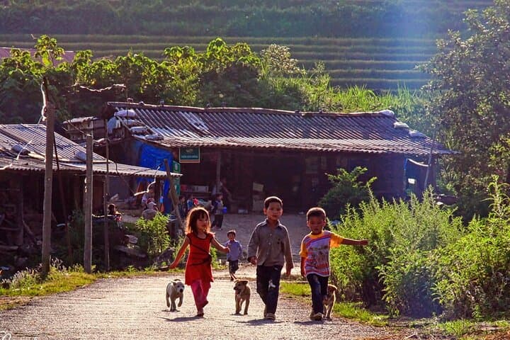
Culture shows in embroidered jackets, hand-stitched headwear, and the cadence of village life. Listen for the Muong Hoa stream daring you to cross and for local children calling from porches. Expect panoramic views of terraced plots, scattered bamboo groves, and Fansipan’s distant silhouette when visibility is clear.
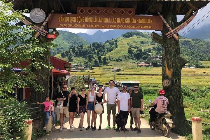
Practical guidance: the full loop from Sapa through Y Linh Ho, Lao Chai and Ta Van runs 4–8 hours depending on pace—mostly well-trodden dirt paths with short, steep sections. Wear broken-in hiking shoes, bring layers for rapidly changing weather, and carry water and basic snacks. Stay on marked trails to protect fragile terraces and respect village customs—ask before photographing people. Midday sun can be strong; start early to enjoy cooler light and softer shadows across the valley.
moderate.
5–7 hours.
Able to walk 8–12 km over uneven terrain with short steep sections; basic cardio and stable ankles helpful
The route is graded moderate: paths are well-worn but include uneven ground and some incline—suitable for beginners with a steady pace and basic fitness.
No formal permits are usually required, but visitors should ask permission before entering private compounds and follow local customs.
Yes; the itinerary typically includes a local lunch in Ta Van village featuring regional dishes and options for dietary restrictions if requested.
You can hike parts independently, but a local guide enhances cultural insight, navigation, and support on narrow or muddy sections.
Sapa grew as a hill station during French colonial times; the valley has long been inhabited by Black H’mong and Red Dao communities who shaped the terraced landscape.
Terraces are vulnerable to erosion and overuse—stay on paths, avoid trampling rice plots, and support local enterprises to ensure tourism benefits communities.
Authenitc Travel DA NANG operates guided outdoor trips and adventures with an emphasis on safety, stewardship, and memorable experiences.
The morning air in Sapa bites with mountain cool; you step out of town onto a narrow path and the Muong Hoa valley opens like a living map—emerald tiers of rice slipping away toward a ribbon of stream. Your guide points the way: a stone bridge, a scattering of wooden houses, and terraces that curve with the slope as if the mountains themselves are breathing.
The morning air in Sapa bites with mountain cool; you step out of town onto a narrow path and the Muong Hoa valley opens like a living map—emerald tiers of rice slipping away toward a ribbon of stream. Your guide points the way: a stone bridge, a scattering of wooden houses, and terraces that curve with the slope as if the mountains themselves are breathing.
This trek follows centuries-old cultivation on the lower flanks of the Hoang Lien Son range. The Black H’mong and Red Dao communities settled here generations ago, shaping terraces and trails while French colonial hikers later mapped the high ridgelines. Geologically, the area is carved from ancient metamorphic stone uplifted into steep, rain-shaped slopes; trails often switchback over soft loam and rocky steps.
Culture shows in embroidered jackets, hand-stitched headwear, and the cadence of village life. Listen for the Muong Hoa stream daring you to cross and for local children calling from porches. Expect panoramic views of terraced plots, scattered bamboo groves, and Fansipan’s distant silhouette when visibility is clear.
Practical guidance: the full loop from Sapa through Y Linh Ho, Lao Chai and Ta Van runs 4–8 hours depending on pace—mostly well-trodden dirt paths with short, steep sections. Wear broken-in hiking shoes, bring layers for rapidly changing weather, and carry water and basic snacks. Stay on marked trails to protect fragile terraces and respect village customs—ask before photographing people. Midday sun can be strong; start early to enjoy cooler light and softer shadows across the valley.