THE ADVENTURE COLLECTIVE® · Independent discovery and booking for outdoor travel

Walk through Sapa’s terraced rice fields with a local guide and visit Hmong, Giay and Red Dao villages. Expect 5–6 hours of mixed terrain, cultural insights, and expansive mountain views.
Walk through Sapa’s terraced rice fields with a local guide and visit Hmong, Giay and Red Dao villages. Expect 5–6 hours of mixed terrain, cultural insights, and expansive mountain views.
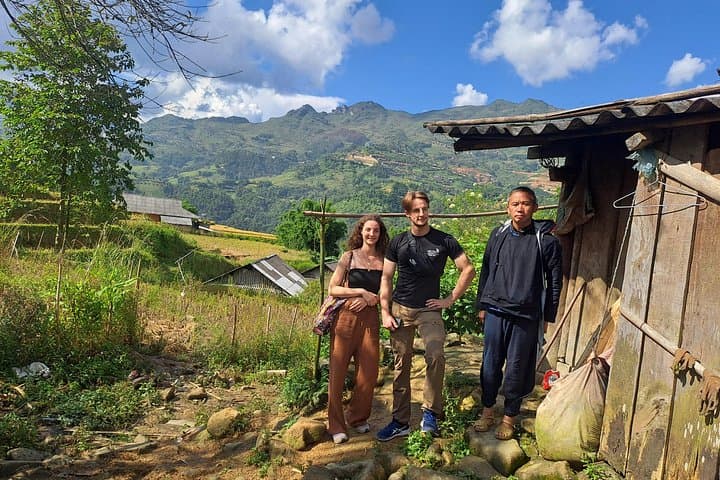
Thick mountain air and a map of terraces spread beneath you—this is Sapa before the morning mist burns off. A local guide meets you in town and leads the descent toward Cat Cat road, down to the Muong Hoa river, across a hanging bridge, then up through bamboo and along ridgelines where rice terraces step down like carved balconies.
Verified experiences and guided adventures in the surrounding area.
Operated by Sapa Local Guide · Sapa, Lao Cai
Thick mountain air and a map of terraces spread beneath you—this is Sapa before the morning mist burns off. A local guide meets you in town and leads the descent toward Cat Cat road, down to the Muong Hoa river, across a hanging bridge, then up through bamboo and along ridgelines where rice terraces step down like carved balconies.
The Hoang Lien range is recent in geological terms—uplifted limestone and metamorphic beds shaped by tectonic collision—yet its human story is older: Hmong, Giay and Red Dao communities have tended these slopes for generations, carving irrigation channels and building stilt houses adapted to steep gradients. Along the trail your guide will explain Hmong marriage rites, Red Dao embroidery, and rice cultivation rhythms that still set the local calendar.
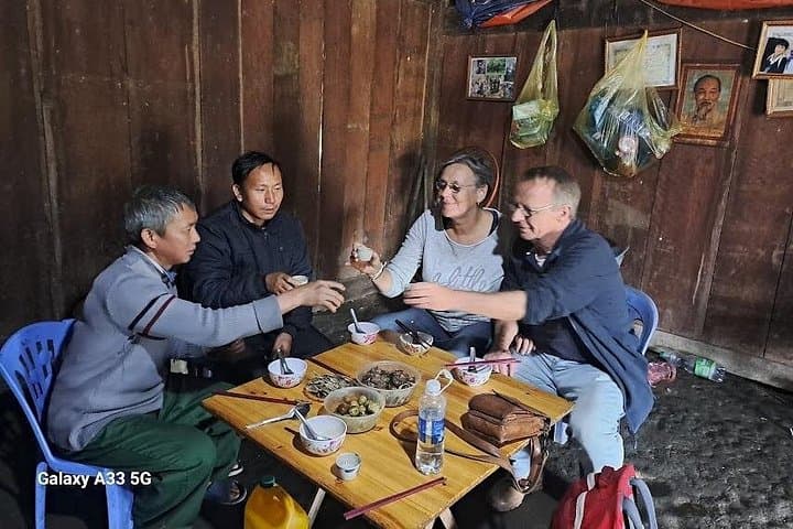
Culturally rich and visually direct, the walk visits Y Linh Ho, Lao Chai and Ta Van villages where small family-run restaurants serve lunch and exchanges are as important as views. Expect stepped paths, occasional muddy sections, bamboo groves, and panoramic valley openings toward the Fansipan massif.
Practicalities: the full outing runs about 5–6 hours and requires moderate fitness—steady footing and some short uphill stretches. Wear grippy footwear, pack a light rain shell and sun protection, and carry water; bottled water and lunch are usually included by the operator. Start mid-morning to take advantage of clearer afternoon views. Respect private yards, ask before photographing people, and consider bringing cash for small purchases from villagers.
moderate.
5–6 hours.
Comfortable walking fitness with ability to handle several hours on uneven, sometimes steep trails.
The guide meets in Sapa town (often in front of the main church) and the trek returns to Sapa by bus after visiting Ta Van village.
Moderate; there are uphill stretches and uneven paths but no technical climbing—good for anyone comfortable walking 5–6 hours.
Yes—lunch at a local family-run restaurant in Y Linh Ho is included and operators can usually accommodate common dietary needs if requested in advance.
Families with older children who can walk several hours are fine; operators advise against bringing very young children due to terrain and duration.
The terraces and village patterns reflect centuries of upland rice farming and the settlement of Hmong, Giay and Red Dao ethnic groups in the Hoang Lien foothills.
Stick to established paths, avoid single-use plastics, and buy locally to support community livelihoods; these practices reduce erosion and keep cultural tourism sustainable.
Sapa Local Guide operates guided outdoor trips and adventures with an emphasis on safety, stewardship, and memorable experiences.


Thick mountain air and a map of terraces spread beneath you—this is Sapa before the morning mist burns off. A local guide meets you in town and leads the descent toward Cat Cat road, down to the Muong Hoa river, across a hanging bridge, then up through bamboo and along ridgelines where rice terraces step down like carved balconies.
Thick mountain air and a map of terraces spread beneath you—this is Sapa before the morning mist burns off. A local guide meets you in town and leads the descent toward Cat Cat road, down to the Muong Hoa river, across a hanging bridge, then up through bamboo and along ridgelines where rice terraces step down like carved balconies.
The Hoang Lien range is recent in geological terms—uplifted limestone and metamorphic beds shaped by tectonic collision—yet its human story is older: Hmong, Giay and Red Dao communities have tended these slopes for generations, carving irrigation channels and building stilt houses adapted to steep gradients. Along the trail your guide will explain Hmong marriage rites, Red Dao embroidery, and rice cultivation rhythms that still set the local calendar.
Culturally rich and visually direct, the walk visits Y Linh Ho, Lao Chai and Ta Van villages where small family-run restaurants serve lunch and exchanges are as important as views. Expect stepped paths, occasional muddy sections, bamboo groves, and panoramic valley openings toward the Fansipan massif.
Practicalities: the full outing runs about 5–6 hours and requires moderate fitness—steady footing and some short uphill stretches. Wear grippy footwear, pack a light rain shell and sun protection, and carry water; bottled water and lunch are usually included by the operator. Start mid-morning to take advantage of clearer afternoon views. Respect private yards, ask before photographing people, and consider bringing cash for small purchases from villagers.