THE ADVENTURE COLLECTIVE® · Independent discovery and booking for outdoor travel

A 48-hour loop from Sapa into the highlands of Y Tý that combines village visits, terraced rice-field views and a mossy forest trek to Ong Chua waterfall. Expect winding mountain roads, a local homestay night, and a rewarding plunge pool at the end of the trail.
A 48-hour loop from Sapa into the highlands of Y Tý that combines village visits, terraced rice-field views and a mossy forest trek to Ong Chua waterfall. Expect winding mountain roads, a local homestay night, and a rewarding plunge pool at the end of the trail.
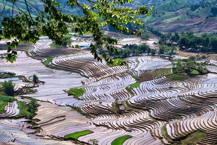
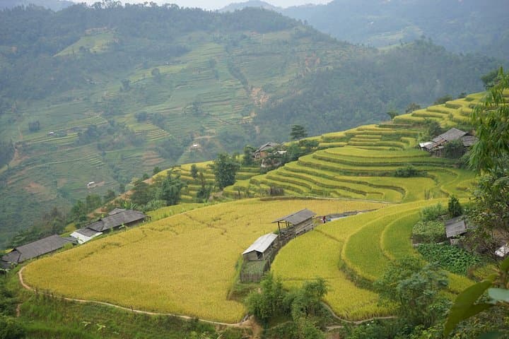
You crest a narrow ridge and the valley opens: stepped rice fields spill down like stacked shelves, clouds slip low and the mountains seem to rearrange themselves as you move. The road to Muong Hum and onward into Y Tý winds through hairpin turns, roadside markets, and small villages where livestock loiters and children watch travelers pass.
Verified experiences and guided adventures in the surrounding area.
Operated by SAIGONESE TREKKING HOUSE · Sapa, Lao Cai
You crest a narrow ridge and the valley opens: stepped rice fields spill down like stacked shelves, clouds slip low and the mountains seem to rearrange themselves as you move. The road to Muong Hum and onward into Y Tý winds through hairpin turns, roadside markets, and small villages where livestock loiters and children watch travelers pass.
This two-day loop threads local geography and culture. The terraced fields here are man-made contours carved into steep slopes over generations by Hmong and Dao communities; the high peaks are part of the Hoang Lien range, an uplifted margin of the eastern Himalayan foothills shaped by tectonic compression and relentless monsoon erosion. Five Finger Mountain (Ngũ Chỉ Sơn) keeps a quiet, jagged presence on the skyline while the Red River and smaller mountain streams cut sinuous courses down-valley, daring you to follow their routes.
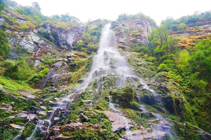
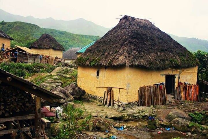
On day one the drive and short walks introduce working villages—Khoang, Ta Giang Phinh and Muong Hum—where simple timber houses, woven textiles and small markets tell the story of upland life. Overnight is in a local guesthouse-style hostel in Y Tý; expect basic comforts and strong local food. Day two is a trek through mossy forest to Ong Chua waterfall: a high cliff release forming blue plunge pools and orchids clinging to damp rock.
Practical edge: weather can flip quickly—start early, carry layered insulation and a reliable rain shell, and allow extra time for dirt roads and stops. Bring cash for small purchases, and wear grippy footwear for uneven village trails and slippery approaches to the falls. Hydrate, move at a steady pace on the climbs, and respect private farmland and homestay customs—small courtesies go far here.
moderate.
2 days (approx. 48 hours).
Good baseline fitness—comfortable with several hours of walking on uneven ground and short climbs.
The trek is moderate: uneven forest paths and some short steep sections; no technical climbing but sturdy shoes and steady footing are required.
Yes—overnight is in a local hostel/homestay with simple facilities; expect shared bathrooms and local-style bedding.
There are small local entrance fees for some attractions like Ong Chua; your tour usually handles admissions, but carry small cash just in case.
Yes—Lao Cai city and Sapa are regional transport hubs; arrange return transport in advance if you need a timed connection.
The area is home to Hmong, Dao and other ethnic minorities whose rice-terracing and house styles reflect centuries of upland agriculture and cross-border trade.
Trail erosion and stream pollution from tourism are growing concerns—stick to established paths, avoid single-use plastics, and support local homestays to keep benefits in the community.
SAIGONESE TREKKING HOUSE operates guided outdoor trips and adventures with an emphasis on safety, stewardship, and memorable experiences.
You crest a narrow ridge and the valley opens: stepped rice fields spill down like stacked shelves, clouds slip low and the mountains seem to rearrange themselves as you move. The road to Muong Hum and onward into Y Tý winds through hairpin turns, roadside markets, and small villages where livestock loiters and children watch travelers pass.
You crest a narrow ridge and the valley opens: stepped rice fields spill down like stacked shelves, clouds slip low and the mountains seem to rearrange themselves as you move. The road to Muong Hum and onward into Y Tý winds through hairpin turns, roadside markets, and small villages where livestock loiters and children watch travelers pass.
This two-day loop threads local geography and culture. The terraced fields here are man-made contours carved into steep slopes over generations by Hmong and Dao communities; the high peaks are part of the Hoang Lien range, an uplifted margin of the eastern Himalayan foothills shaped by tectonic compression and relentless monsoon erosion. Five Finger Mountain (Ngũ Chỉ Sơn) keeps a quiet, jagged presence on the skyline while the Red River and smaller mountain streams cut sinuous courses down-valley, daring you to follow their routes.
On day one the drive and short walks introduce working villages—Khoang, Ta Giang Phinh and Muong Hum—where simple timber houses, woven textiles and small markets tell the story of upland life. Overnight is in a local guesthouse-style hostel in Y Tý; expect basic comforts and strong local food. Day two is a trek through mossy forest to Ong Chua waterfall: a high cliff release forming blue plunge pools and orchids clinging to damp rock.
Practical edge: weather can flip quickly—start early, carry layered insulation and a reliable rain shell, and allow extra time for dirt roads and stops. Bring cash for small purchases, and wear grippy footwear for uneven village trails and slippery approaches to the falls. Hydrate, move at a steady pace on the climbs, and respect private farmland and homestay customs—small courtesies go far here.