THE ADVENTURE COLLECTIVE® · Independent discovery and booking for outdoor travel

Three days of terraced rice fields, mountain air and living culture: this Sapa trek links Cat Cat, Ta Van and Giang Ta Chai villages with panoramic views of the Hoang Lien Son range. Expect steep steps, river-side paths and a homestay night among the Zay and H’mong communities.
Three days of terraced rice fields, mountain air and living culture: this Sapa trek links Cat Cat, Ta Van and Giang Ta Chai villages with panoramic views of the Hoang Lien Son range. Expect steep steps, river-side paths and a homestay night among the Zay and H’mong communities.
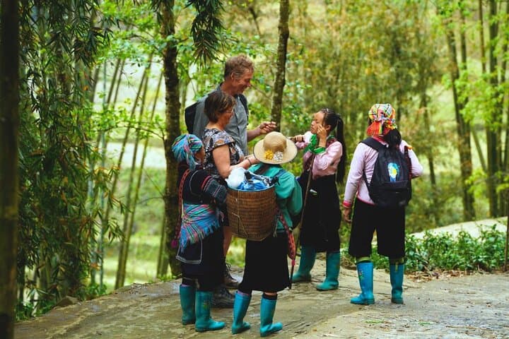
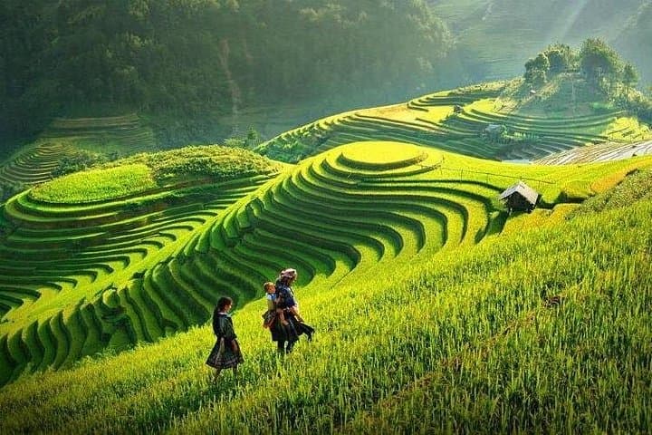
A low sun breaks over the Hoang Lien Son range as the road from Hanoi slips away and the air thins into cool, rice-scented mountain breath. By mid-afternoon you step onto a narrow path above the Muong Hoa River; terraces tier down like carved steps, and the Black H’mong smoke in doorways as children pause to watch you pass. The landscape here moves—clouds racing the ridgelines, wind pushing through bamboo—and it dares you to keep walking.
Verified experiences and guided adventures in the surrounding area.
Operated by Mr Linh's Adventures · Sapa, Lao Cai
A low sun breaks over the Hoang Lien Son range as the road from Hanoi slips away and the air thins into cool, rice-scented mountain breath. By mid-afternoon you step onto a narrow path above the Muong Hoa River; terraces tier down like carved steps, and the Black H’mong smoke in doorways as children pause to watch you pass. The landscape here moves—clouds racing the ridgelines, wind pushing through bamboo—and it dares you to keep walking.
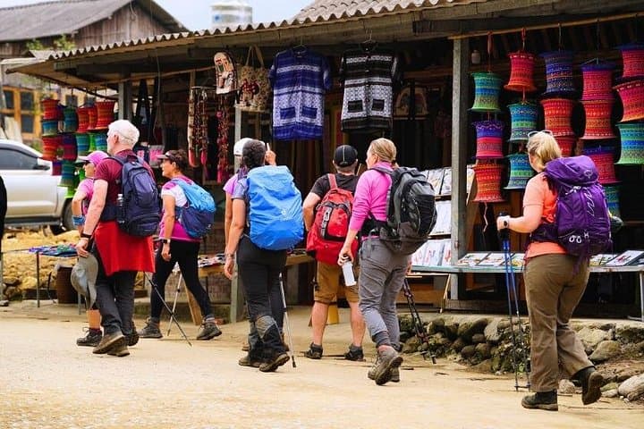
Geology and history shape every bend. The Hoang Lien Son massif, with Fansipan rising to 3,143 m, is the tectonic backbone that created the steep valleys and terraced paddies. The region has long been home to H’mong, Dao, Tay and Giay communities whose languages, textiles and farming rhythms remain visible in village life and market stalls.
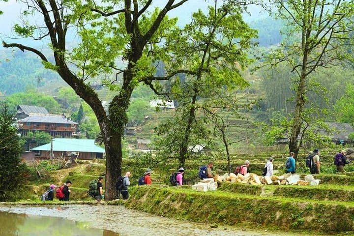
Over three days the itinerary alternates steady road sections with narrow dirt tracks and stone steps: expect 7–10 km on day one, a longer 15–17 km day across rice terraces to Ta Van, and a final 7–10 km walk out through Giang Ta Chai. Trails vary from packed earth to loose scree near stream crossings; some ascents are short but steep. Accommodation alternates hotel comfort with a homestay that offers close contact with local routines.
Practical guidance: start early when terraces glow and trails are cool, carry layered clothing for rapid temperature swings, and bring cash for remote villages. Move respectfully—ask before photographing—and pack out non-biodegradable waste. With durable boots, steady pacing, and an open curiosity, this is a compact, culturally rich trek that rewards stamina with wide views and real human connection.
moderate.
3 days (approx. 72 hours).
Good endurance for sustained walking—able to cover 7–17 km on uneven terrain over consecutive days.
Daily distances range from 7–17 km over mixed terrain; hikes include short steep sections and uneven steps, so moderate fitness and steady pacing are recommended.
Fansipan ascent is optional by cable car from Sapa with a short climb at the top; the primary itinerary focuses on valley treks but the cable car can be added if you prefer a summit experience.
An experienced English-speaking guide is included to navigate villages, explain local culture and handle permits and logistics.
Yes—meals listed (2 breakfasts, 3 lunches, 2 dinners) and accommodation includes a hotel in Sapa plus a homestay night in Ta Van Valley.
Sapa grew as a hill station under French colonialism; surrounding highlands have long been populated by H’mong, Dao and Tay communities whose terracing techniques shaped the landscape.
Rising visitor numbers put pressure on trails and waste systems—favor homestays and local guides, stick to paths, and carry out non-biodegradable trash to support sustainable tourism.
Mr Linh's Adventures operates guided outdoor trips and adventures with an emphasis on safety, stewardship, and memorable experiences.
A low sun breaks over the Hoang Lien Son range as the road from Hanoi slips away and the air thins into cool, rice-scented mountain breath. By mid-afternoon you step onto a narrow path above the Muong Hoa River; terraces tier down like carved steps, and the Black H’mong smoke in doorways as children pause to watch you pass. The landscape here moves—clouds racing the ridgelines, wind pushing through bamboo—and it dares you to keep walking.
A low sun breaks over the Hoang Lien Son range as the road from Hanoi slips away and the air thins into cool, rice-scented mountain breath. By mid-afternoon you step onto a narrow path above the Muong Hoa River; terraces tier down like carved steps, and the Black H’mong smoke in doorways as children pause to watch you pass. The landscape here moves—clouds racing the ridgelines, wind pushing through bamboo—and it dares you to keep walking.
Geology and history shape every bend. The Hoang Lien Son massif, with Fansipan rising to 3,143 m, is the tectonic backbone that created the steep valleys and terraced paddies. The region has long been home to H’mong, Dao, Tay and Giay communities whose languages, textiles and farming rhythms remain visible in village life and market stalls.
Over three days the itinerary alternates steady road sections with narrow dirt tracks and stone steps: expect 7–10 km on day one, a longer 15–17 km day across rice terraces to Ta Van, and a final 7–10 km walk out through Giang Ta Chai. Trails vary from packed earth to loose scree near stream crossings; some ascents are short but steep. Accommodation alternates hotel comfort with a homestay that offers close contact with local routines.
Practical guidance: start early when terraces glow and trails are cool, carry layered clothing for rapid temperature swings, and bring cash for remote villages. Move respectfully—ask before photographing—and pack out non-biodegradable waste. With durable boots, steady pacing, and an open curiosity, this is a compact, culturally rich trek that rewards stamina with wide views and real human connection.