THE ADVENTURE COLLECTIVE® · Independent discovery and booking for outdoor travel

Walk the Muong Hoa Valley from Sapa to Ta Van, sleep in a local homestay, and visit less-visited H’mong and Red Dao villages at a relaxed, moderate pace. This two-day trek mixes rice-terrace panoramas, village culture and a waterfall near Giang Ta Chai.
Walk the Muong Hoa Valley from Sapa to Ta Van, sleep in a local homestay, and visit less-visited H’mong and Red Dao villages at a relaxed, moderate pace. This two-day trek mixes rice-terrace panoramas, village culture and a waterfall near Giang Ta Chai.
A cool mist lifts off terraced rice paddies as you step out of Sapa’s narrow streets and into the Muong Hoa Valley. The first day follows a carved ribbon of trail past stream crossings and layered fields—Y Linh Ho to Lao Chai—where the Black H’mong tend steep plots and dry their indigo cloth on low fences. By late afternoon the path loses its town noise and you arrive in Ta Van, a Dzay village where a homestay family will host dinner and a night’s sleep.
Verified experiences and guided adventures in the surrounding area.
Operated by LOCAL TOURS VIETNAM · Sapa, Lao Cai
A cool mist lifts off terraced rice paddies as you step out of Sapa’s narrow streets and into the Muong Hoa Valley. The first day follows a carved ribbon of trail past stream crossings and layered fields—Y Linh Ho to Lao Chai—where the Black H’mong tend steep plots and dry their indigo cloth on low fences. By late afternoon the path loses its town noise and you arrive in Ta Van, a Dzay village where a homestay family will host dinner and a night’s sleep.
This landscape sits on the northern edge of the Hoang Lien Range at roughly 1,400–1,600 m elevation; terraces are human-cut into volcanic and metamorphic slopes that hold the valley soils. Cultural history is immediate: H’mong, Tay and Red Dao communities have farmed these hills for generations, trading weaving skills and seasonal crops. Small features—rattan bridges, bamboo groves, and a waterfall near Giang Ta Chai—speak to local ingenuity and an economy increasingly shaped by trekking tourism.
Practically, the route is moderate: day one ~12 km through terraces and village tracks; day two ~8 km across mixed trail and bamboo forest before a vehicle return to Sapa. Expect uneven stone steps, mud after rain, and frequent short climbs. Carry a daypack with 1.5–2 L water, rain protection, and cash for market goods. Footwear with good grip matters; poles help on descents.
Respect homestay customs: knock before entering, accept offered tea, and pack out non-biodegradable trash. Timing your trek for early morning or late afternoon improves light for photos and reduces midday fatigue.
moderate.
2 days.
Moderate fitness: able to walk up to 12 km on uneven trails with short, steep sections and carry a daypack
The operator rates it moderate (about 5/10); trails are well used but uneven—beginners in reasonable shape who walk regularly should manage with breaks.
Simple family-run rooms or dorm-style sleeping with shared bathrooms; meals are home-cooked local food and included as per itinerary.
Yes—shared bus transfer with hotel or Sapa bus station pickup is included; remote pickups may require meeting at the office on Fansipan Street.
Most operators can accommodate basic dietary requests if informed in advance; note remote homestays may have limited ingredients so communicate restrictions before arrival.
These villages reflect centuries of upland wet-rice agriculture and ethnic weaving traditions—French-era explorers first put Sapa on maps in the early 20th century.
Stick to marked trails to limit erosion, carry out non-biodegradable waste, and favor homestays that practice sustainable sourcing to support local economies.
LOCAL TOURS VIETNAM operates guided outdoor trips and adventures with an emphasis on safety, stewardship, and memorable experiences.
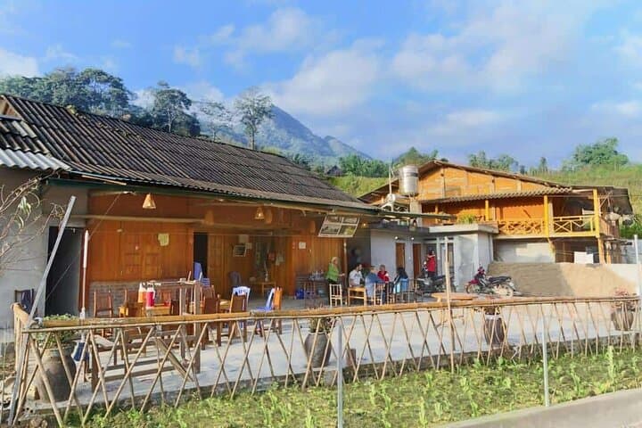
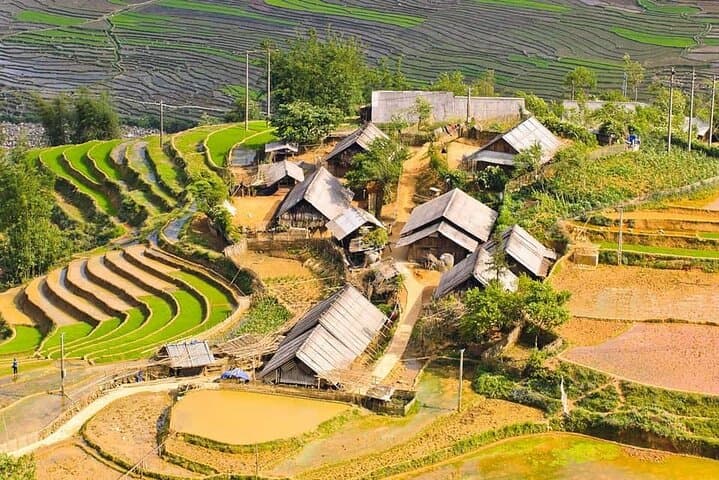
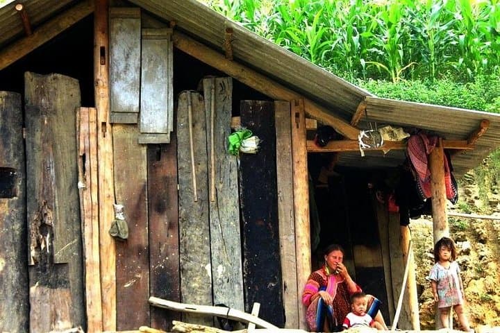
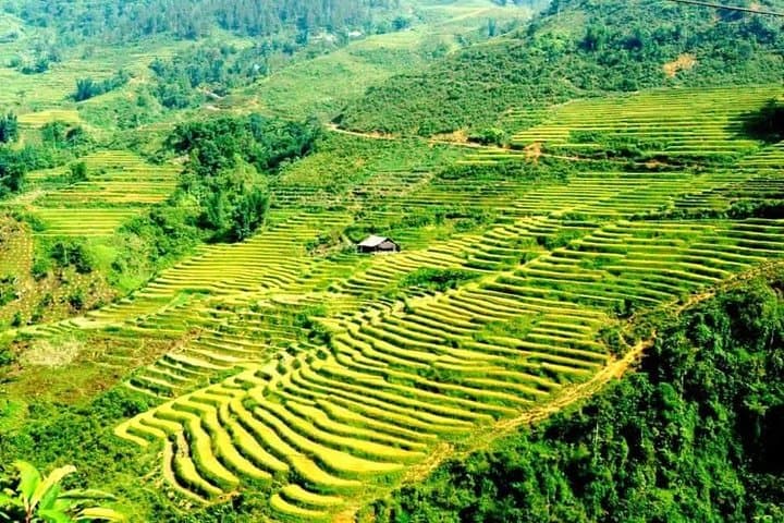
A cool mist lifts off terraced rice paddies as you step out of Sapa’s narrow streets and into the Muong Hoa Valley. The first day follows a carved ribbon of trail past stream crossings and layered fields—Y Linh Ho to Lao Chai—where the Black H’mong tend steep plots and dry their indigo cloth on low fences. By late afternoon the path loses its town noise and you arrive in Ta Van, a Dzay village where a homestay family will host dinner and a night’s sleep.
A cool mist lifts off terraced rice paddies as you step out of Sapa’s narrow streets and into the Muong Hoa Valley. The first day follows a carved ribbon of trail past stream crossings and layered fields—Y Linh Ho to Lao Chai—where the Black H’mong tend steep plots and dry their indigo cloth on low fences. By late afternoon the path loses its town noise and you arrive in Ta Van, a Dzay village where a homestay family will host dinner and a night’s sleep.
This landscape sits on the northern edge of the Hoang Lien Range at roughly 1,400–1,600 m elevation; terraces are human-cut into volcanic and metamorphic slopes that hold the valley soils. Cultural history is immediate: H’mong, Tay and Red Dao communities have farmed these hills for generations, trading weaving skills and seasonal crops. Small features—rattan bridges, bamboo groves, and a waterfall near Giang Ta Chai—speak to local ingenuity and an economy increasingly shaped by trekking tourism.
Practically, the route is moderate: day one ~12 km through terraces and village tracks; day two ~8 km across mixed trail and bamboo forest before a vehicle return to Sapa. Expect uneven stone steps, mud after rain, and frequent short climbs. Carry a daypack with 1.5–2 L water, rain protection, and cash for market goods. Footwear with good grip matters; poles help on descents.
Respect homestay customs: knock before entering, accept offered tea, and pack out non-biodegradable trash. Timing your trek for early morning or late afternoon improves light for photos and reduces midday fatigue.