THE ADVENTURE COLLECTIVE® · Independent discovery and booking for outdoor travel

Hike to Sant Jeroni—the highest point of Montserrat—for sweeping 360° views, a mix of forested tracks and rocky ridgelines, and a dose of Catalan history. This accessible ascent blends natural drama with clear, practical trail logistics.
Hike to Sant Jeroni—the highest point of Montserrat—for sweeping 360° views, a mix of forested tracks and rocky ridgelines, and a dose of Catalan history. This accessible ascent blends natural drama with clear, practical trail logistics.
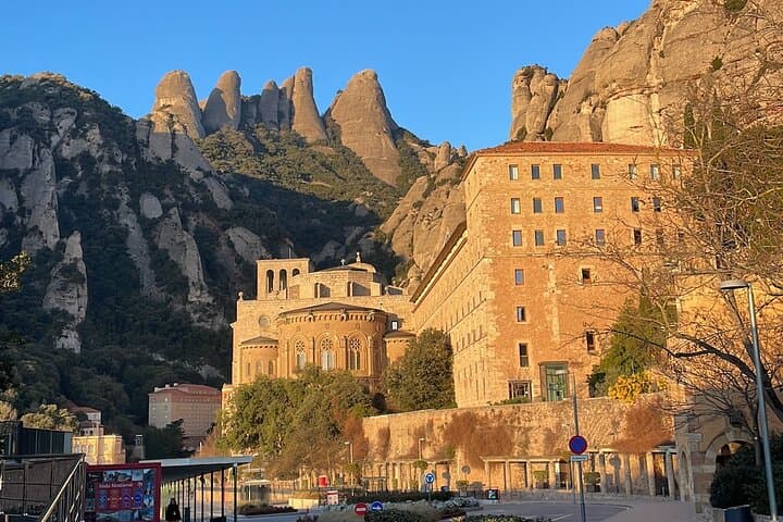
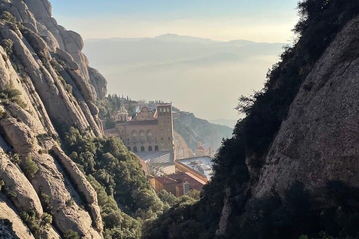
You step off the rackety cremallera at the monastery and the mountain takes the first breath—shade of pine, sharp limestone cliffs, and a path that angles upward toward the highest shoulder of Montserrat.
Verified experiences and guided adventures in the surrounding area.
Operated by Aclimatando Experiencias de Montaña · Monistrol de Montserrat, Catalonia
You step off the rackety cremallera at the monastery and the mountain takes the first breath—shade of pine, sharp limestone cliffs, and a path that angles upward toward the highest shoulder of Montserrat.
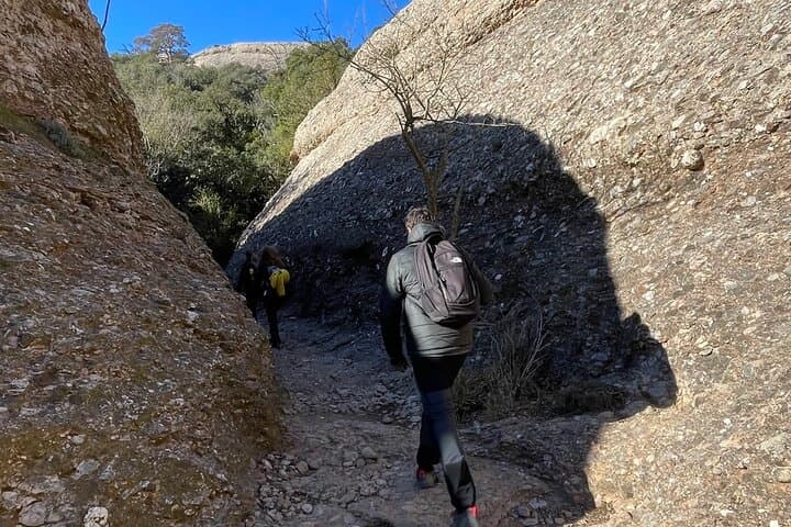
The trail to Sant Jeroni threads forest tracks, open ledges and short rocky scrambles. In about 4 hours participants cover roughly 8–10 km round-trip with approximately 600–750 m of elevation gain, moving from monastery terraces through holm oak and pine to exposed summits with 360° views of the Catalan plain and the Pyrenees on clear days.
Montserrat’s jagged silhouette is the result of Miocene conglomerate rock—rounded boulders cemented by ancient rivers—shaped by erosion into serrated peaks. The massif has been both a pilgrimage site since the 9th century and a refuge for Catalan culture; hermitages and the Benedictine abbey add human history to the geology.
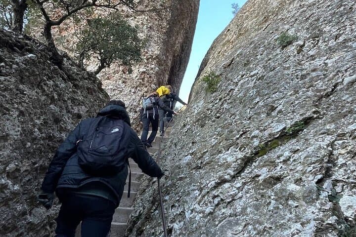
Expect to encounter shepherded goats, nesting raptors, and small chapels tucked into rock. Guides commonly share local lore and point out the monastery’s art and carved stairways as part of the route.
Practical notes: the path is non-technical but uneven—sturdy hiking shoes and poles help on rocky descents. Start early to avoid mid-day heat and crowds at the summit viewpoint. Carry 1.5–2 L water, layered clothing for wind on the ridge, and a light rain shell outside summer. Trail markings are frequent but a guide or map keeps pace steady; mobile signal is intermittent in gaps between crags.
For a full, accessible ascent from Barcelona this route balances cultural stops, wildlife sightings, and commanding summit views without technical climbing.
easy.
3–4 hours.
Basic hiking fitness; comfortable walking on uneven terrain and sustained uphill for several hundred meters of gain.
Most guided ascents take about 3–4 hours round-trip depending on pace and stops; solo hikers should budget extra time for viewpoints.
No technical climbing is required; the route is non-technical but includes uneven rock, short scrambles and steep sections.
Yes—those with basic fitness and comfortable walking on trails can complete it; guides often cater to mixed-ability groups.
Facilities are available at the monastery and nearby visitor areas, but not on the ascending ridges—bring snacks and water.
Montserrat has been a religious and cultural refuge since medieval times—the Benedictine abbey and carved hermitages reflect centuries of pilgrimage.
Montserrat is a protected massif—stay on marked trails, pack out waste, and respect grazing areas to minimize impact.
Aclimatando Experiencias de Montaña operates guided outdoor trips and adventures with an emphasis on safety, stewardship, and memorable experiences.
You step off the rackety cremallera at the monastery and the mountain takes the first breath—shade of pine, sharp limestone cliffs, and a path that angles upward toward the highest shoulder of Montserrat.
You step off the rackety cremallera at the monastery and the mountain takes the first breath—shade of pine, sharp limestone cliffs, and a path that angles upward toward the highest shoulder of Montserrat.
The trail to Sant Jeroni threads forest tracks, open ledges and short rocky scrambles. In about 4 hours participants cover roughly 8–10 km round-trip with approximately 600–750 m of elevation gain, moving from monastery terraces through holm oak and pine to exposed summits with 360° views of the Catalan plain and the Pyrenees on clear days.
Montserrat’s jagged silhouette is the result of Miocene conglomerate rock—rounded boulders cemented by ancient rivers—shaped by erosion into serrated peaks. The massif has been both a pilgrimage site since the 9th century and a refuge for Catalan culture; hermitages and the Benedictine abbey add human history to the geology.
Expect to encounter shepherded goats, nesting raptors, and small chapels tucked into rock. Guides commonly share local lore and point out the monastery’s art and carved stairways as part of the route.
Practical notes: the path is non-technical but uneven—sturdy hiking shoes and poles help on rocky descents. Start early to avoid mid-day heat and crowds at the summit viewpoint. Carry 1.5–2 L water, layered clothing for wind on the ridge, and a light rain shell outside summer. Trail markings are frequent but a guide or map keeps pace steady; mobile signal is intermittent in gaps between crags.
For a full, accessible ascent from Barcelona this route balances cultural stops, wildlife sightings, and commanding summit views without technical climbing.