THE ADVENTURE COLLECTIVE® · Independent discovery and booking for outdoor travel

Walk the crest of the Singalila Ridge from Sandakphu to Phalut for one of the best panoramic views of Kanchenjunga. This ridge trek mixes fir and rhododendron forests, simple village stays, and day‑long mountain vistas.
Walk the crest of the Singalila Ridge from Sandakphu to Phalut for one of the best panoramic views of Kanchenjunga. This ridge trek mixes fir and rhododendron forests, simple village stays, and day‑long mountain vistas.
High above the tea gardens and traffic of the lower hills, the Singalila Ridge opens like a long, wind‑cut spine. At dawn the Kanchenjunga massif pins itself to the sky—sharp, silver, uncompromising—while rhododendron and silver fir breathe mist across the trail. Walking the Sandakphu–Phalut route feels like moving along the roof of the eastern Himalaya: the ridge pushes you forward and the wind tests your balance.
Verified experiences and guided adventures in the surrounding area.
Operated by Darjeeling Sikkim Experiences · Manebhanjan, West Bengal
High above the tea gardens and traffic of the lower hills, the Singalila Ridge opens like a long, wind‑cut spine. At dawn the Kanchenjunga massif pins itself to the sky—sharp, silver, uncompromising—while rhododendron and silver fir breathe mist across the trail. Walking the Sandakphu–Phalut route feels like moving along the roof of the eastern Himalaya: the ridge pushes you forward and the wind tests your balance.
The path follows a historic boundary between Bengal and Nepal; hill tribes such as the Lepcha and Bhutia have grazed these slopes for generations and small stone wayposts mark old grazing routes. Geologically the Singalila Range is a folded, uplifted edge of the Himalaya, its soil acidic and well suited to the deep‑rooted rhododendrons that explode into bloom in spring.
Expect narrow ridge trails, occasional rocky steps, and long forested stretches through fir and rhodo that filter light into green. Wildlife sightings often include barking deer and Himalayan birdlife; snow leopards are extremely rare but the landscape still feels inhabited by large, secretive presences.
Practically: plan for altitude—Sandakphu and Phalut sit around 3,600 m—so move slowly, hydrate, and monitor for mild symptoms of AMS. Trail days typically run 4–6 hours on ridge sections; pack layered insulation, sturdy boots, and rain protection. Local homestays and simple dhabas provide tea, hot meals, and a chance to learn hill culture. The trail is rewarding, straightforward for fit hikers, and delivers one of the clearest panoramic sweeps of eastern Himalayan giants from Nepal across to Bhutan.
moderate.
4–6 days.
Suitable for hikers with steady cardiovascular fitness who can handle full days of walking at high altitude.
Technically the route is straightforward but moderate in difficulty due to sustained elevation, long days, and exposed ridge walking; good fitness and acclimatization are important.
Spring (April–May) brings rhododendron blooms and clear views; autumn (September–November) offers stable weather and crisp visibility.
Entry to Singalila National Park requires a park permit and local checkposts exist; organized groups or guides typically handle permits during booking.
Simple mountain lodges, teahouses and homestays along the route provide basic rooms and cooked meals—expect shared facilities at higher elevations.
The ridge has long been a grazing and trade corridor linking hill communities; British botanists and early mountaineers mapped parts of the Singalila in the 19th century.
Singalila is protected as a national park—stick to marked trails, avoid fuelwood collection, and support local homestays that follow low‑impact practices.
Darjeeling Sikkim Experiences operates guided outdoor trips and adventures with an emphasis on safety, stewardship, and memorable experiences.
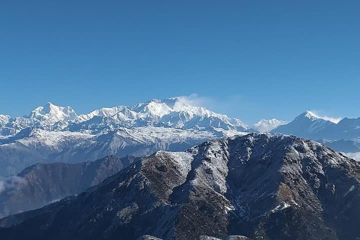
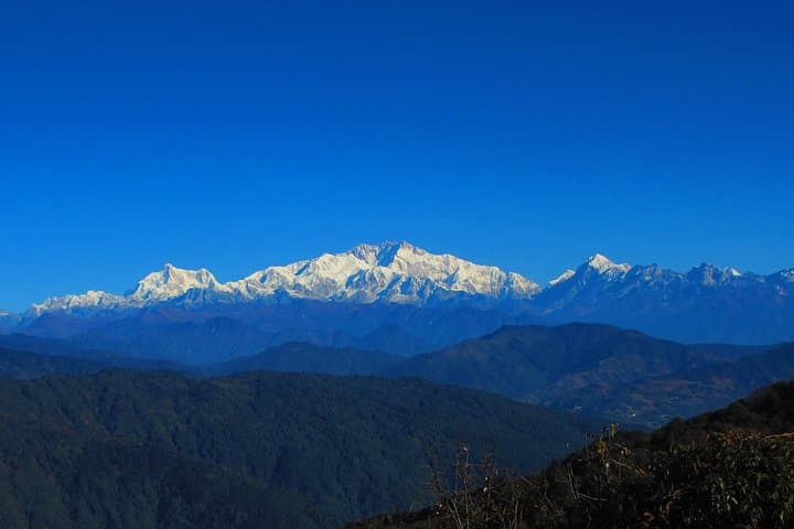
High above the tea gardens and traffic of the lower hills, the Singalila Ridge opens like a long, wind‑cut spine. At dawn the Kanchenjunga massif pins itself to the sky—sharp, silver, uncompromising—while rhododendron and silver fir breathe mist across the trail. Walking the Sandakphu–Phalut route feels like moving along the roof of the eastern Himalaya: the ridge pushes you forward and the wind tests your balance.
High above the tea gardens and traffic of the lower hills, the Singalila Ridge opens like a long, wind‑cut spine. At dawn the Kanchenjunga massif pins itself to the sky—sharp, silver, uncompromising—while rhododendron and silver fir breathe mist across the trail. Walking the Sandakphu–Phalut route feels like moving along the roof of the eastern Himalaya: the ridge pushes you forward and the wind tests your balance.
The path follows a historic boundary between Bengal and Nepal; hill tribes such as the Lepcha and Bhutia have grazed these slopes for generations and small stone wayposts mark old grazing routes. Geologically the Singalila Range is a folded, uplifted edge of the Himalaya, its soil acidic and well suited to the deep‑rooted rhododendrons that explode into bloom in spring.
Expect narrow ridge trails, occasional rocky steps, and long forested stretches through fir and rhodo that filter light into green. Wildlife sightings often include barking deer and Himalayan birdlife; snow leopards are extremely rare but the landscape still feels inhabited by large, secretive presences.
Practically: plan for altitude—Sandakphu and Phalut sit around 3,600 m—so move slowly, hydrate, and monitor for mild symptoms of AMS. Trail days typically run 4–6 hours on ridge sections; pack layered insulation, sturdy boots, and rain protection. Local homestays and simple dhabas provide tea, hot meals, and a chance to learn hill culture. The trail is rewarding, straightforward for fit hikers, and delivers one of the clearest panoramic sweeps of eastern Himalayan giants from Nepal across to Bhutan.