THE ADVENTURE COLLECTIVE® · Independent discovery and booking for outdoor travel

Tackle one of El Salvador’s most demanding day hikes to the summit of San Vicente (Chichontepec). This guided, full-day climb crosses misty cloud forest, a historical crash site, and active fumaroles before returning to Verapaz.
Tackle one of El Salvador’s most demanding day hikes to the summit of San Vicente (Chichontepec). This guided, full-day climb crosses misty cloud forest, a historical crash site, and active fumaroles before returning to Verapaz.
A cool mist clings to the trunks as the group leaves Agua Agria and pushes uphill, boots sinking slightly into mossy soil. The trail climbs steadily through a cloud forest; the air tastes of wet leaves and volcanic minerals. At higher benchlands the trees open and the mountain exhales—steam and the distant hiss of the infiernillos announce the volcano’s presence.
Verified experiences and guided adventures in the surrounding area.
Operated by Natural Trekking Central America · San Vicente, San Vicente Department
A cool mist clings to the trunks as the group leaves Agua Agria and pushes uphill, boots sinking slightly into mossy soil. The trail climbs steadily through a cloud forest; the air tastes of wet leaves and volcanic minerals. At higher benchlands the trees open and the mountain exhales—steam and the distant hiss of the infiernillos announce the volcano’s presence.
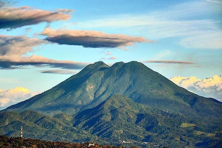
San Vicente (Chichontepec) is the second-highest peak in El Salvador, rising to roughly 2,125 meters. The volcano’s core is layered lava and pyroclastic deposits from Pleistocene and Holocene eruptions; its slopes feed steep ravines that local communities historically used for timber and coffee. On this route you’ll pass the 1995 Aviateca crash site, a sobering point that anchors modern memory to the mountain’s geography.
Culturally, the area blends rural Salvadoran life with indigenous place names and smallholder farms; guides often share local stories about the fumaroles and the infiernillos—clusters of steam vents where hot gases escape, daring you to peer closer.
Practical guidance: expect an 11-hour outing with sustained uphill sections and uneven volcanic terrain. Start before dawn, carry 2–3 liters of water, and layer for rapid weather change. The guide-led trek requires good cardiovascular fitness and sturdy, ankle-supporting boots. Watch for slippery volcanic ash, avoid trampling fragile vegetation, and keep distance from steam vents—the ground can be unstable. Pickup and drop-off are typically in Verapaz; snacks and parking are included. If you have heart, back, or pregnancy restrictions, opt out—this route is physically demanding. Finish the day with a slow descent and a hot drink in Verapaz to warm stiff muscles.
challenging.
10–12 hours.
Requires high aerobic fitness and leg strength; regular hikers who train with long uphill days will be comfortable.
This is a demanding full-day trek with sustained climbs; participants should have a high level of cardiovascular fitness and prior experience on long mountain hikes.
Most people tolerate this elevation without formal acclimatization, but take it slow, hydrate, and watch for light altitude symptoms—descend if you feel unwell.
This is a guided tour with pickup typically in Verapaz; the tour includes snacks and transport back to town.
You can view the steam vents, but keep a safe distance; ground near fumaroles can be hot and unstable, and gases may be hazardous.
The volcano’s slopes have long supported agriculture and local communities; the 1995 Aviateca crash site is a recent, poignant landmark encountered on the route.
Stay on established trails to limit erosion and avoid collecting volcanic rock; support local guides who practice low-impact trekking.
Natural Trekking Central America operates guided outdoor trips and adventures with an emphasis on safety, stewardship, and memorable experiences.
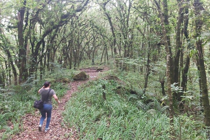
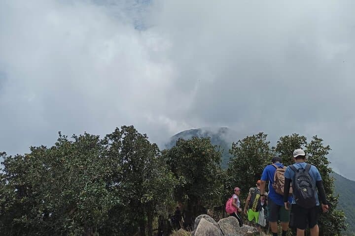
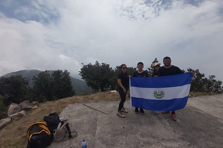
A cool mist clings to the trunks as the group leaves Agua Agria and pushes uphill, boots sinking slightly into mossy soil. The trail climbs steadily through a cloud forest; the air tastes of wet leaves and volcanic minerals. At higher benchlands the trees open and the mountain exhales—steam and the distant hiss of the infiernillos announce the volcano’s presence.
A cool mist clings to the trunks as the group leaves Agua Agria and pushes uphill, boots sinking slightly into mossy soil. The trail climbs steadily through a cloud forest; the air tastes of wet leaves and volcanic minerals. At higher benchlands the trees open and the mountain exhales—steam and the distant hiss of the infiernillos announce the volcano’s presence.
San Vicente (Chichontepec) is the second-highest peak in El Salvador, rising to roughly 2,125 meters. The volcano’s core is layered lava and pyroclastic deposits from Pleistocene and Holocene eruptions; its slopes feed steep ravines that local communities historically used for timber and coffee. On this route you’ll pass the 1995 Aviateca crash site, a sobering point that anchors modern memory to the mountain’s geography.
Culturally, the area blends rural Salvadoran life with indigenous place names and smallholder farms; guides often share local stories about the fumaroles and the infiernillos—clusters of steam vents where hot gases escape, daring you to peer closer.
Practical guidance: expect an 11-hour outing with sustained uphill sections and uneven volcanic terrain. Start before dawn, carry 2–3 liters of water, and layer for rapid weather change. The guide-led trek requires good cardiovascular fitness and sturdy, ankle-supporting boots. Watch for slippery volcanic ash, avoid trampling fragile vegetation, and keep distance from steam vents—the ground can be unstable. Pickup and drop-off are typically in Verapaz; snacks and parking are included. If you have heart, back, or pregnancy restrictions, opt out—this route is physically demanding. Finish the day with a slow descent and a hot drink in Verapaz to warm stiff muscles.