THE ADVENTURE COLLECTIVE® · Independent discovery and booking for outdoor travel

A full-day descent from the Omalos plateau to Agia Roumeli, the Samaria Gorge long route is Crete’s signature hike: long, rocky, and vividly raw. This guide covers what to expect — geology, logistics, and how to prepare for the long downhill march to the Libyan Sea.
A full-day descent from the Omalos plateau to Agia Roumeli, the Samaria Gorge long route is Crete’s signature hike: long, rocky, and vividly raw. This guide covers what to expect — geology, logistics, and how to prepare for the long downhill march to the Libyan Sea.
You stand at Xyloskalo on the Omalos plateau with the wind pushing warm air through the first cleft of the White Mountains. Below, the gorge narrows into a shaded corridor of limestone walls; the riverbed dares you forward, stones polished by centuries of runoff and footsteps.
Verified experiences and guided adventures in the surrounding area.
Operated by MTM Experiences · Chania, Crete
You stand at Xyloskalo on the Omalos plateau with the wind pushing warm air through the first cleft of the White Mountains. Below, the gorge narrows into a shaded corridor of limestone walls; the riverbed dares you forward, stones polished by centuries of runoff and footsteps.
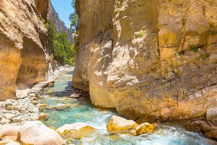
Geology here is blunt and honest: vertical limestone carved by water and time into sheer cliffs, talus slopes and a gravelly riverbed that channels winter torrents. The Lefka Ori (White Mountains) have a tough human history too — shepherds and villagers used these routes for seasonal movement, while in modern times Samaria became a National Park in 1962 to protect endemic species like the kri-kri, the Cretan wild goat.
The long route drops roughly 1,200–1,300 meters from Xyloskalo to the Libyan Sea over 16–18 km of mostly downhill trail. Expect mixed terrain: packed dirt, loose scree, boulder-hopping and narrow passages where the walls close in. Culture along the way is quiet and practical — a tavern at Omalos for coffee, small fishing ledgers in Agia Roumeli and a ferry that signals the hike’s end.
Practical guidance: allocate a full day (transport and ferry included), wear sturdy hiking shoes, carry 2–3 liters of water, and pace yourself on the long descent to protect knees. Time your finish to match the afternoon ferry (often around 17:30) and leave no trace: trails here are fragile and the park’s protections depend on visitor care.
challenging.
10–13 hours (including transfers and ferry).
Good endurance for a long downhill hike; should be comfortable walking 4–6 hours on uneven terrain and managing steep descents
The gorge route is about 16–18 km on foot with roughly 1,200–1,300 m of net descent; walking time is commonly 4–7 hours depending on pace and breaks.
No formal permit is required for most visitors, though the National Park may collect a modest entrance fee in high season and park rules must be observed.
Most organized trips include transfers to the Omalos start and arrange a late-afternoon ferry from Agia Roumeli to Sougia or Sfakia; confirm pickup and ferry details with your operator.
Not for complete novices — the distance, uneven terrain and long descent require basic hiking experience and good fitness; consider a shorter section or guided option if unsure.
Declared a National Park in 1962 to protect endemic species, Samaria has been traversed by shepherds and villagers for centuries and played roles in local wartime histories.
Trails are susceptible to erosion; stay on marked paths, pack out all waste and respect seasonal closures to protect rare flora and fauna.
MTM Experiences operates guided outdoor trips and adventures with an emphasis on safety, stewardship, and memorable experiences.
You stand at Xyloskalo on the Omalos plateau with the wind pushing warm air through the first cleft of the White Mountains. Below, the gorge narrows into a shaded corridor of limestone walls; the riverbed dares you forward, stones polished by centuries of runoff and footsteps.
You stand at Xyloskalo on the Omalos plateau with the wind pushing warm air through the first cleft of the White Mountains. Below, the gorge narrows into a shaded corridor of limestone walls; the riverbed dares you forward, stones polished by centuries of runoff and footsteps.
Geology here is blunt and honest: vertical limestone carved by water and time into sheer cliffs, talus slopes and a gravelly riverbed that channels winter torrents. The Lefka Ori (White Mountains) have a tough human history too — shepherds and villagers used these routes for seasonal movement, while in modern times Samaria became a National Park in 1962 to protect endemic species like the kri-kri, the Cretan wild goat.
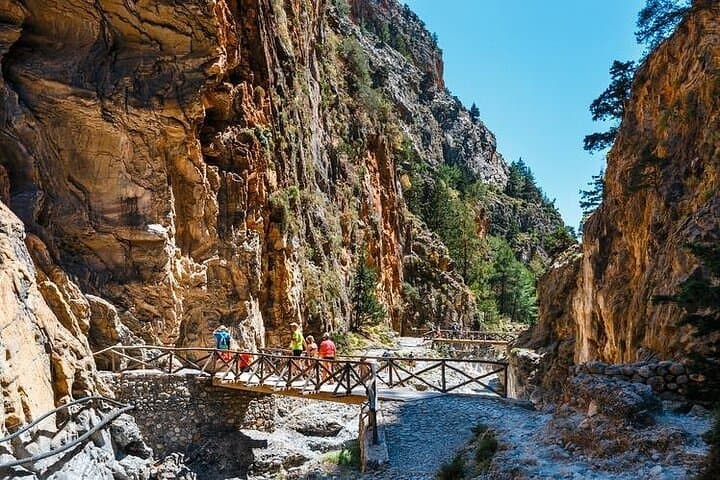
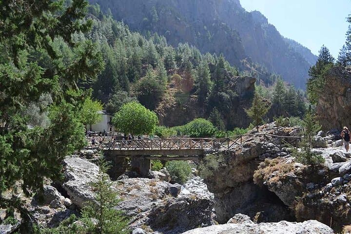
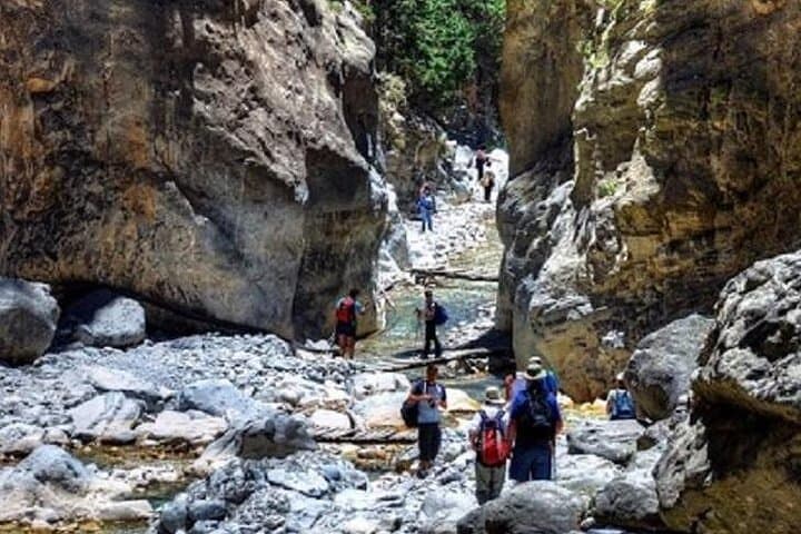
The long route drops roughly 1,200–1,300 meters from Xyloskalo to the Libyan Sea over 16–18 km of mostly downhill trail. Expect mixed terrain: packed dirt, loose scree, boulder-hopping and narrow passages where the walls close in. Culture along the way is quiet and practical — a tavern at Omalos for coffee, small fishing ledgers in Agia Roumeli and a ferry that signals the hike’s end.
Practical guidance: allocate a full day (transport and ferry included), wear sturdy hiking shoes, carry 2–3 liters of water, and pace yourself on the long descent to protect knees. Time your finish to match the afternoon ferry (often around 17:30) and leave no trace: trails here are fragile and the park’s protections depend on visitor care.