THE ADVENTURE COLLECTIVE® · Independent discovery and booking for outdoor travel

Turn a two-hour walk through St. Paul into an interactive city quest—from the Capitol steps to the Mississippi waterfront. This app-led scavenger hunt mixes local history, public art, and photo challenges for groups and solo players alike.
Turn a two-hour walk through St. Paul into an interactive city quest—from the Capitol steps to the Mississippi waterfront. This app-led scavenger hunt mixes local history, public art, and photo challenges for groups and solo players alike.
You start on Rev. Dr. Martin Luther King Jr. Boulevard with the Capitol’s limestone face behind you and the Mississippi daring you downstream. The air carries city sounds—cyclists, a distant river tug—and the hunt’s map slides open on your phone. Over the next two hours you’ll thread through stone steps, civic plazas, and muraled alleys, chasing photo prompts and trivia that make the city unclench.
Verified experiences and guided adventures in the surrounding area.
Operated by Let's Roam · Saint Paul, Minnesota
You start on Rev. Dr. Martin Luther King Jr. Boulevard with the Capitol’s limestone face behind you and the Mississippi daring you downstream. The air carries city sounds—cyclists, a distant river tug—and the hunt’s map slides open on your phone. Over the next two hours you’ll thread through stone steps, civic plazas, and muraled alleys, chasing photo prompts and trivia that make the city unclench.
Saint Paul grew from riverboats and rail; its bluff-top neighborhoods stand on glacial deposits left by Ice Age flows. The route stitches together Beaux-Arts public buildings, mid-century storefronts, and pocket parks where public art marks local stories: abolitionists, writers, and a bookish philanthropist etched into bronze and brick.
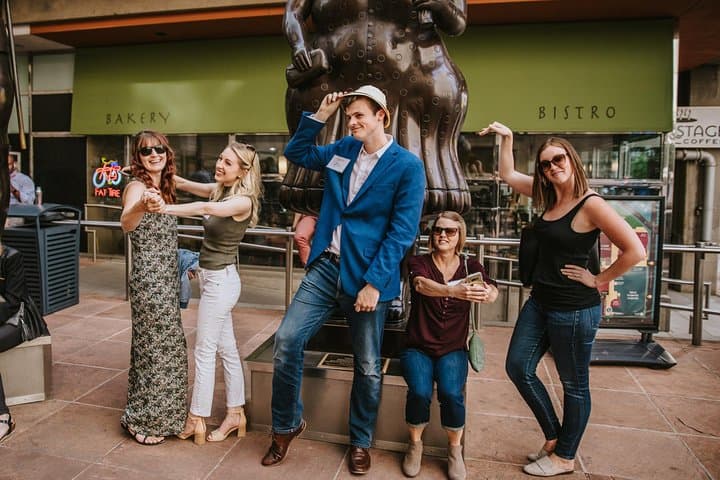
Culturally, the scavenger hunt is a shortcut to neighborhood quirks—coffee shops that double as vinyl stores, a comic-strip statue, and a riverside path favored by joggers. The app-led format turns wayfinding into play, assigning roles like Photographer or Brainiac so groups can split tasks and stay engaged.
Practical guidance: bring a fully charged smartphone and a portable battery, comfortable walking shoes, and a lightweight jacket—St. Paul weather can flip in an hour. The route is wheelchair and stroller accessible on main sidewalks, but some alleys have cobbles. Start early on weekends to avoid crowds near the Capitol and allot 2–3 hours if you plan stops for coffee or photos. Expect roughly 1.5–3 miles of walking on paved city streets with short inclines.
This hunt is less about fitness and more about curiosity: fast feet help, but clever answers win. Follow local signage, respect private property, and leave no trace—especially along the riverfront where native plantings are being restored.
moderate.
2 hours (typical).
Light to moderate walking fitness; able to stand and walk for several consecutive 20–40 minute stretches.
The guided experience is designed for about 2 hours and typically covers 1.5–3 miles, depending on side trips and photo stops.
No—this is a self-guided private tour you can start at any time after redeeming your voucher in the app.
Main sidewalks and many points are accessible, but expect some cobbled alleys and short stair sections; routes are generally navigable for most mobility devices.
You’ll want a power bank; if your device fails contact Let’s Roam support by phone or email per the redemption instructions included with your booking.
Saint Paul’s growth was shaped by river traffic and rail; many civic buildings date to late 19th and early 20th centuries and reflect the city’s role as Minnesota’s capital.
The riverfront and pocket parks along the route are part of local restoration efforts—stay on paths and avoid trampling planted areas to support native species.
Let's Roam operates guided outdoor trips and adventures with an emphasis on safety, stewardship, and memorable experiences.
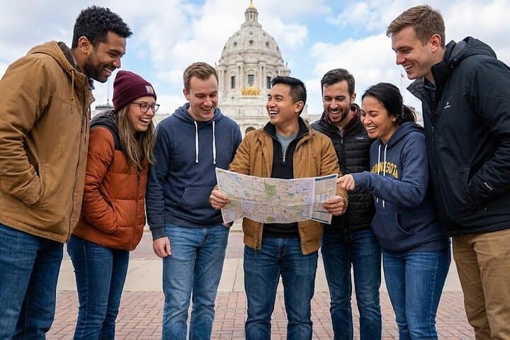


You start on Rev. Dr. Martin Luther King Jr. Boulevard with the Capitol’s limestone face behind you and the Mississippi daring you downstream. The air carries city sounds—cyclists, a distant river tug—and the hunt’s map slides open on your phone. Over the next two hours you’ll thread through stone steps, civic plazas, and muraled alleys, chasing photo prompts and trivia that make the city unclench.
You start on Rev. Dr. Martin Luther King Jr. Boulevard with the Capitol’s limestone face behind you and the Mississippi daring you downstream. The air carries city sounds—cyclists, a distant river tug—and the hunt’s map slides open on your phone. Over the next two hours you’ll thread through stone steps, civic plazas, and muraled alleys, chasing photo prompts and trivia that make the city unclench.
Saint Paul grew from riverboats and rail; its bluff-top neighborhoods stand on glacial deposits left by Ice Age flows. The route stitches together Beaux-Arts public buildings, mid-century storefronts, and pocket parks where public art marks local stories: abolitionists, writers, and a bookish philanthropist etched into bronze and brick.
Culturally, the scavenger hunt is a shortcut to neighborhood quirks—coffee shops that double as vinyl stores, a comic-strip statue, and a riverside path favored by joggers. The app-led format turns wayfinding into play, assigning roles like Photographer or Brainiac so groups can split tasks and stay engaged.
Practical guidance: bring a fully charged smartphone and a portable battery, comfortable walking shoes, and a lightweight jacket—St. Paul weather can flip in an hour. The route is wheelchair and stroller accessible on main sidewalks, but some alleys have cobbles. Start early on weekends to avoid crowds near the Capitol and allot 2–3 hours if you plan stops for coffee or photos. Expect roughly 1.5–3 miles of walking on paved city streets with short inclines.
This hunt is less about fitness and more about curiosity: fast feet help, but clever answers win. Follow local signage, respect private property, and leave no trace—especially along the riverfront where native plantings are being restored.