THE ADVENTURE COLLECTIVE® · Independent discovery and booking for outdoor travel

A day-trip ferry from St. Maarten drops you into Fort Bay at the base of sheer volcanic cliffs, where taxi tours and the Mt. Scenery hike reveal Saba’s cloud forest, village life, and dramatic views. Expect a steep climb, a $3 trail donation, and island hospitality.
A day-trip ferry from St. Maarten drops you into Fort Bay at the base of sheer volcanic cliffs, where taxi tours and the Mt. Scenery hike reveal Saba’s cloud forest, village life, and dramatic views. Expect a steep climb, a $3 trail donation, and island hospitality.
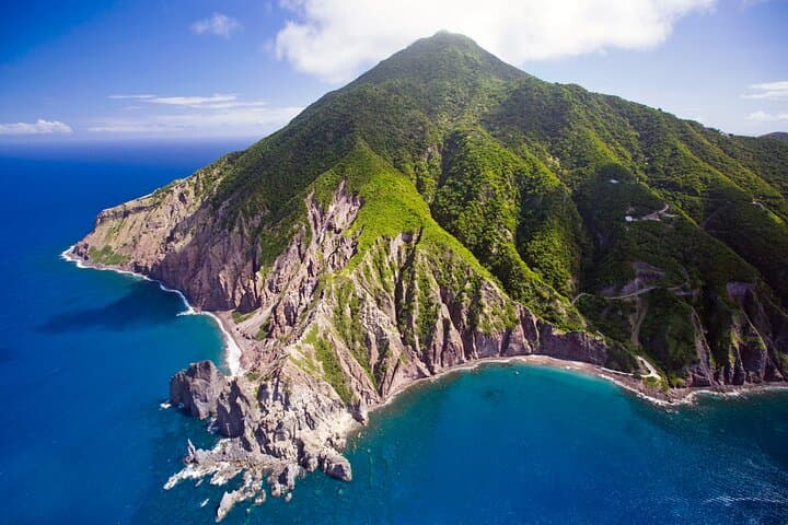
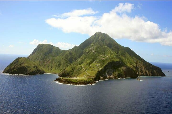
You step off the ferry into Fort Bay and the sea seems to push back against sheer black cliffs, daring you to climb. The boat ride (about 75–90 minutes) leaves St. Maarten behind and delivers you to Saba’s dramatic coastline — the only proper harbor cuts a small notch into an otherwise vertical island.
Verified experiences and guided adventures in the surrounding area.
Operated by Aqua Mania Adventures · Windwardside, Saba
You step off the ferry into Fort Bay and the sea seems to push back against sheer black cliffs, daring you to climb. The boat ride (about 75–90 minutes) leaves St. Maarten behind and delivers you to Saba’s dramatic coastline — the only proper harbor cuts a small notch into an otherwise vertical island.
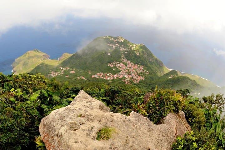
Saba’s geology is volcanic: basalt cliffs rise from deep water to a cloud forest crown. Human history leaves its mark too—the old slave path and narrow mule tracks recall the island’s past economies and the grit required to move goods inland. Windwardside and The Bottom are working villages with whitewashed cottages and bright roofs; local craft stalls and small restaurants show a low-key island culture shaped by seafaring and subsistence farming.
Most visitors pair a taxi loop with a hike on the Mt. Scenery trail. At roughly 887 m (2,910 ft), Mt. Scenery rewards a steep, often muddy climb with sweeping views over neighboring islands on clear days. The Saba Trail Shop requests a small US$3 donation for trail upkeep and issues a badge — a simple conservation model that keeps the paths maintained.
Practical notes: check in an hour before departure and bring a valid passport (passport cards are not accepted). The climb can be strenuous; arrive with sturdy shoes, water, and rain protection for sudden tropical showers. Taxis are the only practical way up from Fort Bay; plan return rendezvous times carefully. If you want snorkeling instead, ask about shorter shore options — the island is as inviting below the surface as above it.
challenging.
8 hours.
Good aerobic fitness recommended; participants should be comfortable with steep, sustained climbs and uneven, sometimes muddy terrain.
Yes — a valid passport is required for travel between St. Maarten and Saba; passport cards are not accepted.
The Mt. Scenery trail is steep and can be strenuous; it’s suitable for hikers with good fitness and proper footwear, and you can opt to hike only part of it.
Round-trip ferry transfers are included; the island portion uses taxi tours to reach Windwardside and trailheads—these are part of the tour package.
Windwardside has small restaurants and shops where you can buy lunch and local crafts; the tour also includes a lunch option.
Saba’s narrow mule paths and old slave road reflect a history of cliffside landings and pack-based transport; villages developed where limited flat land allowed farming and settlement.
The Saba Trail Shop’s small donation supports trail maintenance; staying on marked routes protects fragile cloud-forest plants and endemic species.
Aqua Mania Adventures operates guided outdoor trips and adventures with an emphasis on safety, stewardship, and memorable experiences.

You step off the ferry into Fort Bay and the sea seems to push back against sheer black cliffs, daring you to climb. The boat ride (about 75–90 minutes) leaves St. Maarten behind and delivers you to Saba’s dramatic coastline — the only proper harbor cuts a small notch into an otherwise vertical island.
You step off the ferry into Fort Bay and the sea seems to push back against sheer black cliffs, daring you to climb. The boat ride (about 75–90 minutes) leaves St. Maarten behind and delivers you to Saba’s dramatic coastline — the only proper harbor cuts a small notch into an otherwise vertical island.
Saba’s geology is volcanic: basalt cliffs rise from deep water to a cloud forest crown. Human history leaves its mark too—the old slave path and narrow mule tracks recall the island’s past economies and the grit required to move goods inland. Windwardside and The Bottom are working villages with whitewashed cottages and bright roofs; local craft stalls and small restaurants show a low-key island culture shaped by seafaring and subsistence farming.
Most visitors pair a taxi loop with a hike on the Mt. Scenery trail. At roughly 887 m (2,910 ft), Mt. Scenery rewards a steep, often muddy climb with sweeping views over neighboring islands on clear days. The Saba Trail Shop requests a small US$3 donation for trail upkeep and issues a badge — a simple conservation model that keeps the paths maintained.
Practical notes: check in an hour before departure and bring a valid passport (passport cards are not accepted). The climb can be strenuous; arrive with sturdy shoes, water, and rain protection for sudden tropical showers. Taxis are the only practical way up from Fort Bay; plan return rendezvous times carefully. If you want snorkeling instead, ask about shorter shore options — the island is as inviting below the surface as above it.