THE ADVENTURE COLLECTIVE® · Independent discovery and booking for outdoor travel

A high-altitude trek into the Karakoram that ends at Rush Lake—one of the world’s highest alpine lakes. Expect glacier crossings, steep meadows, and panoramic views of Hunza and the surrounding giants.
A high-altitude trek into the Karakoram that ends at Rush Lake—one of the world’s highest alpine lakes. Expect glacier crossings, steep meadows, and panoramic views of Hunza and the surrounding giants.
The trail opens on a crisper morning above Hoper Valley, wind threading through moraine ridges as your group climbs into thinning air. Rush Lake sits beyond a final alpine meadow — a broad, mirror-smooth bowl at roughly 4,700 meters that reflects ridgelines and hanging glaciers. On clear days the Karakoram's serrated skyline, including distant snowfields, crowds the horizon.
Verified experiences and guided adventures in the surrounding area.
Operated by Rock Valley Tours Pakistan · Karimabad, Gilgit-Baltistan
The trail opens on a crisper morning above Hoper Valley, wind threading through moraine ridges as your group climbs into thinning air. Rush Lake sits beyond a final alpine meadow — a broad, mirror-smooth bowl at roughly 4,700 meters that reflects ridgelines and hanging glaciers. On clear days the Karakoram's serrated skyline, including distant snowfields, crowds the horizon.
This route follows centuries-old access routes used by Nagar and Hunza communities; the valleys themselves mark a junction between the Karakoram, Himalaya and Hindu Kush ranges. Geologically the region is young and raw: glacially carved U-shaped valleys, active moraines and steep headwalls that feed the streams you cross. Local culture centers on terrace farming and small hamlets—Baltit and Altit forts in Karimabad are living reminders of the Silk Road-era trade and local governance.
Expect 6–8 hours of walking on active terrain during approach days, steep pitches to reach the lake, glacier crossings near Hoper and Miyar, and an optional non-technical ascent to a 5,000 m trekking peak for panoramic views. Weather shifts fast: sun can be fierce at altitude and storms can drop snow even in summer.
Practical guidance: allow at least two days to acclimatize in Gilgit/Hunza before the heavy ascent, bring glacier-capable boots and basic crampons depending on season, and travel with a licensed guide and porters for route finding and load sharing. Hydrate, pace your ascent, and layer for wide temperature swings—this is high-altitude trekking where prudence rewards the views.
challenging.
11–12 days.
Good cardiovascular fitness with prior multi-day hiking experience; comfortable carrying a daypack and walking 6–8 hours on steep terrain at altitude.
Late June to September offers the most stable weather and accessible trails; late spring can have exposed snow requiring crampons.
The peak is a strenuous but mostly non-technical ascent—expect steep snow or scree, and slow pace above 4,500 m; guide-led roping may be used if conditions demand.
No special trekking permits are typically required for Rush Lake itself, but carry valid ID/passport and check local regulations; organized tours handle logistics and permissions if needed.
Altitude sickness is possible above 3,000–3,500 m; follow acclimatization guidelines, ascend slowly, and inform guides immediately if symptoms appear.
Hunza and Nagar valleys were key nodes on local Silk Road routes; Baltit and Altit forts in Karimabad date back several centuries and reflect a long borderland history.
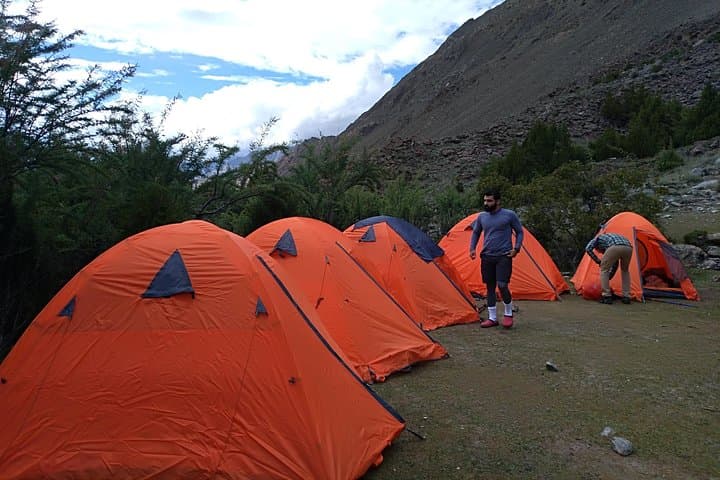
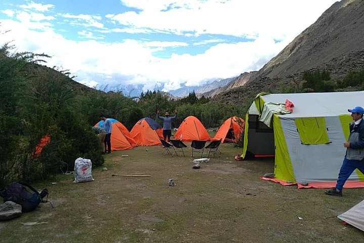
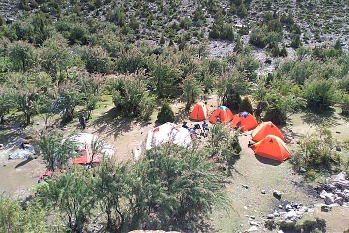
High-altitude ecosystems are fragile—stick to established campsites, pack out waste, and minimize wood use to protect sparse alpine vegetation.
Rock Valley Tours Pakistan operates guided outdoor trips and adventures with an emphasis on safety, stewardship, and memorable experiences.
The trail opens on a crisper morning above Hoper Valley, wind threading through moraine ridges as your group climbs into thinning air. Rush Lake sits beyond a final alpine meadow — a broad, mirror-smooth bowl at roughly 4,700 meters that reflects ridgelines and hanging glaciers. On clear days the Karakoram's serrated skyline, including distant snowfields, crowds the horizon.
The trail opens on a crisper morning above Hoper Valley, wind threading through moraine ridges as your group climbs into thinning air. Rush Lake sits beyond a final alpine meadow — a broad, mirror-smooth bowl at roughly 4,700 meters that reflects ridgelines and hanging glaciers. On clear days the Karakoram's serrated skyline, including distant snowfields, crowds the horizon.
This route follows centuries-old access routes used by Nagar and Hunza communities; the valleys themselves mark a junction between the Karakoram, Himalaya and Hindu Kush ranges. Geologically the region is young and raw: glacially carved U-shaped valleys, active moraines and steep headwalls that feed the streams you cross. Local culture centers on terrace farming and small hamlets—Baltit and Altit forts in Karimabad are living reminders of the Silk Road-era trade and local governance.
Expect 6–8 hours of walking on active terrain during approach days, steep pitches to reach the lake, glacier crossings near Hoper and Miyar, and an optional non-technical ascent to a 5,000 m trekking peak for panoramic views. Weather shifts fast: sun can be fierce at altitude and storms can drop snow even in summer.
Practical guidance: allow at least two days to acclimatize in Gilgit/Hunza before the heavy ascent, bring glacier-capable boots and basic crampons depending on season, and travel with a licensed guide and porters for route finding and load sharing. Hydrate, pace your ascent, and layer for wide temperature swings—this is high-altitude trekking where prudence rewards the views.