THE ADVENTURE COLLECTIVE® · Independent discovery and booking for outdoor travel

A quiet, north-side approach to Kilimanjaro, the 8-day Rongai route trades crowds for moorland, Mawenzi’s jagged ridges and a higher-acclimatization profile. Built-in rest days and varied terrain make this a top choice for summit-focused trekkers.
A quiet, north-side approach to Kilimanjaro, the 8-day Rongai route trades crowds for moorland, Mawenzi’s jagged ridges and a higher-acclimatization profile. Built-in rest days and varied terrain make this a top choice for summit-focused trekkers.
You step out of the minibus at the wooded Nale Muru gate and the air feels cooler, thinner, and sharp with resin from pine trunks. The Rongai route pushes northward from Moshi into a quieter flank of Kilimanjaro, trading the crowds of the south for wide moorland, giant Senecio valleys and a skyline dominated by Mawenzi’s jagged spire.
Verified experiences and guided adventures in the surrounding area.
Operated by Kilimanjaro Heroes Adventures · Moshi, Kilimanjaro Region
You step out of the minibus at the wooded Nale Muru gate and the air feels cooler, thinner, and sharp with resin from pine trunks. The Rongai route pushes northward from Moshi into a quieter flank of Kilimanjaro, trading the crowds of the south for wide moorland, giant Senecio valleys and a skyline dominated by Mawenzi’s jagged spire.
Geology here is volcanic and recent: Kibo’s broad cone and Mawenzi’s eroded towers are products of thrusts and eruptions that left ice at the summit. The Chagga people have farmed the lower slopes for centuries; on approach you pass coffee and maize terraces before the forest gives way to heath and the lunar saddle between Mawenzi and Kibo.
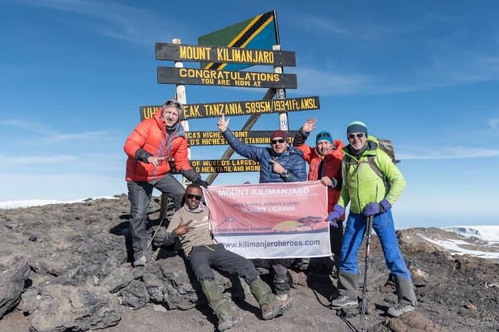
Expect roughly 60–70 km of walking over eight days with a net elevation gain of about 3,900 m to Uhuru Peak (5,895 m). Terrain ranges from pine paths and moorland to scree and high semi-desert on the Saddle. Wildlife is possible on lower slopes—antelopes and sometimes elephant tracks—while porters and guides manage camps and logistics.
Practical notes: the itinerary’s built-in acclimatization (Kikelewa and Mawenzi Tarn days) raises summit success rates; carry layered clothing, a reliable sleeping bag rated to -10°C, and a charged headlamp for the midnight push. Hydrate, eat regularly, and communicate any altitude symptoms to guides immediately. Plan flights to Kilimanjaro or Arusha, budget park and rescue fees, and respect park rules: camp only in designated sites and pack out waste.
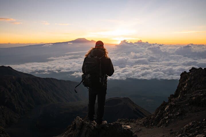
This route rewards patience with expansive views into Kenya, quiet high camps, and the distinct satisfaction of arriving at the Roof of Africa from a relatively remote approach.
challenging.
8 days.
Good aerobic fitness with experience on multiday hikes; prior high-altitude trekking experience strongly recommended
It’s challenging due to altitude and long days; overall distance is moderate (≈60–70 km) but the summit ascent involves nearly 4,000 m of vertical gain from trailhead to Uhuru Peak.
No technical climbing is required—this is a non-technical trek—but comfort on scree, steep slopes and in cold conditions is necessary.
The Rongai route is drier on the northern side during the long rains; dry seasons (January–March and June–October) are typically preferred, though Rongai remains a solid option in shoulder seasons.
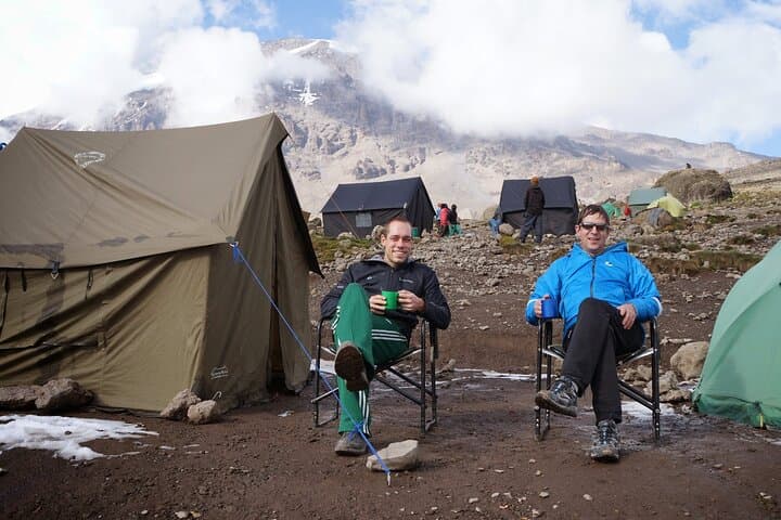
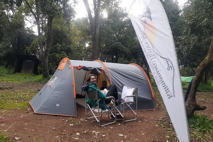
Camping in two-person tents is standard, with meals provided by the crew; some nights begin or end at simple mountain huts depending on the itinerary.
Kilimanjaro is a stratovolcanic massif with three cones (Kibo, Mawenzi, Shira); the region is home to the Chagga, who historically farmed the mountain’s fertile lower slopes.
Kilimanjaro National Park protects fragile alpine ecosystems and glaciers; stick to trails, carry out waste, and pay park fees that fund conservation and rescue services.
Kilimanjaro Heroes Adventures operates guided outdoor trips and adventures with an emphasis on safety, stewardship, and memorable experiences.
You step out of the minibus at the wooded Nale Muru gate and the air feels cooler, thinner, and sharp with resin from pine trunks. The Rongai route pushes northward from Moshi into a quieter flank of Kilimanjaro, trading the crowds of the south for wide moorland, giant Senecio valleys and a skyline dominated by Mawenzi’s jagged spire.
You step out of the minibus at the wooded Nale Muru gate and the air feels cooler, thinner, and sharp with resin from pine trunks. The Rongai route pushes northward from Moshi into a quieter flank of Kilimanjaro, trading the crowds of the south for wide moorland, giant Senecio valleys and a skyline dominated by Mawenzi’s jagged spire.
Geology here is volcanic and recent: Kibo’s broad cone and Mawenzi’s eroded towers are products of thrusts and eruptions that left ice at the summit. The Chagga people have farmed the lower slopes for centuries; on approach you pass coffee and maize terraces before the forest gives way to heath and the lunar saddle between Mawenzi and Kibo.
Expect roughly 60–70 km of walking over eight days with a net elevation gain of about 3,900 m to Uhuru Peak (5,895 m). Terrain ranges from pine paths and moorland to scree and high semi-desert on the Saddle. Wildlife is possible on lower slopes—antelopes and sometimes elephant tracks—while porters and guides manage camps and logistics.
Practical notes: the itinerary’s built-in acclimatization (Kikelewa and Mawenzi Tarn days) raises summit success rates; carry layered clothing, a reliable sleeping bag rated to -10°C, and a charged headlamp for the midnight push. Hydrate, eat regularly, and communicate any altitude symptoms to guides immediately. Plan flights to Kilimanjaro or Arusha, budget park and rescue fees, and respect park rules: camp only in designated sites and pack out waste.
This route rewards patience with expansive views into Kenya, quiet high camps, and the distinct satisfaction of arriving at the Roof of Africa from a relatively remote approach.