THE ADVENTURE COLLECTIVE® · Independent discovery and booking for outdoor travel

A compact 2D1N trek from Aik Berik leads you through rainforest, pine stands and savannah to camp at 2,600 m and a pre-dawn ascent to Puncak Kondo (3,200 m) for sunrise over Segara Anak. This route includes visits to Benang Kelambu and Benang Stokel waterfalls.
A compact 2D1N trek from Aik Berik leads you through rainforest, pine stands and savannah to camp at 2,600 m and a pre-dawn ascent to Puncak Kondo (3,200 m) for sunrise over Segara Anak. This route includes visits to Benang Kelambu and Benang Stokel waterfalls.
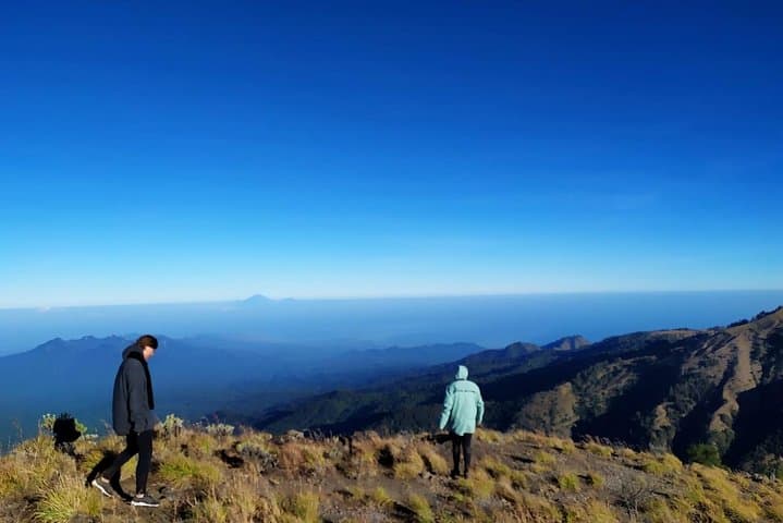
Dawn arrives cool and clear at the basecamp and the jungle exhales — mist lifts from the river, and an old four-wheel-drive hums toward the rain forest gate. You start on a narrow path that threads rainforest, gives way to a stand of pine, and then opens into sun-bright savannah as the trail climbs. By late afternoon the campsite at about 2,600 m sits under a sky that seems to lean toward the ridge, offering a first, wide look at Rinjani’s crater geometry.
Verified experiences and guided adventures in the surrounding area.
Operated by Central Rinjani Trekking · Central Lombok, West Nusa Tenggara
Dawn arrives cool and clear at the basecamp and the jungle exhales — mist lifts from the river, and an old four-wheel-drive hums toward the rain forest gate. You start on a narrow path that threads rainforest, gives way to a stand of pine, and then opens into sun-bright savannah as the trail climbs. By late afternoon the campsite at about 2,600 m sits under a sky that seems to lean toward the ridge, offering a first, wide look at Rinjani’s crater geometry.
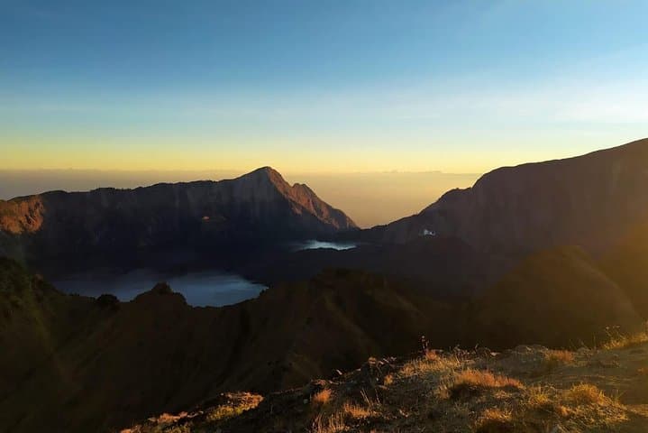
This Aik Berik route, opened officially by Central Lombok authorities in 2018, approaches Rinjani from a less-traveled angle and links two well-known waterfalls — Benang Kelambu and Benang Stokel — with high‑altitude camping. Geologically, Rinjani is a young stratovolcano; the trail crosses volcanic soils, river-cut gullies and volcanic scree before arriving at the crater rim and Segara Anak lake views on the second day.
Locally, the mountain is sacred to Sasak communities and the route passes through villages where simple guesthouses and local guides sustain guiding traditions. Practical advice: expect night temperatures to drop sharply at the camp, and plan for a steep pre-dawn push from 2,600 m to Puncak Kondo at 3,200 m to catch sunrise over Segara Anak and the distant profile of Mt. Agung.
Bring layered insulation, a reliable headlamp, and a hydration system; guides provide tents and basic sleeping gear but personal essentials — warm layers, good boots, and medication for altitude sensitivity — make the difference. Move deliberately on loose volcanic soil, keep water intake steady, and allow time at the rim to adapt before descending back to the forest and the return vehicle.
moderate.
2 days (2D1N).
Suitable for hikers with regular cardio fitness able to handle a 1–3 hour uphill day and a steep 1–2 hour pre-dawn ascent to 3,200 m.
No technical climbing skills are required, but participants should be comfortable on uneven trails and able to handle a steep 1–2 hour ascent to 3,200 m.
The tour includes free entrance to Benang Kelambu and Benang Stokel waterfalls; guides typically handle any national park fees — confirm with your operator before departure.
Yes — tents, sleeping bags, mats and a basic first aid kit are provided as part of the package.
The route reaches 3,200 m quickly; stay hydrated, ascend at a steady pace, avoid alcohol the night before, and inform guides of any symptoms immediately.
The Aik Berik approach was opened officially in 2018 to diversify access to Rinjani’s high country; the mountain remains culturally important to Sasak communities surrounding the park.
Rinjani sits inside a protected national park — stick to established trails, pack out waste, and avoid open fires to reduce human impact on fragile highland vegetation.
Central Rinjani Trekking operates guided outdoor trips and adventures with an emphasis on safety, stewardship, and memorable experiences.
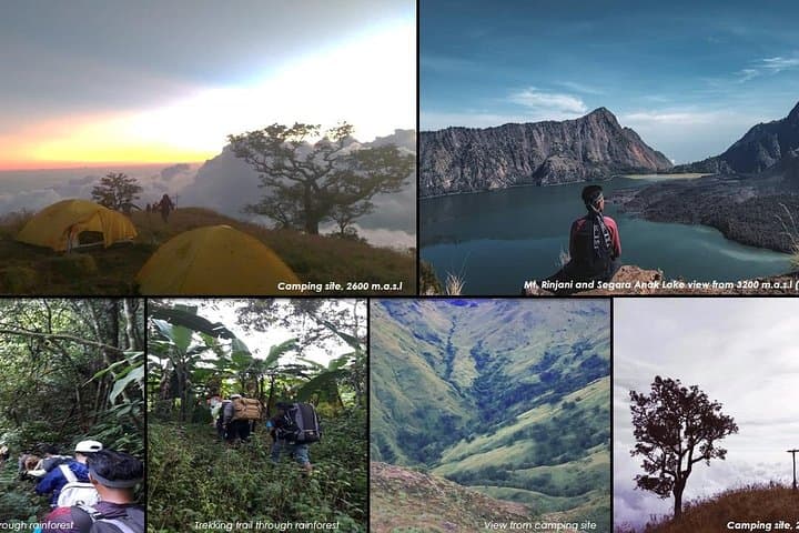
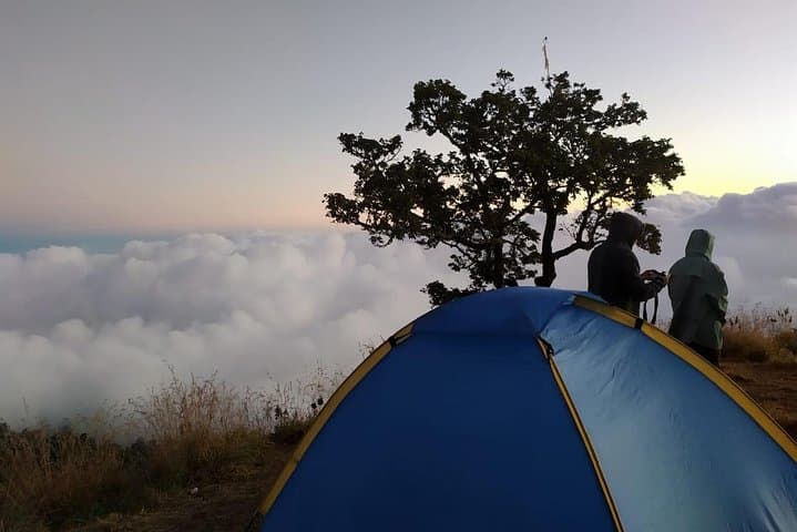
Dawn arrives cool and clear at the basecamp and the jungle exhales — mist lifts from the river, and an old four-wheel-drive hums toward the rain forest gate. You start on a narrow path that threads rainforest, gives way to a stand of pine, and then opens into sun-bright savannah as the trail climbs. By late afternoon the campsite at about 2,600 m sits under a sky that seems to lean toward the ridge, offering a first, wide look at Rinjani’s crater geometry.
Dawn arrives cool and clear at the basecamp and the jungle exhales — mist lifts from the river, and an old four-wheel-drive hums toward the rain forest gate. You start on a narrow path that threads rainforest, gives way to a stand of pine, and then opens into sun-bright savannah as the trail climbs. By late afternoon the campsite at about 2,600 m sits under a sky that seems to lean toward the ridge, offering a first, wide look at Rinjani’s crater geometry.
This Aik Berik route, opened officially by Central Lombok authorities in 2018, approaches Rinjani from a less-traveled angle and links two well-known waterfalls — Benang Kelambu and Benang Stokel — with high‑altitude camping. Geologically, Rinjani is a young stratovolcano; the trail crosses volcanic soils, river-cut gullies and volcanic scree before arriving at the crater rim and Segara Anak lake views on the second day.
Locally, the mountain is sacred to Sasak communities and the route passes through villages where simple guesthouses and local guides sustain guiding traditions. Practical advice: expect night temperatures to drop sharply at the camp, and plan for a steep pre-dawn push from 2,600 m to Puncak Kondo at 3,200 m to catch sunrise over Segara Anak and the distant profile of Mt. Agung.
Bring layered insulation, a reliable headlamp, and a hydration system; guides provide tents and basic sleeping gear but personal essentials — warm layers, good boots, and medication for altitude sensitivity — make the difference. Move deliberately on loose volcanic soil, keep water intake steady, and allow time at the rim to adapt before descending back to the forest and the return vehicle.